MORVEL transform fault map compilation
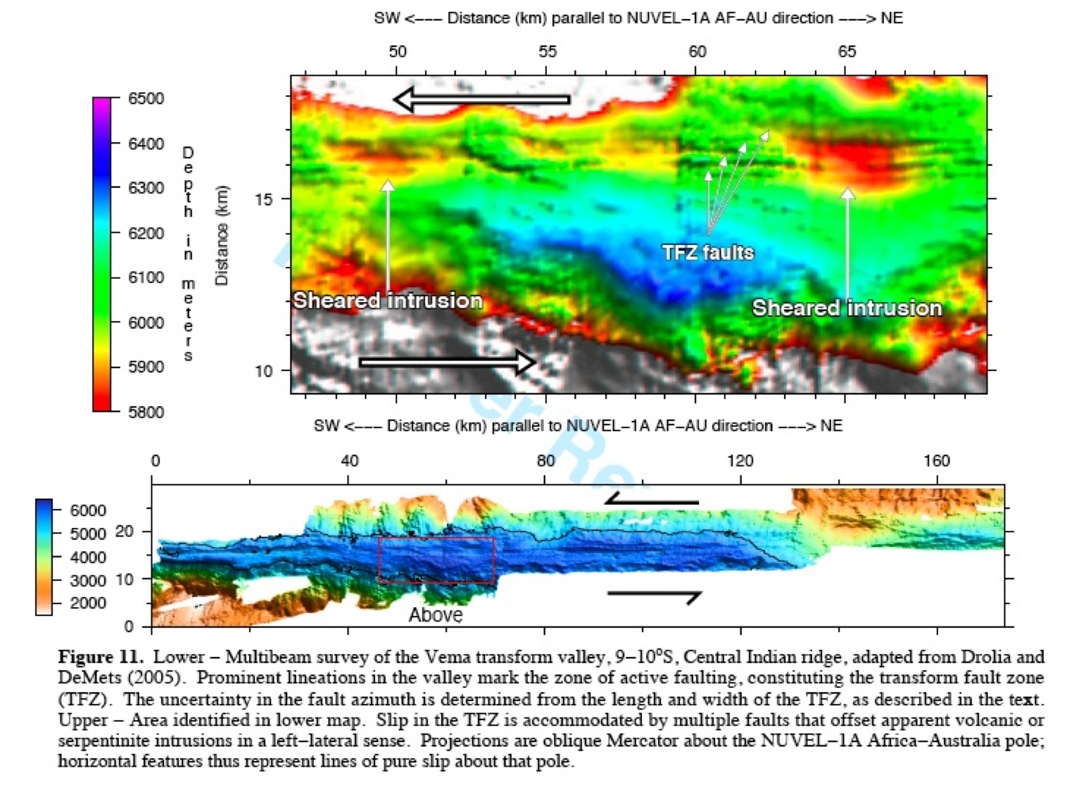
General information: The directions of 163 transform faults that offset the mid-ocean ridge system were used to estimate plate slip directions for MORVEL. Surveys of many of these transform faults with modern swath mapping sonar systems have imaged the individual strike-slip fault(s) that accommodate present slip within the transform valleys. The graphic below, taken from the MORVEL scientific publication, shows one such example, namely, the Vema transform fault, which offsets the Central Indian Ridge from 9-10°S. The Vema transform fault valley has been mapped well enough to image the active fault strands.
Where available, plots similar to this are presented for other transform faults used to estimate MORVEL. These maps are organized by plate boundary via the links located in the column immediately to the left of this window. Some images have lines that indicate where we interpreted the zone within which recent strike-slip faulting has occurred, otherwise known as the "transform fault zone".
C. DeMets, D. Argus, & R. Gordon