MORVEL GPS station velocities
Hundreds of GPS station velocities were used for the MORVEL analysis to connect five tectonic plates to the MORVEL plate circuit. Many of the station velocities were determined from processing of raw GPS station data at the University of Wisconsin-Madison using GIPSY processing software from the Jet Propulsion Laboratory and post-processing procedures described in the MORVEL paper published in Geophysical Journal International.
To the left, you will find links to text files with the GPS station velocities used for MORVEL. The station velocities are all specified relative to either ITRF2000 or ITRF2005, as described in the MORVEL paper. The velocities at the left formed the basis for the plate-specific GPS site velocities that were inverted with the geological MORVEL data to estimate the MORVEL angular velocities. Corrections for motion of the ITRF2000 and ITRF2005 reference frames relative to the geocenter are also made, as described in the MORVEL paper and supplementary tables.
The graphic below illustrates one example of a GPS station coordinate time series derived via processing at UW-Madison. The NLIB site in North Liberty, Iowa, was one of several hundred sites whose velocities were used to establish the motion of the North American plate relative to ITRF2005. To create the graphic below, the daily locations of NLIB in ITRF2005 were reduced by the estimated daily motion of the North America plate relative to ITRF2005 at NLIB, namely, 1.51 mm/yr to the south and 15.4 mm/yr to the west. The reduced coordinate time series therefore shows the residual movement of NLIB with respect to the plate interior. WN and FN in the graphic below are abbreviations for the approximate random (white) noise and longer-period noise in the daily coordinate determinations (shown by red circles), with units of millimeters. Blue circles show 20-day average locations, which help to average down the random noise.
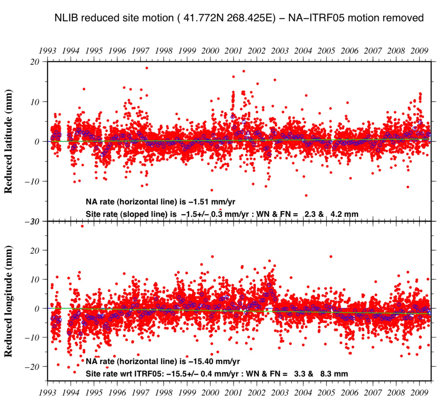
North Liberty, Iowa GPS coordinate time series
C. DeMets, D. Argus, & R. Gordon