SLIP - GIS Data Layers
Last updated on November 1, 2000 by P.M. Colgan
2000 GSA Poster - In Progress
GSA
Poster - Panel A
GSA
Poster - Panel B
Type I Data - Data used as model input
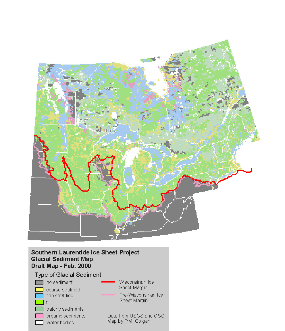
Glacial Sediment
Cover Map
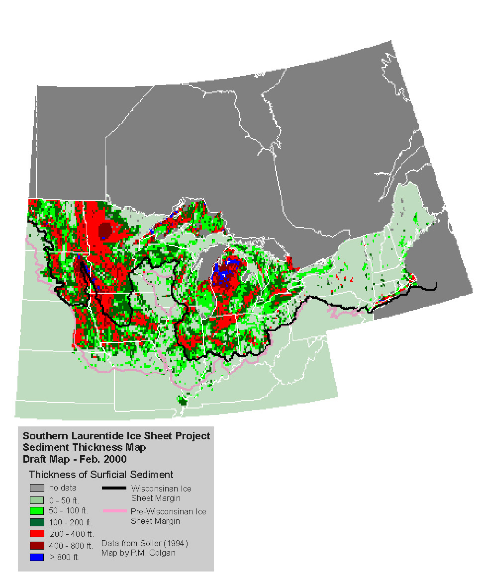
Glacial Sediment
Thickness Map
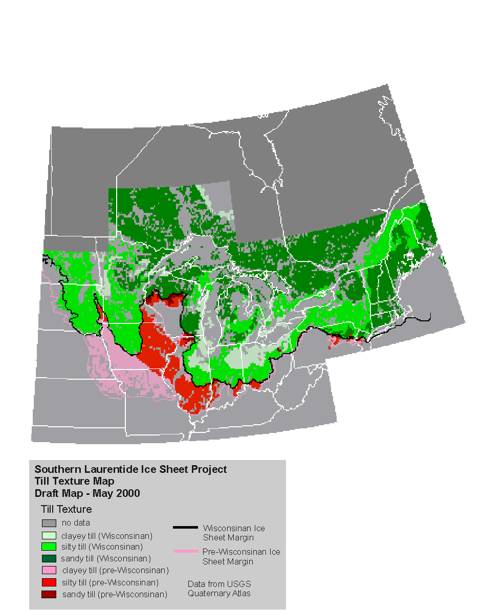
Till Texture Map
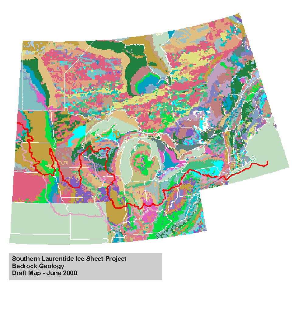
Bedrock Geology
Map
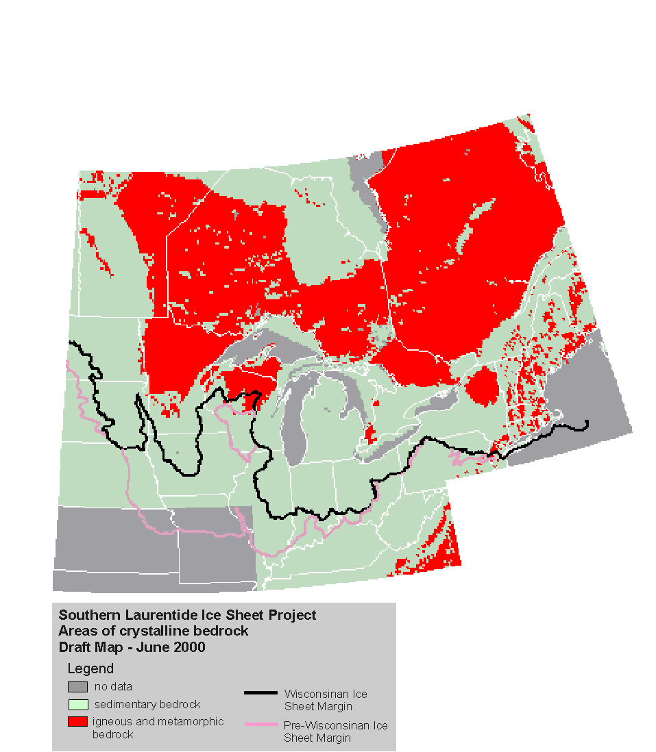
Areas of Crystalline
Bedrock Map
Type II Data - Model calibration data
Ice Lobe Chronology
Ice Surface
Profiles
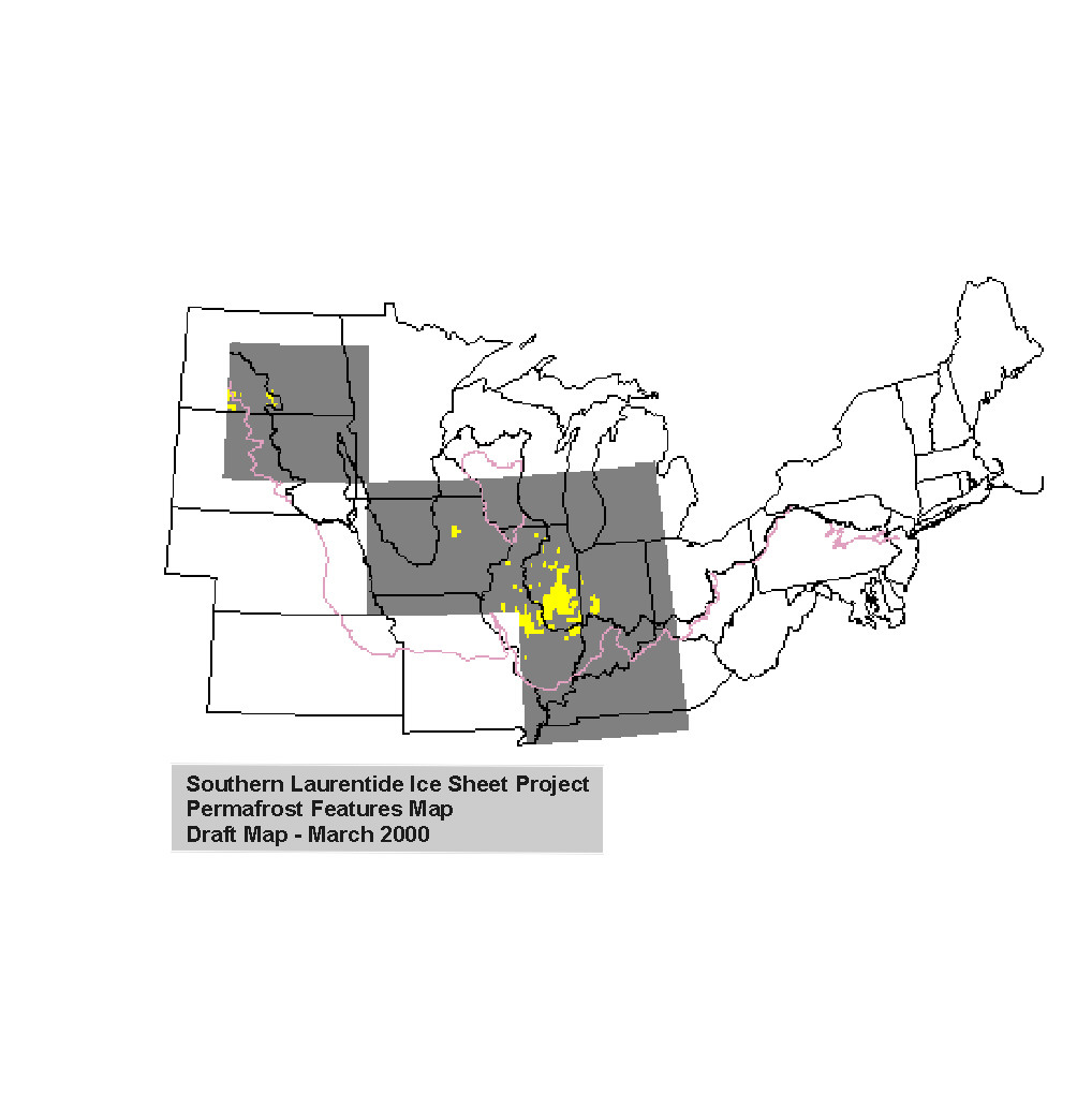
Permafrost Features
Map
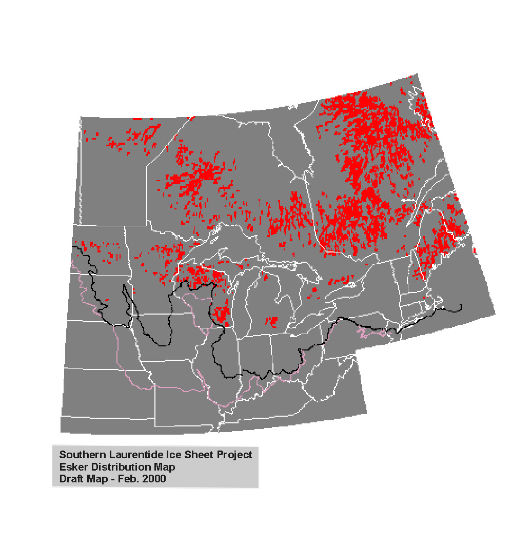
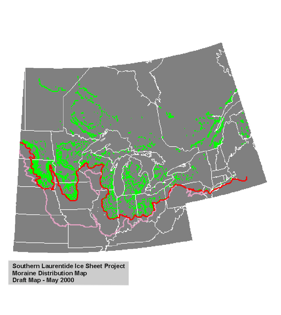
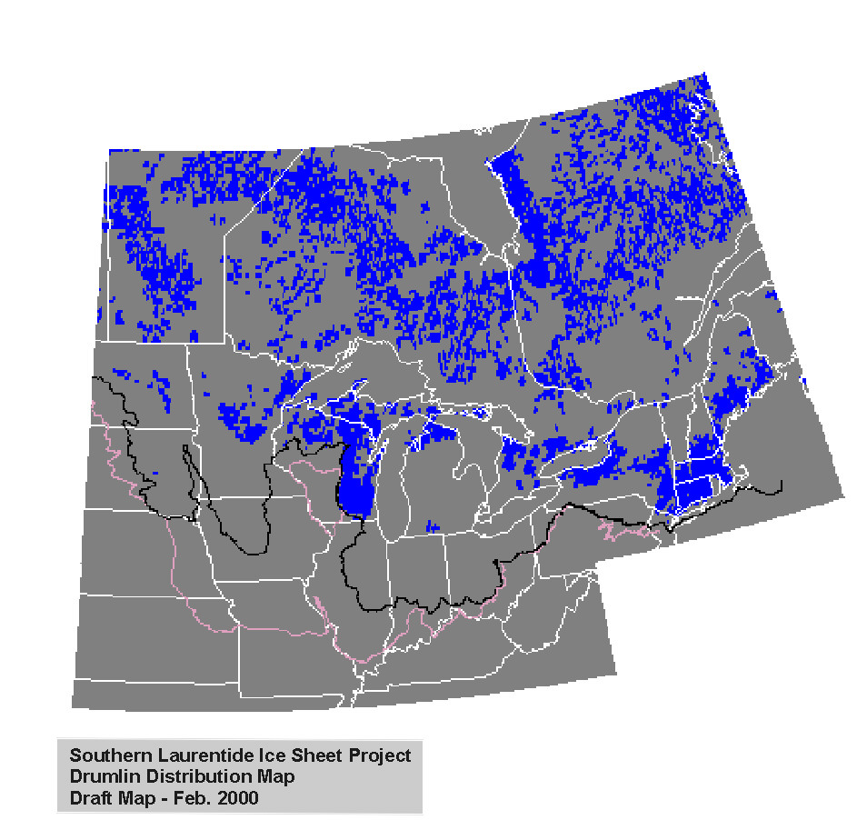
Type III Data - Data compared to model output
Esker Distribution
Map
Moraine Distribution
Map
Drumlin Distribution
Map
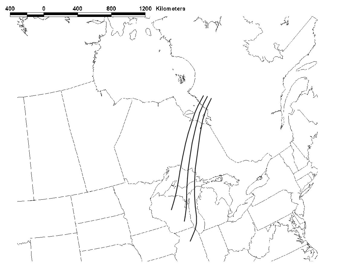
Model flow lines
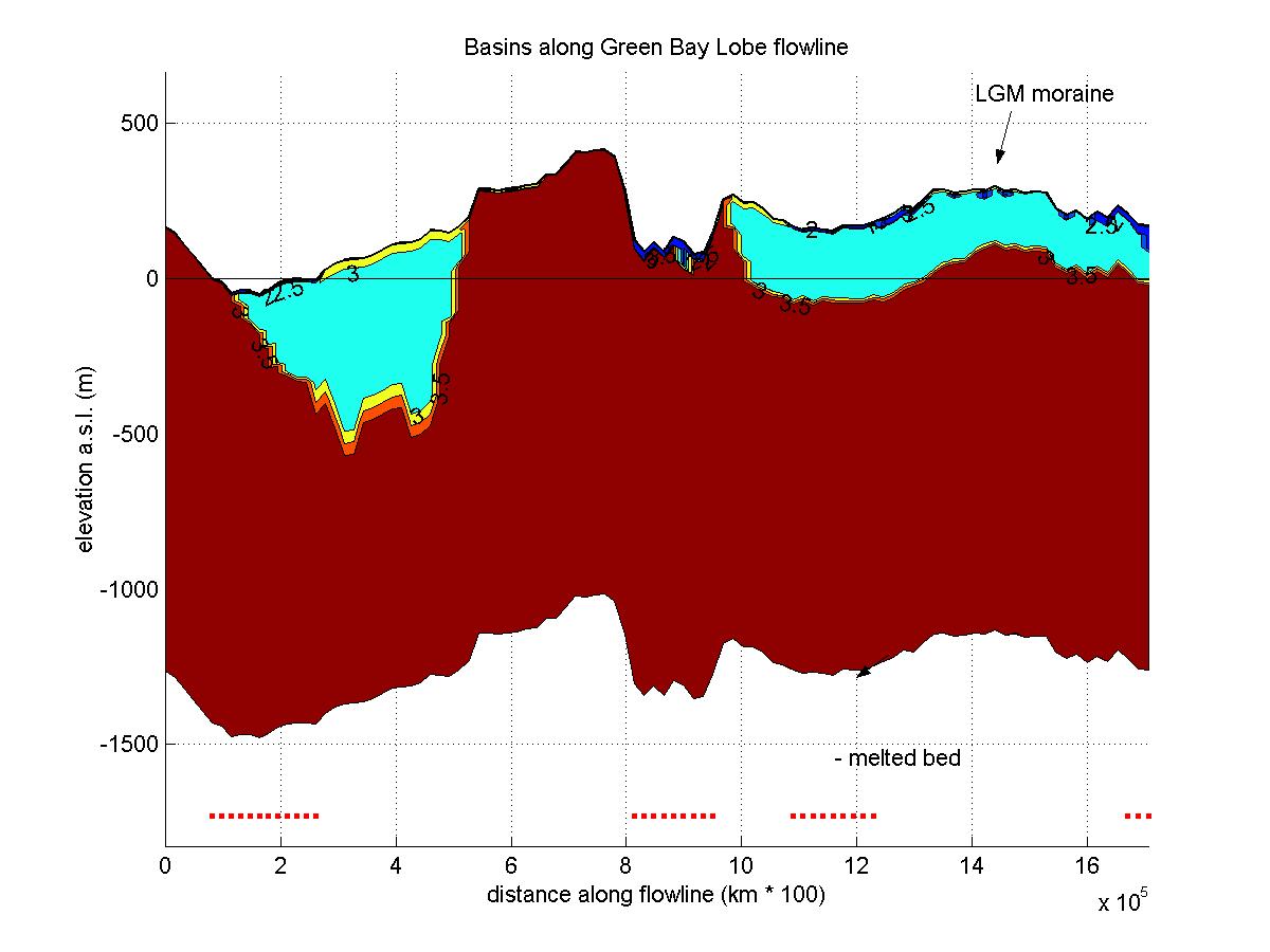
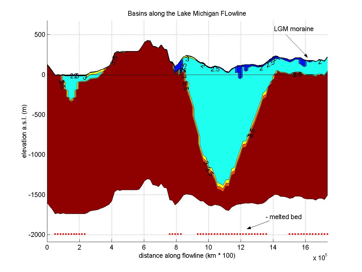
Here are some flow lines for the Green Bay Lobe and the Lake Michigan Lobe.
Map showing
the location of flowlines
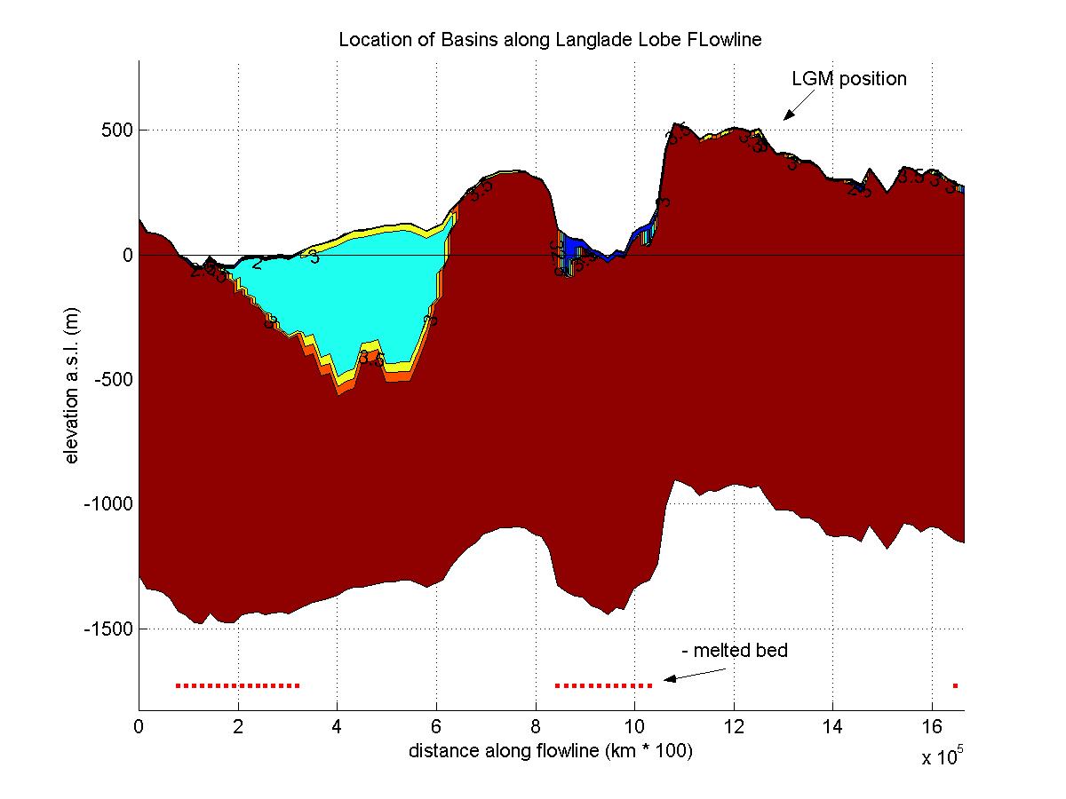
Model input
data along the Langlade Lobe flow line
Model input
data along the Green Bay Lobe flow line
Model input
data along the Lake Michigan Lobe flow line
Mapping Techniques
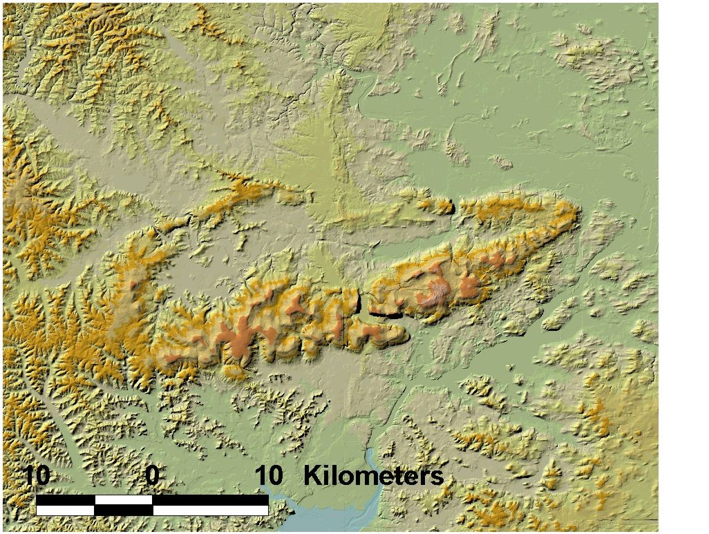
An example of the type of 30 m DEMs we are using for our regional mapping
efforts
Baraboo Shaded
Relief DEM
Regional Glacial Landform Associations
Map of
Landform Associations
Explanation
of Landform Associations