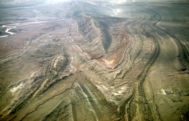
15. Rivers That Cut Through Mountains: Evidence for Superimposed Stream Systems in the Rockies
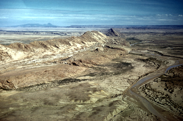
051-33: A view to the north along Hogback Mountain (a monocline) that intersects the San Juan River 18 miles west of Farmington, NM. The Chaco River, at the right, flows northward parallel to the Hogback. The mountain at the left horizon (in Colorado) is the Sleeping Ute. The strata of Mesa Verde lie along the central horizon. (23Aug59)
113-12: Chaco River cuts Hogback Mountain (a monocline) 20 miles west of Farmington, NM. View is to the south from over the San Juan River. The Chaco River is superimposed upon this ridge. (11Apr66)
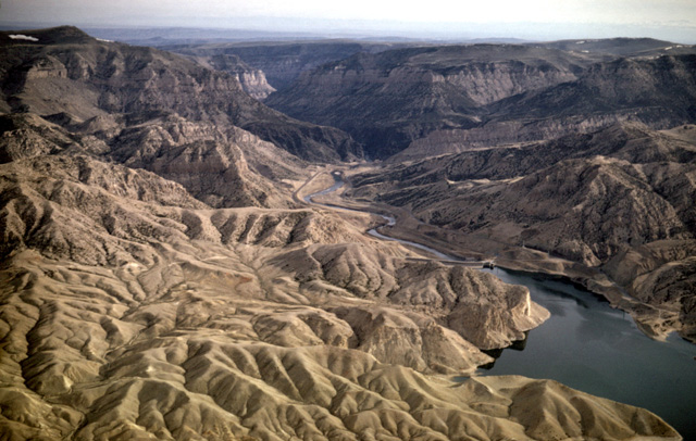
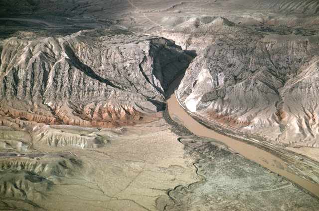
130-18: Boysen Reservoir, Wind River canyon through Owl Creek Mountains, 25 miles northeast of Riverton, WY. View to NNE. The Wind River changes it name to the Bighorn River as it passes through the Owl Creek Mountains; the stream is superimposed on the mountain structure. (15Apr66)
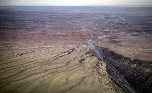
130-20: Wind River/Bighorn River exits Owl Creek Mountains and flows into Bighorn Basin. Five miles south of Thermopolis, WY; view toward north. The red Chugwater shale (Triassic) is visible in the middle distance. (15Apr66)
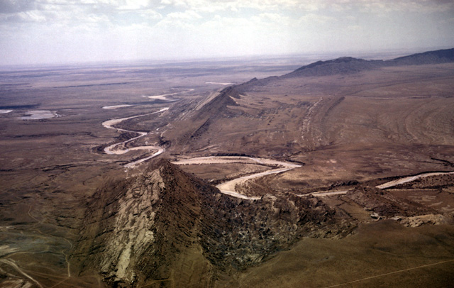
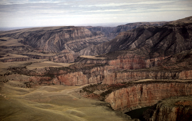
130-27: Sheep Mountain anticline between Greybull and Lovell, WY. View to southeast. Anticline plunges to northwest. At left is northwest-plunging syncline. Note that the Bighorn River has been superimposed across this structure. See Lovell-Greybull Area, Big Horn Co., WY, Department of Agriculture, Commodity Stabilization Service, 1961: Air photo BBN-3BB-66. (15Apr66)
091-04: Sheep Mountain, Bighorn Basin, WY. The Bighorn River, flowing over Tertiary basin fill was superimposed upon the Sheep Mountain anticline. View toward the southeast looking upstream. Struts belong to a rented Piper Scout. See Lovell-Greybull Area, Big Horn Co., WY, Department of Agriculture, Commodity Stabilization Service, 1961: Air photo BBN-3BB-110. (27Jun65)
130-28: Sheep Mountain anticline located between Greybull and Lovell, WY. View to southwest. Bighorn River superimposed across the fold; note railroad uses the same cut. Madison ls (Mississippian) and Amsden fm (Pennsylvanian) form the ridge; the red Chugwater fm (Triassic) crops out near the river. See Lovell-Greybull Area, Big Horn Co., WY, Department of Agriculture, Commodity Stabilization Service, 1961: Air photo BBN-3BB-110. (15Apr66)
132-20: Bighorn River canyon between the Pryor and Bighorn Mountains in MT. View to the northeast. This is another superimposed stream. (15Apr66)
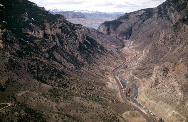
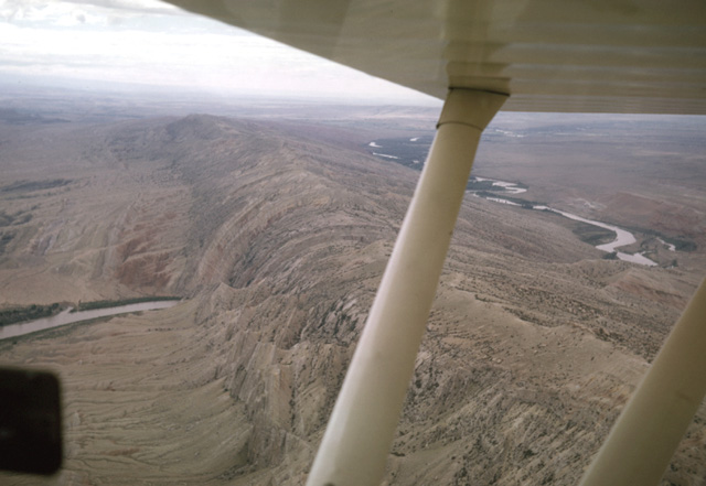
131-31: View up the Shoshone River from just west of Cody, WY. The Buffalo Bill Reservoir and the Absaroka Range are visible in the distance. US Highways 14, 16 and 20 are at the right of the river. Cedar Mountain lies to the left; Rattlesnake Mountain is at the right. Compare this view with photo 131-22. (15Apr66)
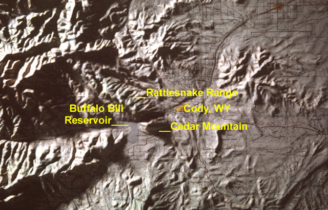
161-21vc: Index map: Shoshone River, Cody, WY
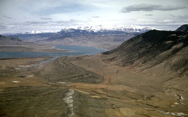
131-22: South side of Cedar Mountain, 6 miles southwest of Cody, WY. View to west showing Buffalo Bill Reservoir on the Shoshone River and the Absaroka Range east of Yellowstone Park. That the Shoshone River has cut a valley between Cedar Mountain and Rattlesnake Mountain rather than draining south of Cedar Mountain is taken as evidence that the stream was superimposed across this once-buried ridge. Compare this view with photo 131-31. (15Apr66)
Click here to return
Copyright © 2001 Louis J. Maher, Jr.