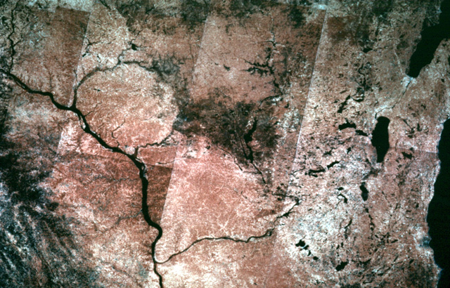
314-09: Landsat mosaic of Wisconsin and adjacent parts of Minnesota and Iowa. Note that the lakes and moraines in the Green Bay Lobe are clearly shown from space.
11. Glacial Features in the Midwest
314-09: Landsat mosaic of Wisconsin and adjacent parts of Minnesota and Iowa. Note that the lakes and moraines in the Green Bay Lobe are clearly shown from space.
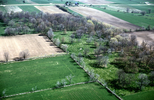
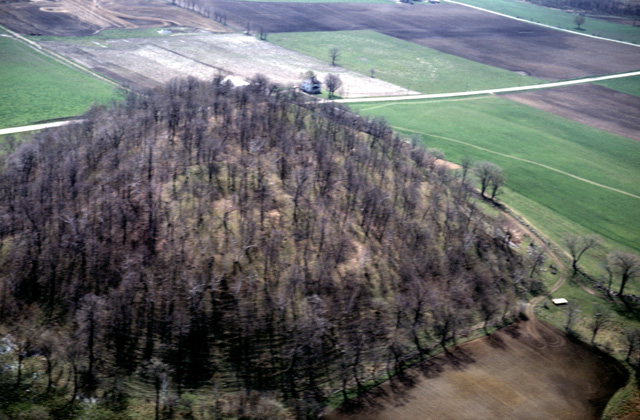
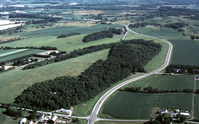
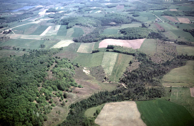
133-18: Moraine in the Kettle Moraine, Fond du Lac and Sheboygan Counties, WI. Note stone walls around cleared fields and the boulders remaining in the wood lot. View to southeast. See also photo 133-19. (18May66)
133-19: View down on moraine in the Kettle Moraine, Fond du Lac and Sheboygan Counties, WI. Note stone walls around cleared fields and the boulders remaining in the wood lot. View to south. See also photo 133-18. (18May66)
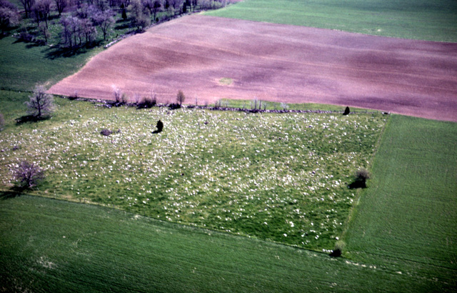
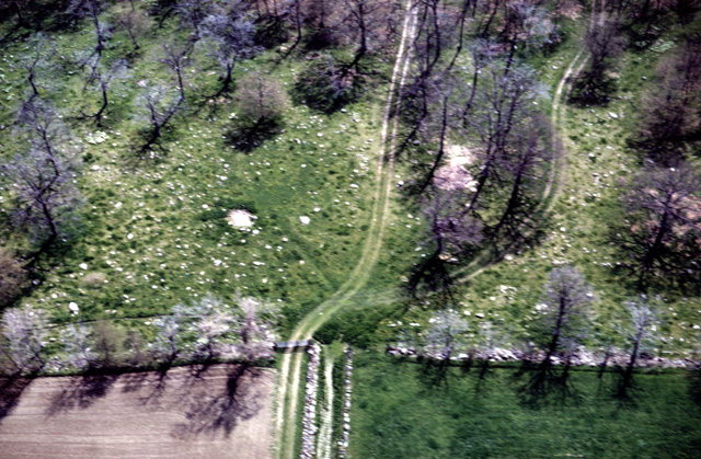
133-21: Moraine in the Kettle Moraine, Fond du Lac and Sheboygan Counties, WI. Boulders remain inside the pasture fence, but they have been removed from the fields. View to southeast. (18May66)
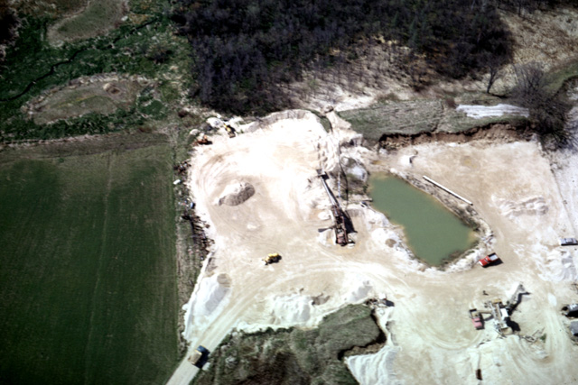
133-22: Sand pit in the Kettle Moraine, Fond du Lac and Sheboygan Counties, WI. View to the west. Note the shallow water table in this former outwash channel. (18May66)
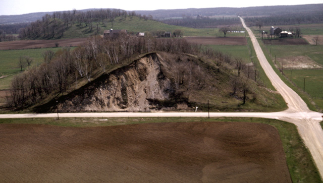
133-26: Moulin Kame in the Kettle Moraine, 4 miles northeast of Dundee, WI. Conner Hill, looking southwest; Sec 8, T14N, R20E, Kewaskum 15-minute Quad. (18May66)
133-28: Moulin Kames, Kettle Moraine, 4 miles northeast of Dundee, WI. View to east. Garriety Hill in foreground; Conner Hill in background. (18May66)
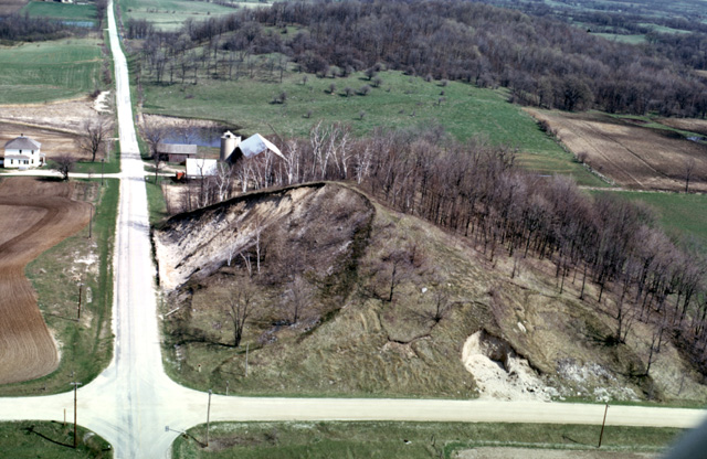
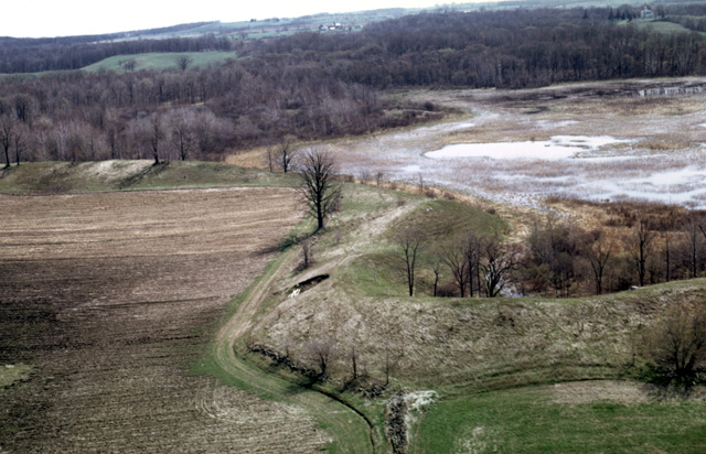
175-13: Garriety Hill, a moulin kame in Kettle Moraine, 4 miles northeast of Dundee, WI. View to north at southwest corner Sec 8, T14N, R20E, Kewaskum Quad. (4May67)
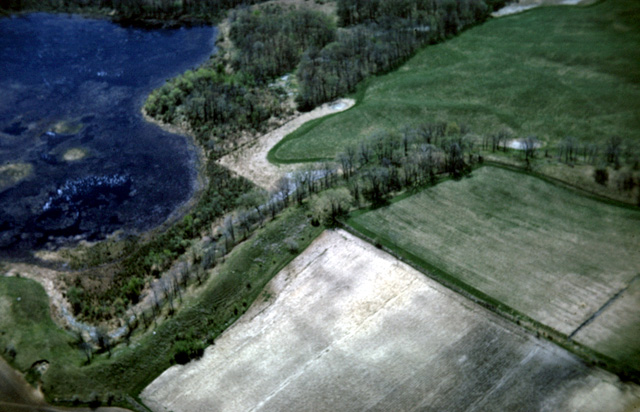
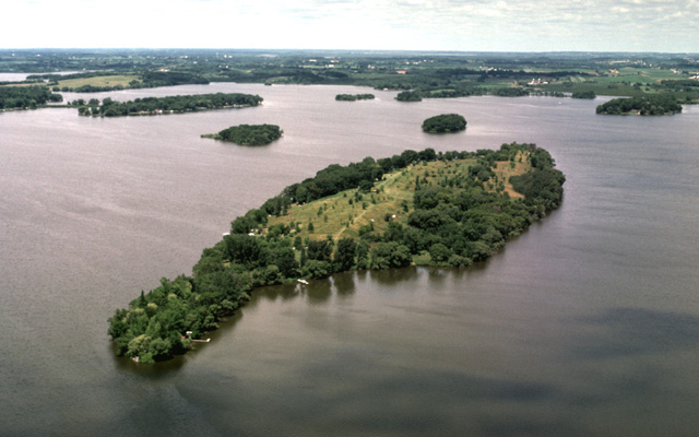
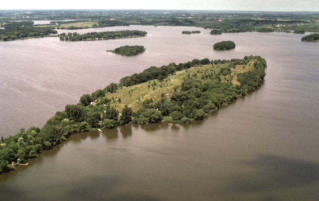
086-23: Parnell Esker and kettle lake, 3 miles northeast of Dundee, WI. View to the southeast; NE 1/4 Sec 20, T14N, R20E, Kewaskum Quad. See also photo 175-10. (12May65)
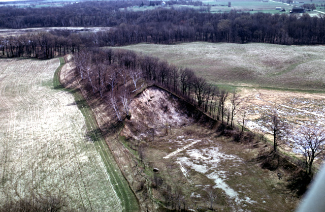
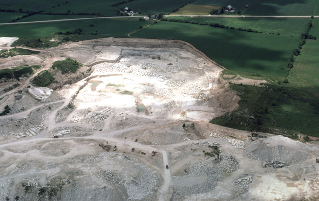
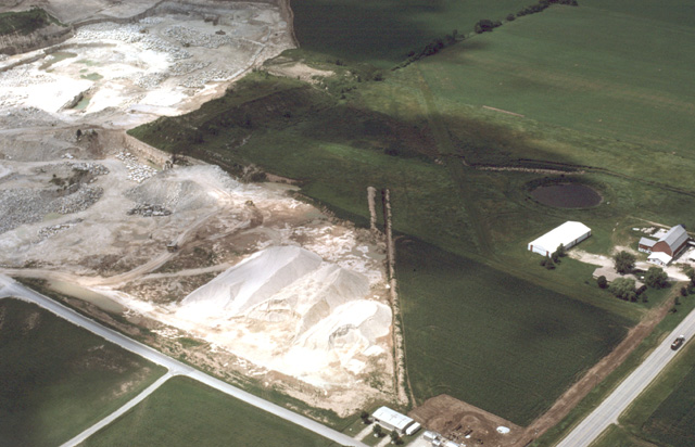
175-09: Sand quarry in the Parnell Esker, 3 miles northeast of Dundee, WI. View to the northeast; Center Sec 20, T14N, R20E, Kewaskum Quad. Note the few large boulders that the esker stream was carrying. The marsh at the right has been channelized. See also photo 257-11. (4May67)
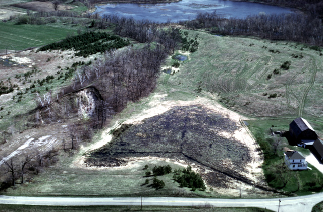
257-11: Quarry in Parnell Esker, Kettle Moraine State Park, 3 miles northeast of Dundee, WI. View to the north; Center Sec 20, T14N, R20E, Kewaskum Quad., WI. Note that the marsh in the center of the photo has been drained by the landowner. See also photo 175-09. (27Apr76)
436-25: Sand quarry in the Parnell Esker, 3 miles northeast of Dundee, WI. View to the northeast; Center Sec 20, T14N, R20E, Kewaskum Quad. See also photos 175-09 and 257-11. This exposure of the esker illustrates how the season and year of photography can influence what we can see either from the air or the ground. (29Jun99)
175-10: Parnell Esker and a kettle lake (marsh), 3 miles northeast of Dundee, WI. View to the NNE; northeast 1/4 Sec 20, T14N, R20E, Kewaskum Quad. Note the "borrow pit" a farmer has made in the side of the esker near the center of the photo. (4May67)
427-11: Johnstown Moraine 9 miles west of Madison, WI. View to the east with Lake Mendota visible in the distance. The quarry in the foreground (Ordovician Platteville dolomite) is in the Driftless Area. Shoveler's Sink, the pond in the middle distance, formed in front of the moraine. The moraine is currently being developed for housing. (23Sep97)
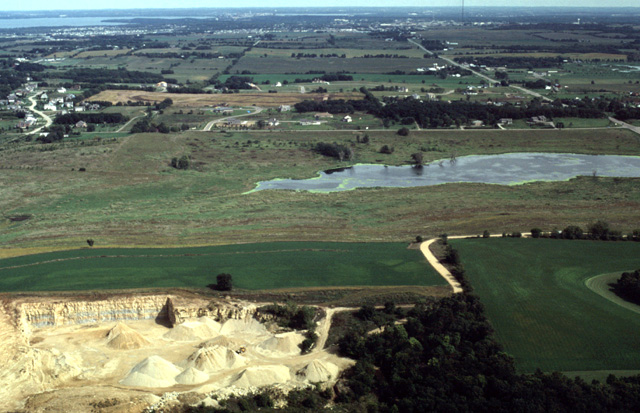
427-15: Black Earth Creek at Cross Plains, WI. The sand pit in the foreground is utilizing outwash from the Johnstown moraine. View to the WNW. The creek drains into the Wisconsin River valley just visible in the distance. (23Sep97)
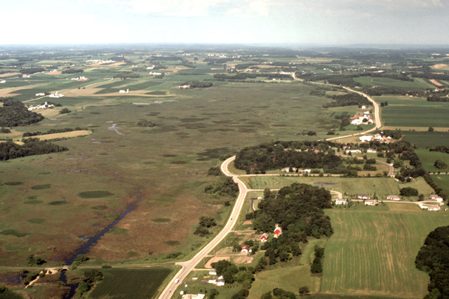
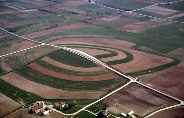
440-16: Waunakee Marsh State Wildlife Area, west of Waunakee, WI. View to the west along WI Hy 19. The marsh occupies one of the numerous tunnel channels through which meltwater was discharged from beneath the glacier that occupied the Green Bay Lowland. This discontinuous valley system extends westward to the Wisconsin River. (30Jun00)
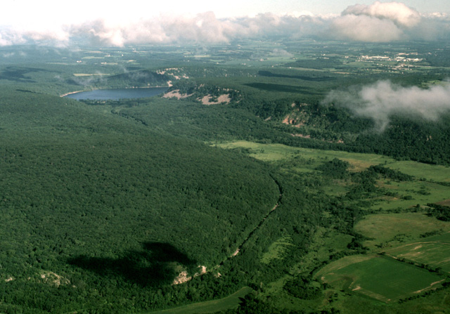
431-12: Devils Lake gorge, 7 miles southeast of Baraboo, WI. View looking northwest. Devils Nose is on the left with Chicago and Northwestern Railroad tracks. This part of the gorge lacks the talus that is common around Devils Lake; the glacier bulldozed it into the tree-covered moraine that blocks the valley. The lake is higher than the valley in the right foreground. (30Jun98)
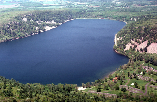
434-07: Devils Lake gorge, from a position over the South Range of the Baraboo Syncline, 5 miles south of Baraboo, WI. View looking NNW. The quartzite here dips 15 to 20 degrees to the north. Devils Lake has formed between two segments of the Johnstown Moraine. The northern moraine can be seen as the tree-covered ridge on the opposite side of the lake; the southern moraine blockage is just out of sight at the lower right. (9May99)
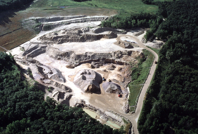
444-24: Quarry in the Johnstown Moraine along Tower Road at the crest of the South Range of the Baraboo syncline 5 miles SE of Baraboo, WI. View to SW. Quarrying began in outwash sediments west of the moraine. A few years ago the underlying Baraboo quartzite was encountered (center of view), and it is being utilized as well. (11Jul01)
086-26: Drumlin topography in Green Bay lowland south of Fond du Lac, WI. Note linear fields parallel to drumlin alignment. View to NNE. (12May65)
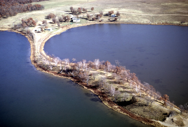
435-17: Drumlins in Lake Sinissippi, an artificial lake near Hustisford, WI. View is toward the northwest. See also photo 435-18. (29Jun99)
435-18: Drumlins in Lake Sinissippi, an artificial lake near Hustisford, WI. View is toward the northwest. See also photo 435-17. (29Jun99)
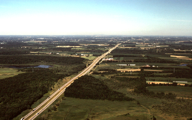
444-14: Drumlin landscape of the Green Bay Lobe. View WSW along I94 toward Madison, WI, which is visible near the horizon 17 miles away. Most of the tree-covered hills are drumlins; many of the wetlands between have been drained. Note that the swells and swales along the Interstate form a subdued representation of the topography. (11Jul01)
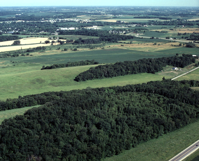
444-16: A series of drumlins of the Green Bay Lobe about two miles SE of Waterloo, WI. View to the NW. State Hy 89 is at the lower right corner (11Jul01)
444-20: Drumlins of the Green Bay Lobe. View to the north along State Hy 89. Waterloo, WI is 2 miles away at the upper left corner. (11Jul01)
133-31: Drumlin with contoured fields, south-central WI. View to southeast. (18May66)
141-21: NNW/SSE-trending drumlins 9 miles southwest of Charlevoix, MI. View to the ESE. (2Jun66)
141-22: NNW/SSE-trending drumlins 5 miles south of Charlevoix, MI. View to the southeast. See also 141-23. (2Jun66)
141-23: NNW/SSE-trending drumlins 5 miles south of Charlevoix, MI. View southward along their axes. Some of these same features are visible in 141-22. (2Jun66)
436-23: The Valders Lime and Stone Company Quarry at Valders, WI. The quarry is developed in Silurian dolomite about 12 miles east of the Niagraran Escarpment. It is situated at a high spot on the landscape, and most of the section being mined is in Silurian reef carbonates. Over the years quarry operations have exposed an interesting sequence of Quaternary sediments. View is toward the north. See also photo 436-24. (29Jun99)
436-24: The Valders Lime and Stone Company Quarry at Valders, WI. The quarry is developed in Silurian dolomite about 12 miles east of the Niagraran Escarpment. It is situated at a high spot on the landscape, and most of the section being mined is in Silurian reef carbonates. View is toward the northwest. Quarry operations have exposed an interesting sequence of Quaternary sediments; in this view at the east end of the quarry is the type locality of the Valders Till. See also photo 436-23. (29Jun99)
162-19: Esker in Hunter Lake, Sherburne Co. MN, 9 miles NNE of Elk River, MN. View to NNE (25Oct66)
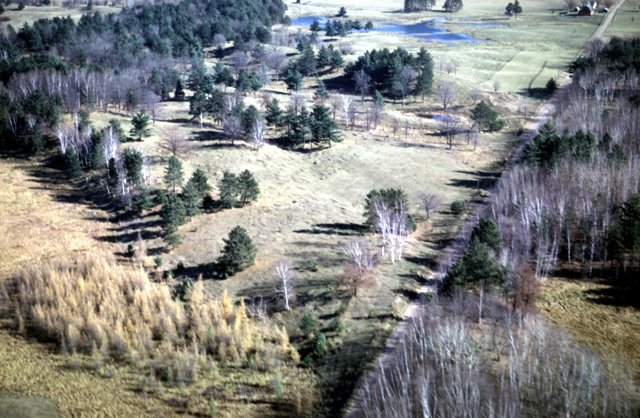
162-29: Finlayson Esker and Fall vegetation near Finlayson, MN. (25Oct66)
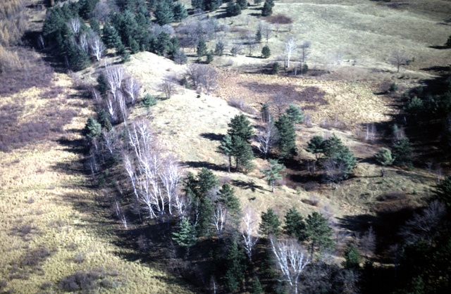
162-28: Fall vegetation (tamarack, paper birch, and white pine) on glaciated terrain with an esker cut by the road. View to the northeast, near Finlayson, MN. (25Oct66)
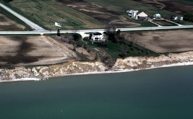
226-11: The type section of the Two Creeks Forest Bed between Two Rivers and Kewaunee, WI. View is to the northwest. The road at the upper left corner is the boundary between Manitowoc (left) and Kewaunee (right) Counties. The road paralleling Lake Michigan is State Hy 42. In 1966 or 1967, R.F. Black, D.L. Clark and others of the University of Wisconsin, excavated down to the forest bed and erected a sheet-steel building to protect the exposure of a number of spruce trees that had first been killed by rising lake level and then bulldozed by ice of the Great Lakean advance. The wood from this and other nearby exposures averages 11,850 yr B.P. The steel building was located near the shore about where the tire tracks end in the plowed field south of the tavern. By the Spring of 1973, shoreline erosion had left only debris at the edge of the water. (15May73)
Copyright © 2001 Louis J. Maher, Jr.