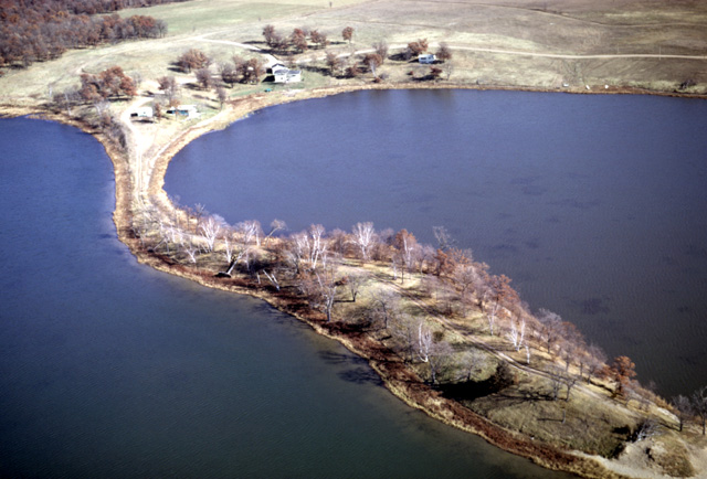
162-19: Esker in Hunter Lake, Sherburne Co. MN, 9 miles NNE of Elk River, MN. View to the NNE. (25Oct66)
10. Glacial Landscapes, Apostle Islands, Long Island of Chequamegon Bay
162-19: Esker in Hunter Lake, Sherburne Co. MN, 9 miles NNE of Elk River, MN. View to the NNE. (25Oct66)
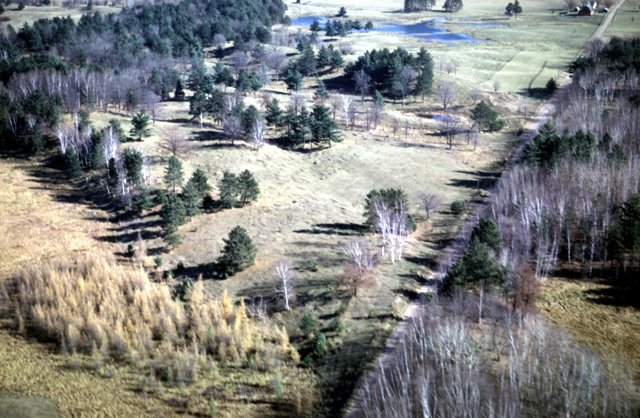
162-28: Fall vegetation (tamarack, paper birch, and white pine) on glaciated terrain with an esker cut by the road. View to the northeast, near Finlayson, MN. (25Oct66)
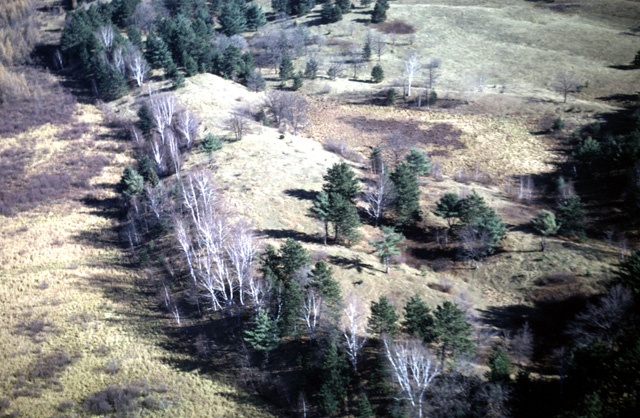
162-29: Finlayson Esker and Fall vegetation near Finlayson, MN. (25Oct66)
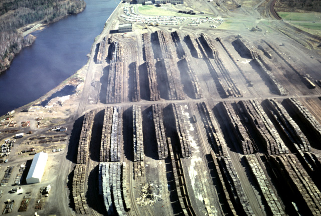
163-07: Stacked logs and smoke at paper mill in Cloquet, MN. St. Louis River is at the left. View to the east. (25Oct66)
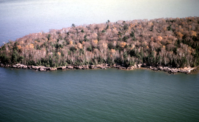
163-26: York Island, one of the Apostle Islands, 12 miles NNW of Bayfield, WI. The Apostle Islands are composed of the Bayfield Group (Cambrian(?) or Upper Proterozoic) feldspathic quartzose sandstone with some orthoquartzitic sandstone. (25Oct66)
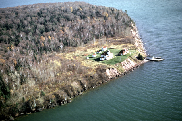
163-28: Raspberry Island, one of the Apostle Islands, 11 miles NNW of Bayfield, WI, showing Raspberry Island Light. View to the southeast. (25Oct66)
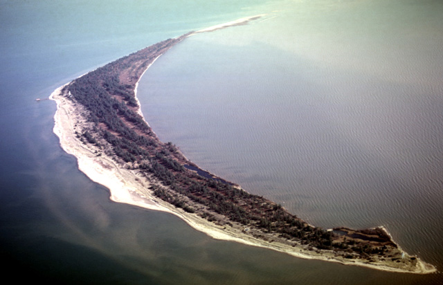
163-30: Long Island in Chequamegon Bay, WI. View to ESE. This once was a spit connecting southeastward to Chequamegon Point; it was breached on several occasions in the 19th Century. Chequamegon Point Light is at the lower right corner of the photo; La Pointe Light, with a pier, is at the extreme left. Note how the tree patterns indicate former beach ridges. (25Oct66)
163-31: Long Island in Chequamegon Bay, WI. La Point Light and pier are at the left. View is to the southeast. Chequamegon Point is visible in the distance. (25Oct66)
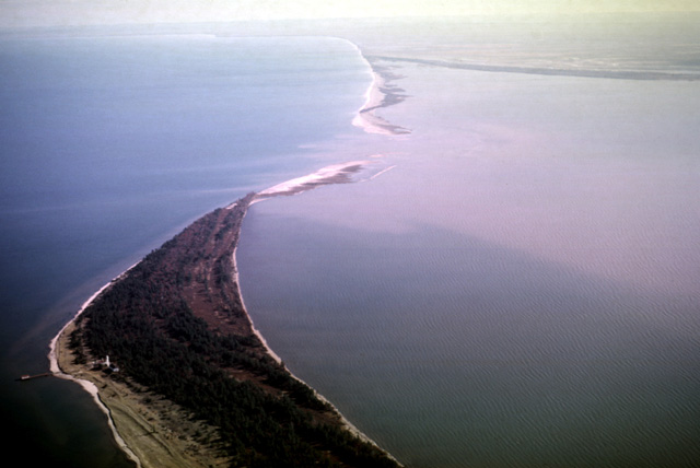
163-32: Long Island in Chequamegon Bay, WI. La Point Light and pier are at the left. View is to the southeast. Part of Chequamegon Point is visible in the distance. (25Oct66)
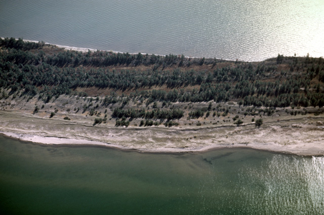
163-33: A detail of the north shore of Long Island in Chequamegon Bay, WI. View is to the south. La Point Light lies off the photo to the left. Note that the rows of trees grow on the better-drained soil of former beach ridges. The island is apparently growing on the north side while suffering erosion on the side facing the bay. (25Oct66)
163-34: The western end of Long Island in Chequamegon Bay, WI. View to the WSW. Note how erosion on the bay side (left) has flooded the southernmost swale forming several lakes. (25Oct66)
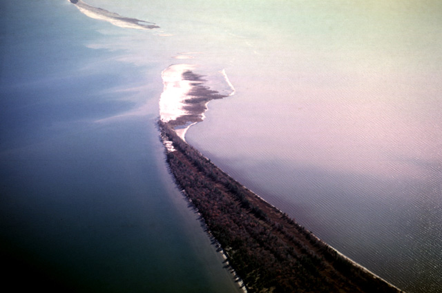
163-35: Eastern tip of Long Island in Chequamegon Bay, WI. View to the SSE. The tip of Chequamegon Point is at the upper margin. (25Oct66)
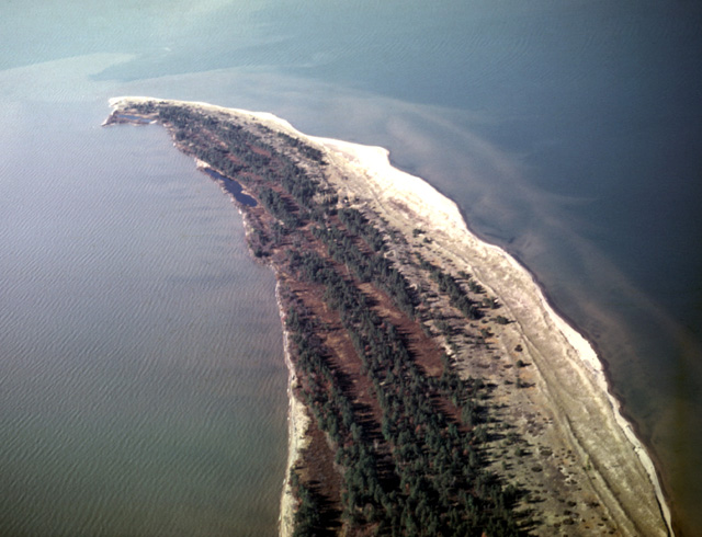
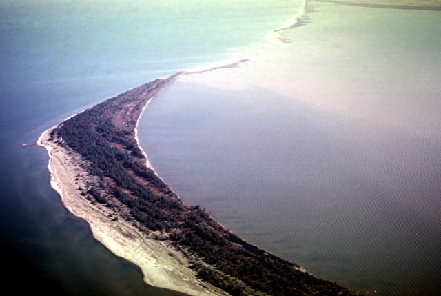
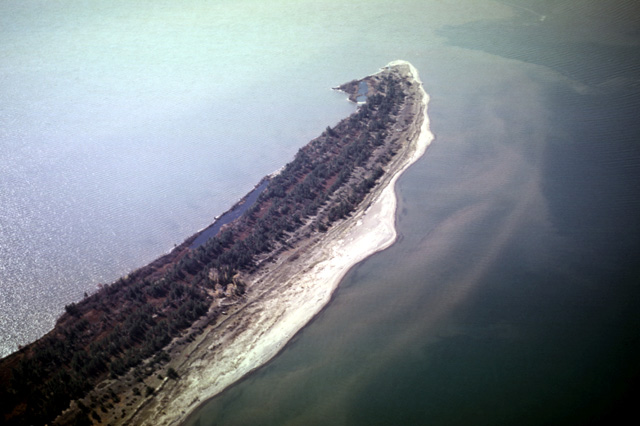
163-36: Western tip of Long Island in Chequamegon Bay, WI. View is to the west; Chequamegon Point Light is at the tip. Note that the rows of trees lie on the better-drained soil of former beach ridges. The island is apparently growing on the north (right) side while suffering erosion on the side facing the bay. (25Oct66)
Copyright © 2001 Louis J. Maher, Jr.