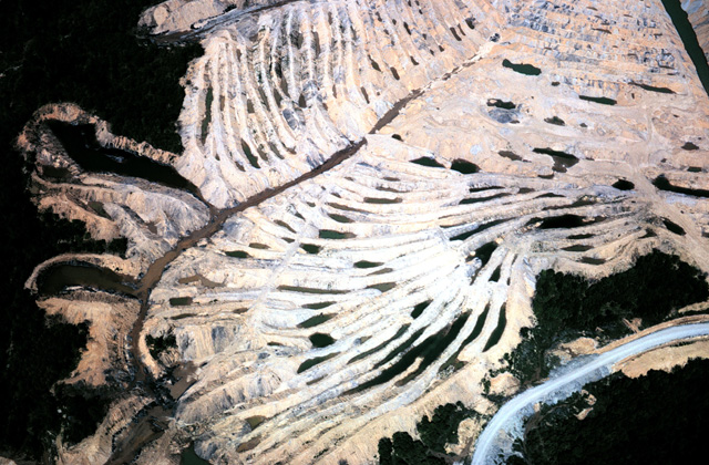
136-13: Coal strip mine south of Victoria, IL. (1Jun66)
9. Strip Mines, Sinkholes, Limestone Quarries, Lake Michigan Shoreline
136-13: Coal strip mine south of Victoria, IL. (1Jun66)
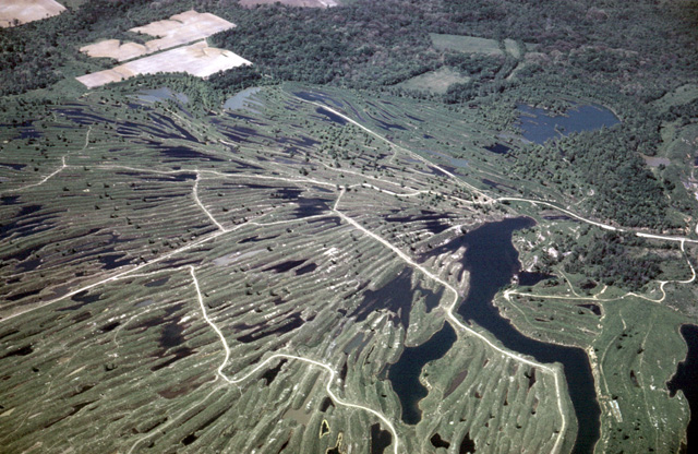
136-17: Old coal strip mine south of Victoria, IL. (1Jun66)
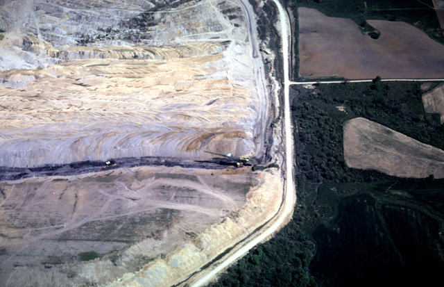
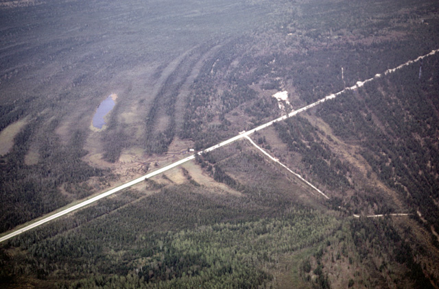
136-18: Active coal mining power shovels west of Farmington, IL. Note how the sediment oxidizes to a lighter color as it is exposed to the air. (1Jun66)
136-28: Little Sinking Creek; view to the north. Mammoth Cave Quad, KY. (1Jun66)
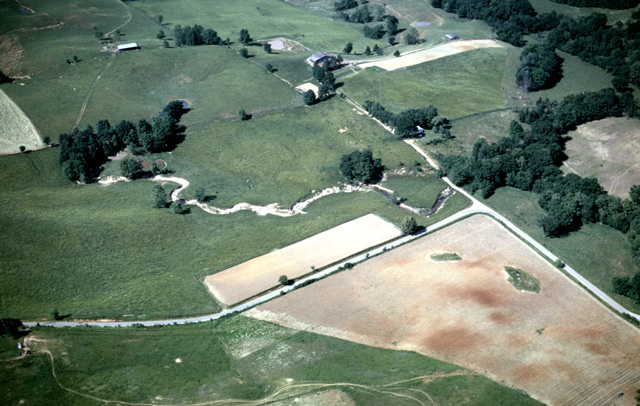
136-29: Little Sinking Creek; view to the northeast. Note terra rosa in the plowed field. Mammoth Cave Quad, KY. (1Jun66)
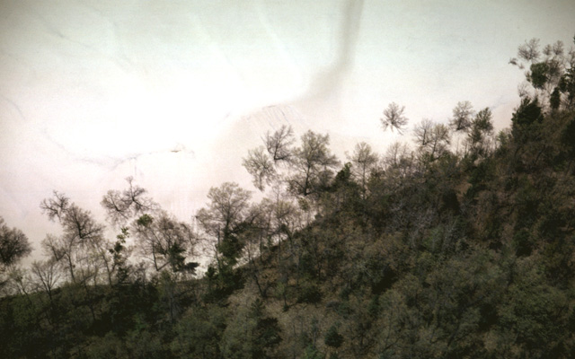
136-32: Pilot Knob (Limestone); view to the north. Mammoth Cave Quad, KY. (1Jun66)
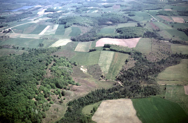
140-03: Field of sinkholes; view to the south near Rocky Hill, KY. Note relation of various sinkholes to the water table and the terra rosa in the plowed fields. Site south of the Dripping Springs Escarpment. Mammoth Cave Quad, KY. (1Jun66)
140-09: Dry valley with terra rosa in plowed fields south of Green River, Woolsey Valley area, Mammoth Cave Quad, KY. View to the northeast. (1Jun66)
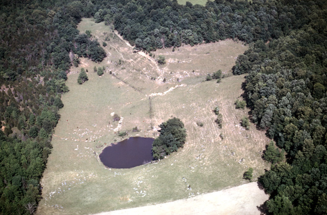
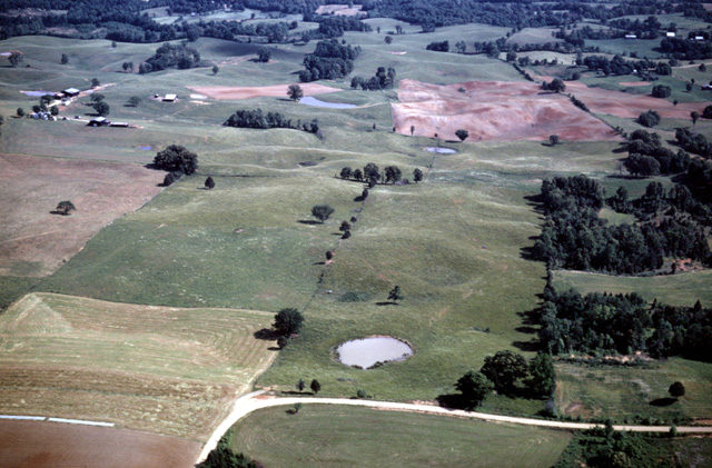
140-11: Dry valley with sinkhole (and quite a few cows); view to the east about a mile southwest of Cedar Hill School. Mammoth Cave Quad, KY. (1Jun66)
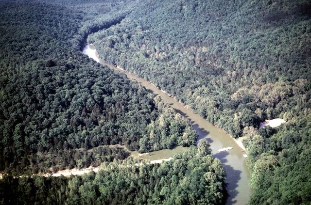
140-15: Green River with ferry, Mammoth Cave Quad, KY. View to northwest in downstream direction; probably Sanders Ferry, four miles west of Mammoth Cave. (1Jun66)
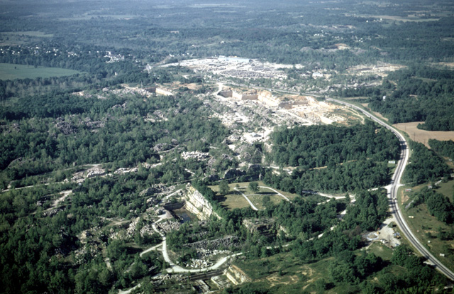
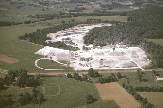
140-18: General southward view of Bedford limestone quarries, Bedford, IN. (2Jun66)
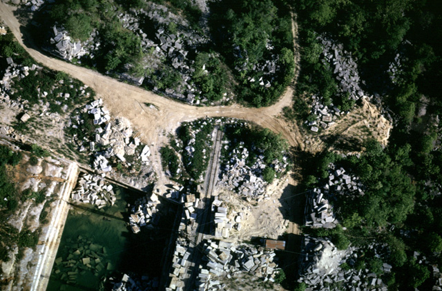
140-23: Near vertical view of limestone (Mississippian) quarry at Bedford, IN. Top is to the north. (2Jun66)
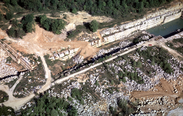
140-25: Limestone quarry (Mississippian) at Bedford IN. View to the northwest. (2Jun66)
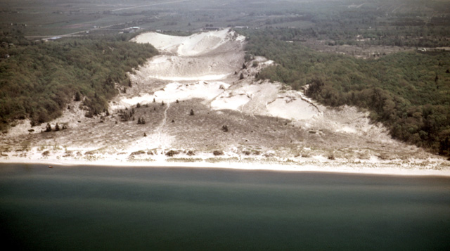
140-35: Blow-out dune along Lake Michigan shore north of Benton Harbor, MI. Erosion of the transverse dunes along the shore can produce parabolic dunes. View to the east. (2Jun66)
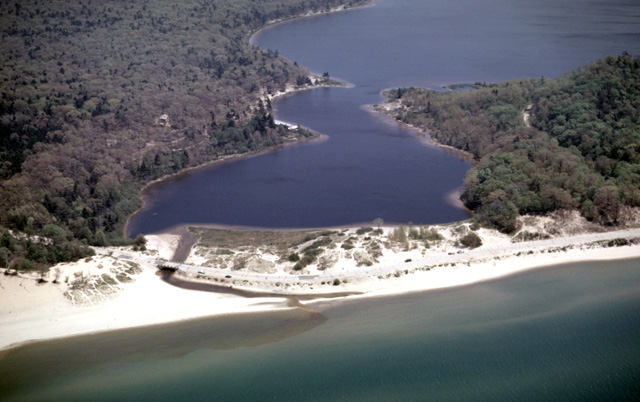
141-07: Lake Michigan shoreline. Drainage blocked by sand at Duck Lake, southwest of Whitehall, MI. View to east. Which way is the long-shore transport today? Which way is it on most days? (2Jun66)
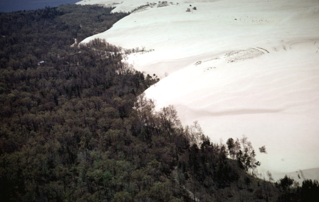
141-11: Dunes covering trees at Little Sable Point, MI. View to the south. (2Jun66)
141-13: Dunes submerging trees at Little Sable Point, MI. View to the north. (2Jun66)
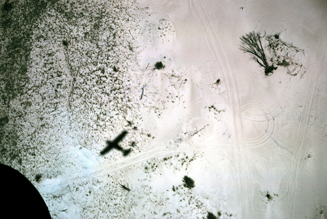
141-15: Near vertical view of sand at Little Sable Point, MI. View to northeast. Tree has fallen owing to loss of root support. Once sand becomes mobile vegetation has a difficult time stabilizing it. Note dune-buggy tracks. (2Jun66)
141-21: NNW/SSE-trending drumlins 9 miles southwest of Charlevoix, MI. View to the ESE. (2Jun66)
141-22: NNW/SSE-trending drumlins 5 miles south of Charlevoix, MI. View to the southeast. See also 141-23. (2Jun66)
141-23: NNW/SSE-trending drumlins 5 miles south of Charlevoix, MI. View southward along their axes. Some of these same features are visible in 141-22. (2Jun66)
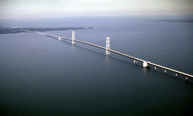
141-25: Mackinac Bridge at the Straits of Mackinac between Lake Michigan and Lake Huron. View to the northeast. St. Ignace, MI is at the left; a portion of Mackinac Island is at the upper right. (2Jun66)
141-30: Isostatically-raised beaches near Pointe aux Chenes, Lake Michigan, about ten miles northwest of St. Ignace, MI. View to the east. (2Jun66)
141-32: Soil differences on old beaches are mirrored in the vegetation. Isostatically-raised beaches near Pointe aux Chenes, Lake Michigan, about ten miles northwest of St. Ignace, MI. View to the north. (2Jun66)
141-35: Old isostatically-raised beaches near Naubinway, MI. View to the southeast. (2Jun66)
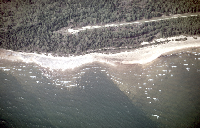
142-05: Wave refraction along north shore Lake Michigan east of Manistique, MI. Note the wave energy is concentrated on the headlands instead of the bay. (2Jun66)
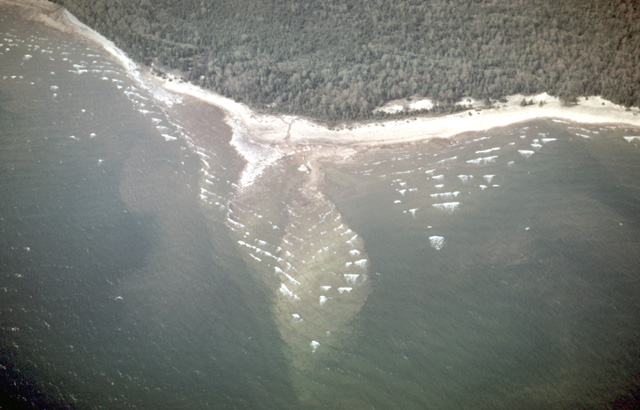
142-06: Wave refraction on a rocky headland east of Manistique, MI. (2Jun66)
Copyright © 2001 Louis J. Maher, Jr.