
161-30vc: Index map of Wind River Basin and Owl Creek Mountains, WY
7. Owl Creek Mountains, Sheep Mountain, Bighorn Basin, Bighorn Mountains
161-30vc: Index map of Wind River Basin and Owl Creek Mountains, WY
093-04: Wind River Basin, WY. View to west looking upstream over the Wind River to the Wind River Mountains. The deep notch on the mountain flank is the valley of Bull Lake. (21Jul65)
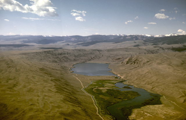
093-10: Valley of Dinwoody Lakes, Wind River Mountains, WY. View to the south. Note recessional moraines in the valley. (21Jul65)
093-19: Moraine at Dinwoody Lakes, Wind River Mountains, WY. View to the south. (21Jul65)
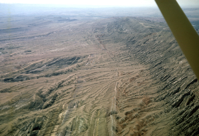
093-27: Mud flow north of Dubois, WY and west of Little Horse Creek. View toward northwest. Sediment derived from Tertiary sediments exposed to the west. See also photo 093-29. The flow has pushed Little Horse Creek to the east. Note the ponds and depressions on the surface of the flow. (21Jul65)
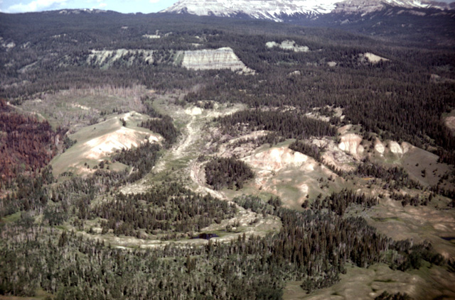
093-29: Mud flow north of Dubois, WY and west of Little Horse Creek. Sediment derived from Tertiary sediments exposed in middle distance. View toward west. See also photo 093-27. (21Jul65)
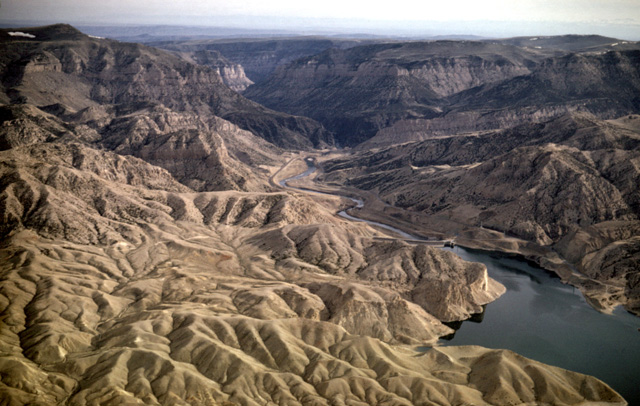
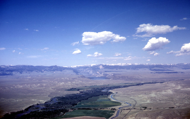
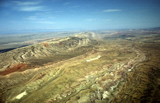
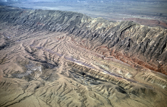
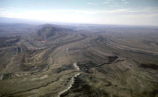
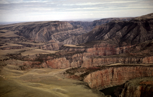
130-18: Boysen Reservoir, Wind River canyon through Owl Creek Mountains. 25 miles northeast of Riverton, WY. View to NNE. The Wind River changes it name to the Bighorn River as it passes through the Owl Creek Mountains; the stream is superimposed on the mountain structure. (15Apr66)
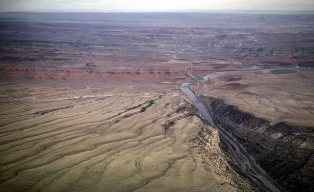
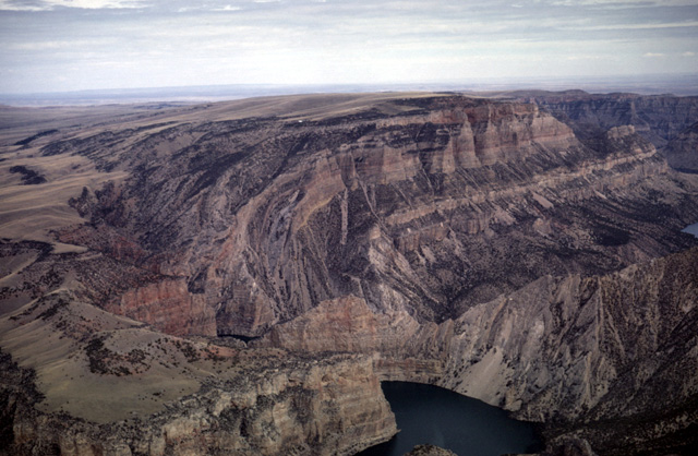
130-20: Wind River/Bighorn River exits Owl Creek Mountains and flows into Bighorn Basin. Five miles south of Thermopolis, WY; view toward north. The surface rocks in the foreground belong to the Phosphoria fm (Permian); the red Chugwater shale (Triassic) is visible in the middle distance. (15Apr66)
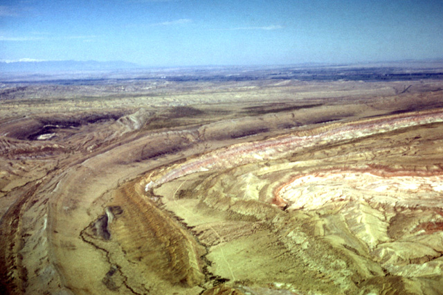
130-21: Phosphoria fm (Permian) forms dip slope on the north side of the Owl Creek Mountains about five miles south of Thermopolis, WY. View looking southwest. (15Apr66)
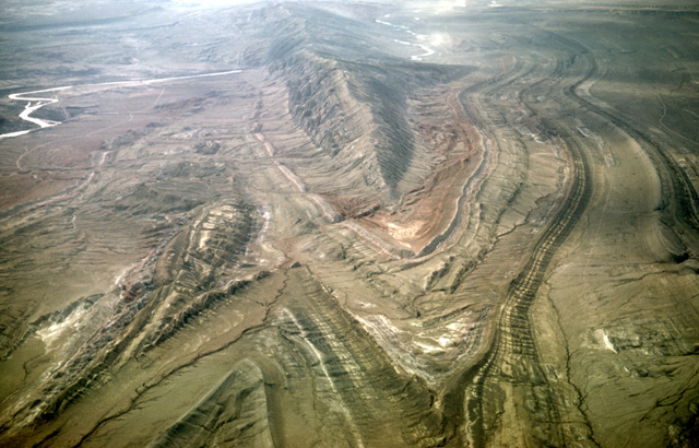
130-27: Sheep Mountainn anticline between Greybull and Lovell, WY. View to southeast. Anticline plunges to northwest. At left is northwest-plunging syncline. Note that Bighorn River has been superimposed across this structure. See Lovell-Greybull Area, Big Horn Co., WY, Department of Agriculture, Commodity Stabilization Service, 1961: Air photo BBN-3BB-66. (15Apr66)
130-32: Looking SSE over syncline at Sheep Mountain anticline between Greybull and Lovell, WY. Sheep Mountain has a core of the Madison fm (Mississippian). The Thermopolis shale, black shale of Cretaceous age, passes through the lower right corner of the photo. The rock in the foreground is the Cretaceous Mowry fm. See Lovell-Greybull Area, Big Horn Co., WY, Department of Agriculture, Commodity Stabilization Service, 1961: Air photo BBN-3BB-66 (15Apr66)
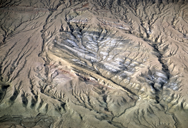
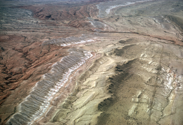
089-23: View of west side of the Sheep Mountain anticline, Bighorn Basin, WY. View to the northeast. Madison limestone (Mississippian) and overlying Amsden fm (Mississippian-Pennsylvanian) form Sheep Mountain. The red Triassic Chugwater shale forms a low valley. Then in sequence occur the thin white ridge-forming Jurassic Gypsum Spring fm, the Jurassic Sundance fm, the Jurassic Morrison and Cretaceous Cloverly fms, and the Cretaceous Thermopolis fm with its distinctive white sandy interval that is partially hidden by recent alluvium. See Lovell-Greybull Area, Big Horn Co., WY, Department of Agriculture, Commodity Stabilization Service, 1961: Air photo BBN-3BB-107. (25Jun65)
089-28: Red Chugwater fm (Triassic) and white Gypsum Spring fm (Jurassic) at south end of Sheep Mountain, Bighorn Basin, WY. View to northeast. Bighorn Mountains in background. See Lovell-Greybull Area, Big Horn Co., WY, Department of Agriculture, Commodity Stabilization Service, 1961: Air photo BBN-3BB-190. (25Jun65)
089-31: Sheep Mountain, Bighorn Basin, WY. View to northwest. See Lovell-Greybull Area, Big Horn Co., WY, Department of Agriculture, Commodity Stabilization Service, 1961: Air photo BBN-3BB-13. (25Jun65)

090-04: Sheep Mountain, Bighorn Basin, WY. View to south. Black Thermopolis and Mowry fms (Cretaceous) crop out in northeast-plunging syncline in the foreground. The adjacent northeast-plunging anticline extends through the middle of the view. See Lovell-Greybull Area, Big Horn Co., WY, Department of Agriculture, Commodity Stabilization Service, 1961: Air photo BBN-3BB-65. (25Jun65)
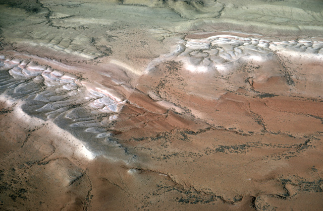
090-07: Sheep Mountain area, Bighorn Basin, WY. View to northwest on the flank of a gentle anticline. The pink and green formations in the lower right quarter of the photo range from the Gypsum Spring fm through the Sundance, Morrison (Jurassic), and Cloverly fms (Cretaceous). The remainder of the photo shows exposures of the black Thermopolis shale, a narrow syncline in the Mowry shale and another exposure of the Thermopolis shale in a small dome. The Absaroka Range is at left horizon. See Lovell-Greybull Area, Big Horn Co., WY, Department of Agriculture, Commodity Stabilization Service, 1961: Air photo BBN-2BB-256. (25Jun65)
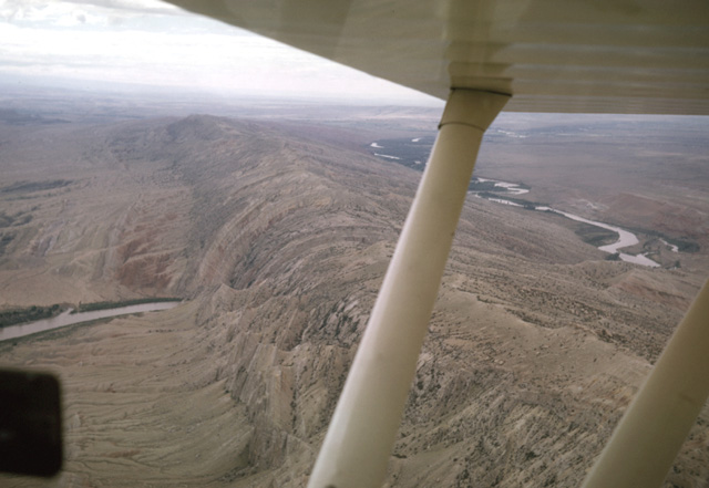
091-04: Sheep Mountain, Bighorn Basin, WY. The Bighorn River, flowing over Tertiary basin fill was superimposed upon the Sheep Mountain anticline. View toward the southeast looking upstream. Struts belong to a rented Piper Scout. See Lovell-Greybull Area, Big Horn Co., WY, Department of Agriculture, Commodity Stabilization Service, 1961: Air photo BBN-3BB-110. (27Jun65)
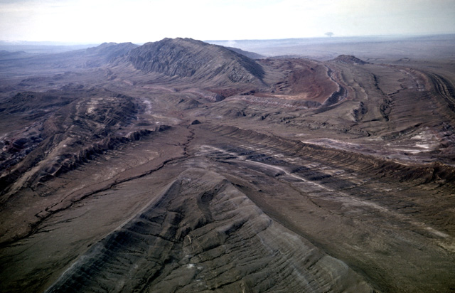
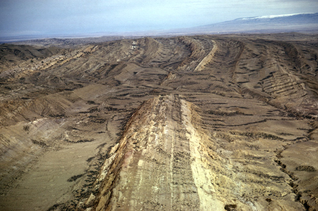
130-28: Sheep Mountain anticline located between Greybull and Lovell, WY. View to southwest. Bighorn River superimposed across the fold; note railroad uses the same cut. Madison ls (Mississippian) and Amsden fm (Pennsylvanian) form the ridge; the red Chugwater fm (Triassic) crops out near the river. See Lovell-Greybull Area, Big Horn Co., WY, Department of Agriculture, Commodity Stabilization Service, 1961: Air photo BBN-3BB-110. (15Apr66)
090-36: Sheep Mountain, Bighorn Basin, WY. View to the southwest. The units (red Chugwater, Gypsum Spring, Sundance, Morrison, Cloverly, and black Thermopolis shale are partially obscured by erosion debris. See Lovell-Greybull Area, Big Horn Co., WY, Department of Agriculture, Commodity Stabilization Service, 1961: Air photo BBN-3BB-65. (25Jun65)
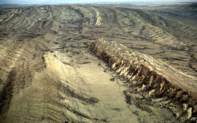
090-37: Sheep Mountain, Bighorn Basin; looking southeast along strike along the east side of the Sheep Mountain anticline. The black Thermopolis shale is exposed in the adjacent, partially faulted northwest-plunging syncline. See Lovell-Greybull Area, Big Horn Co., WY, Department of Agriculture, Commodity Stabilization Service, 1961: Air photo BBN-3BB-128. (25Jun65)
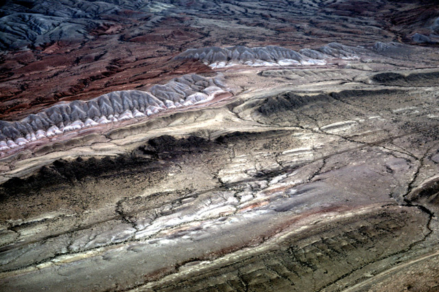
130-29: Exposure of the Thermopolis shale (Cretaceous) in a syncline on northeast side of Sheep Mountain between Greybull and Lovell, WY. See Lovell-Greybull Area, Big Horn Co., WY, Department of Agriculture, Commodity Stabilization Service, 1961: Air photo BBB-3BB-128. (15Apr66)
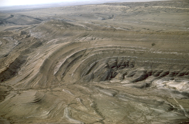
089-16: Sheep Mountain area, Bighorn Basin, WY. Dome exposing black Thermopolis shale of Cretaceous age. View to southeast. See Lovell-Greybull Area, Big Horn Co., WY, Department of Agriculture, Commodity Stabilization Service, 1961: Air photo BBN-3BB-68. (25Jun65)
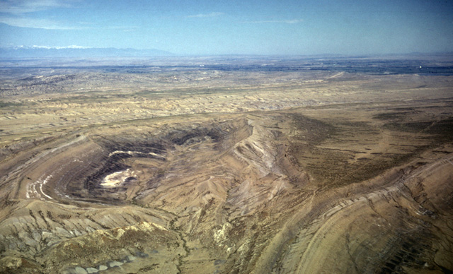
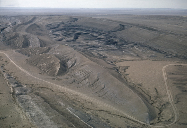
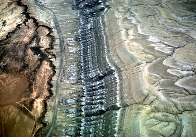
090-09: Sheep Mountain, Bighorn Basin, WY. View to southeast. The Sheep Mountain anticline plunges to the northwest. The white Muddy sand of the black Thermopolis shale appears at the center of view and bends around the nose of the anticline to extend along strike at the left. The Mowry shale crops out in a SE-plunging syncline at the right. At the right-center of the view it is possible see the linear furrow of a Bentonite strip-mining operation in the upper part of the Mowry shale. See Lovell-Greybull Area, Big Horn Co., WY, Department of Agriculture, Commodity Stabilization Service, 1961: Air photo BBN-3BB-66. (25Jun65)
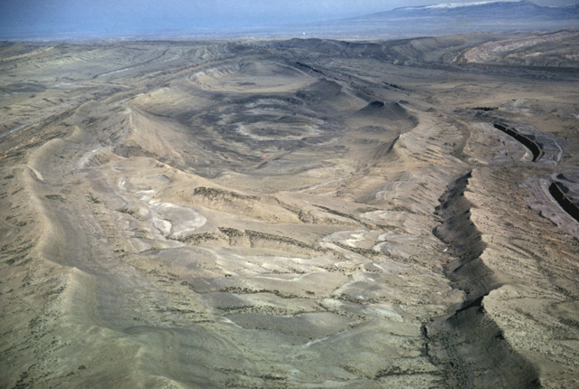
090-11: Sheep Mountain, Bighorn Basin, WY. View to northwest. Eroded dome exposing Thermopolis shale. Note the faulted white Muddy sand in the dome; the northwest side has been uplifted relative to the southwest. The Thermopolis is again exposed in an anticline at the lower right of the photo. The northwest-plunging syncline that exists between the two anticlines contains the Mowry shale, Frontier fm, and Cody shale, all of Cretaceous age. See Lovell-Greybull Area, Big Horn Co., WY, Department of Agriculture, Commodity Stabilization Service, 1961: Air photo BBN-2BB-256. (25Jun65)
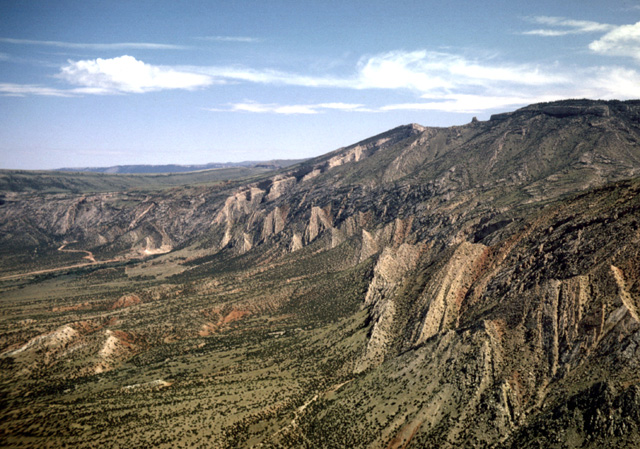
090-23: West flank of Bighorn Mountains east of Lovell, WY. View toward the NNW. (25Jun65)
090-33: Jurassic and Cretaceous rocks in the Bighorn Basin, WY. View toward the northeast to the Bighorn Mountains. Site lies east of the Bighorn River to the north of Greybull, WY. The brown Sundance fm (Jurassic) crops out at the lower left of the photo; it is overlain by the brown Morrison (Jurassic) and pink and brown Cloverly fm (Cretaceous) and black Thermopolis shale (Cretaceous). See Lovell-Greybull Area, Big Horn Co., WY, Department of Agriculture, Commodity Stabilization Service, 1961: Air photo BBN-3BB-60. (25Jun65)
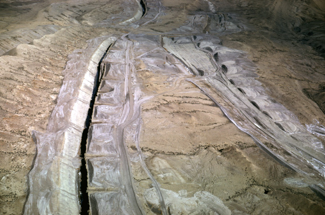
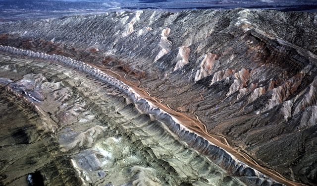
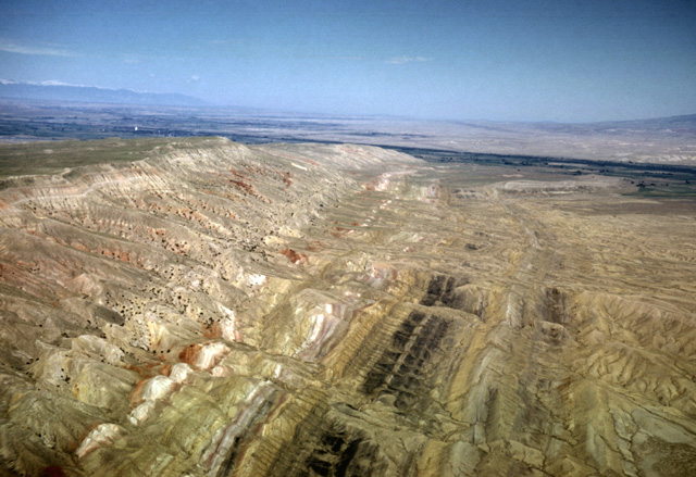
130-35: Bentonite open-cut mines from the Cretaceous Mowry fm in a small syncline northwest of Sheep Mountain, WY. View to northwest. See Lovell-Greybull Area, Big Horn Co., WY, Department of Agriculture, Commodity Stabilization Service, 1961: Air photo BBN-3BB-67. (15Apr66)
130-36: View along axis of minor anticline in Sheep Mountain area, WY. View to the northwest. The Thermopolis shale (Cretaceous) is exposed at the crest of the anticline in the middle distance. The surrounding rock is the Cretaceous Mowry shale. Note bentonite open-cut mining from the upper part of the Mowry fm along the northeast margin. See Lovell-Greybull Area, Big Horn Co., WY, Department of Agriculture, Commodity Stabilization Service, 1961: Air photo BBN-3BB-68. (15Apr66)
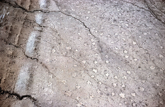
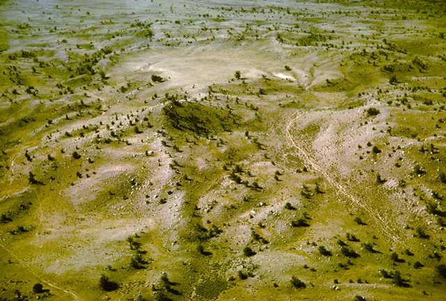
131-01: Air view of anthills in Mesozoic strata of the Sheep Mountain. area southeast of Lovell, WY. The diameters of many of these anthills exceed 40 feet. Elevation of plane about 300 feet. See, for example, Lovell-Greybull Area, Big Horn Co., WY, Department of Agriculture, Commodity Stabilization Service, 1961: Air photo BBN-2BB-200. (15Apr66)
131-11: Eroded dome in Sheep Mountain area between Greybull and Lovell, WY. View to the southeast. Thermopolis shale and its Muddy ss member are exposed. See Lovell-Greybull Area, Big Horn Co., WY, Department of Agriculture, Commodity Stabilization Service, 1961: Air photo BBN-2BB-256. (15Apr66)
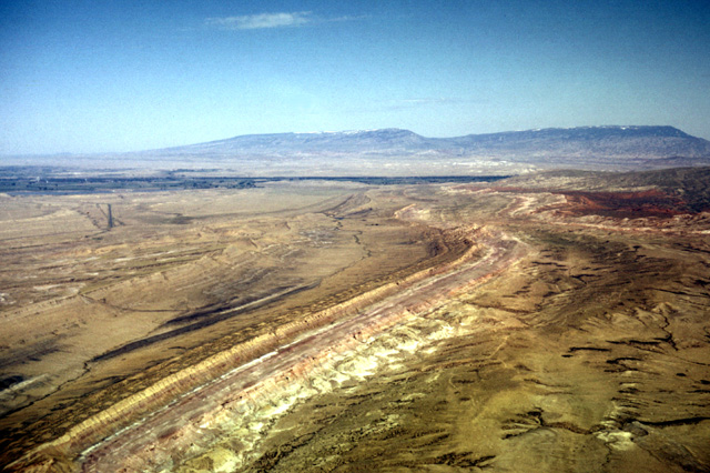
131-12: Eroded dome in Sheep Mountain area between Greybull and Lovell, WY. View to southeast. Haulage road delivers bentonite to processing plant southwest of Sheep Mountain. Thermopolis shale (Cretaceous) is exposed in center of fold. The overlying unit is the Mowry shale (Cretaceous) which contains the bentonite. See Lovell-Greybull Area, Big Horn Co., WY, Department of Agriculture, Commodity Stabilization Service, 1961: Air photo BBN-3BB-48. (15Apr66)
090-12: Little Sheep Mountain area, Bighorn Basin, WY. View to the northwest along strike. From right to left the units range through Chugwater, Gypsum Spring, Sundance, Morrison, Cloverly, Thermopolis, Mowry, Frontier and Cody. The green valley in the distance is the Shoshone River near Lovell, WY. The Pryor Mountains lie on the horizon in MT. See Lovell-Greybull Area, Big Horn Co., WY, Department of Agriculture, Commodity Stabilization Service, 1961: Air photo BBN-2BB-91. (25Jun65)
090-15: Looking northwest along strike east of Little Sheep mountain, Bighorn Basin, WY. The beds dip steeply, and, from left to right, the rock ages range from Mississippian through Cretaceous. Lovell, WY lies in the Shoshone River valley in the distance. The Absaroka Mountains lie on the horizon at the left; the Pryor Mountains are at the right. See Lovell-Greybull Area, Big Horn Co., WY, Department of Agriculture, Commodity Stabilization Service, 1961: Air photo BBN-2BB-198. (25Jun65)
131-03: Tear fault in the Gypsum Spring (Jurassic) and Chugwater (Triassic) fms northwest of Little Sheep Mountain, 12 miles southeast of Lovell, WY. See also photos 131-04 and 131-05; Lovell-Greybull Area, Big Horn Co., WY, Department of Agriculture, Commodity Stabilization Service, 1961: Air photo BBN-2BB-201. (15Apr66)
131-04: View southeast along strike toward a tear fault northwest of Little Sheep Mountain, 12 miles southeast of Lovell, WY. From left to right the formations are red Chugwater fm (Triassic), white Gypsum Spring fm (Jurassic) and brown Sundance fm (Jurassic). See also photos 131-03 and 131-05; Lovell-Greybull Area, Big Horn Co., WY, Department of Agriculture, Commodity Stabilization Service, 1961: Air photo BBN-2BB-201. (15Apr66)
131-05: Tear fault in the Gypsum Spring (Jurassic) and Chugwater (Triassic) fms northwest of Little Sheep Mountain, 12 miles southeast of Lovell, WY. View to southwest. See also photos 131-03 and 131-04; Lovell-Greybull Area, Big Horn Co., WY, Department of Agriculture, Commodity Stabilization Service, 1961: Air photo BBN-2BB-201. (15Apr66)
131-14: Southwest-dipping Cretaceous sands and clays in the Sheep Mountain area between Greybull and Lovell, WY. View to northwest. Pryor Mountains of Montana in the right background. See Lovell-Greybull Area, Big Horn Co., WY, Department of Agriculture, Commodity Stabilization Service, 1961: i.e. Air photo BBN-2BB-257. (15Apr66)
131-15: Southwest-dipping Cretaceous sands and clays in the Sheep Mountain area between Greybull and Lovell, WY. View to northwest. Note the large ant hills in the clay valleys. See Lovell-Greybull Area, Big Horn Co., WY, Department of Agriculture, Commodity Stabilization Service, 1961: i.e. Air photo BBN-2BB-257. (15Apr66)
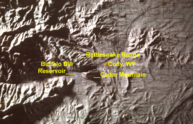
161-21vc: Index map of Cedar Mountain, WY
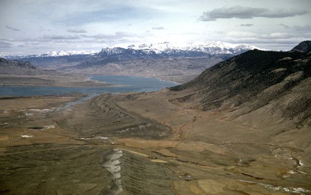
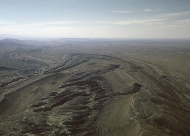
131-22: South side of Cedar Mountain (6 miles southwest of Cody, WY. View to west showing Buffalo Bill Reservoir on the Shoshone River and the Absaroka Range east of Yellowstone Park. That the Shoshone River has cut a valley between Cedar Mountain and Rattlesnake Mountain rather than draining south of Cedar Mountain is taken as evidence that the stream was superimposed across this once-buried ridge. Compare this view with photo 131-31. (15Apr66)
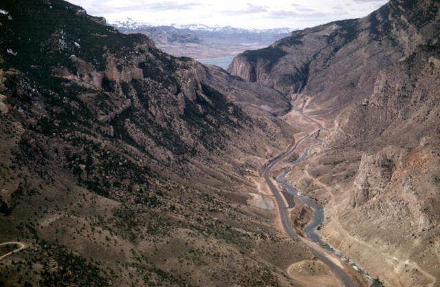
131-31: View up the Shoshone River from just west of Cody, WY. The Buffalo Bill Reservoir and the Absaroka Range are visible in the distance. US Highways 14, 16 and 20 are at the right of the river. Cedar Mountain lies to the left; Rattlesnake Mountain is at the right. Compare this view with photo 131-22. (15Apr66)
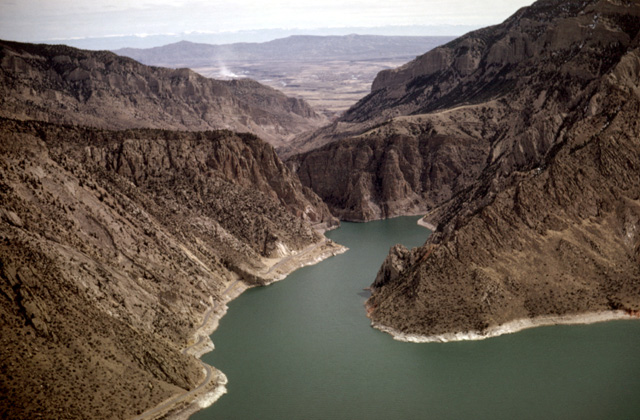
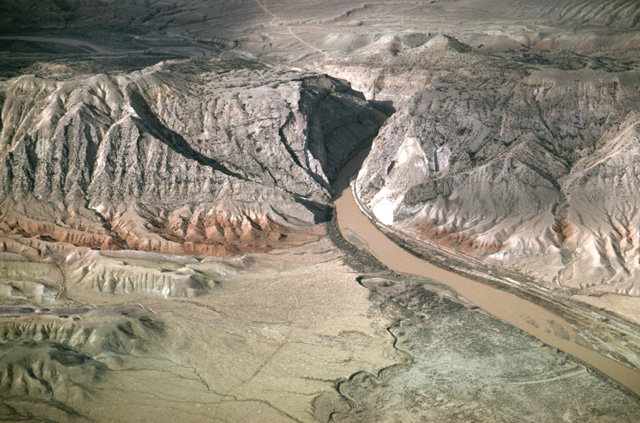
131-27: East end of the Buffalo Bill Reservoir looking downstream toward Cody, WY. See photos 131-22 and 131-31 for evidence the Shoshone River was superimposed across this ridge. (15Apr66)
131-33: Heart Mountain (8123 ft), a portion of the Heart Mountain thrust, lies 9 miles north of Cody, WY. View to north. Absaroka Range in the left distance. 15Apr66)
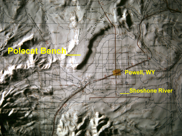
161-23vc: Index map of Polecat Bench, WY
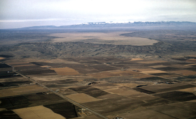
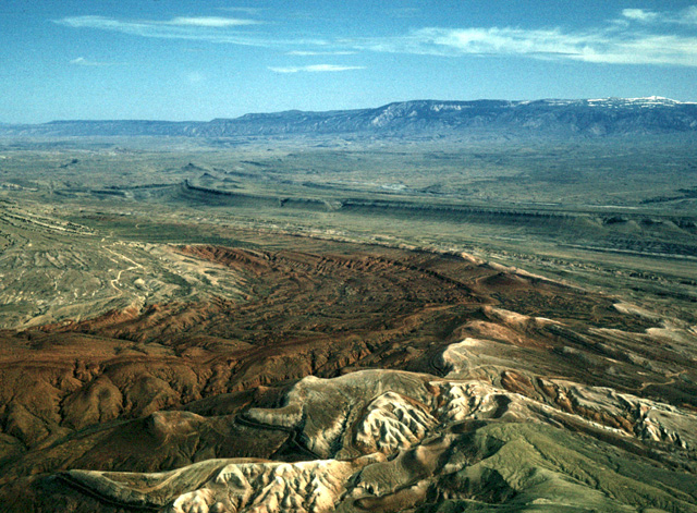
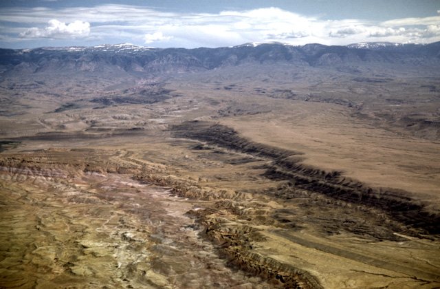
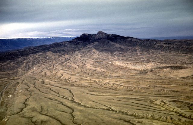
131-34: Polecat Bench from about 15 miles NNE of Cody, WY. This feature is armored by stream gravel, and it represents a small part of the sediment that once filled the Bighorn Basin. View to NNE. The Pryor and Bighorn are at the horizon. (15Apr66)
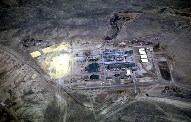
132-02: Sulphur and Petroleum plant, Elk Basin Oil Field, 20 miles WNW of Lovell, WY. (15Apr66)
132-09: Stream captures on escarpment south of the Pryor Mountains north of Lovell, WY. Rocks (Cretaceous) are Thermopolis shale overlain by the Mowry shale. (15Apr66)
132-20: Bighorn River Canyon between the Pryor and Bighorn Mountains in MT. View to the northeast. This is another superimposed stream. (15Apr66)
132-22: Bighorn Canyon through the Bighorn Mountains in MT. View to northeast. (15Apr66)
Copyright © 2001 Louis J. Maher, Jr.