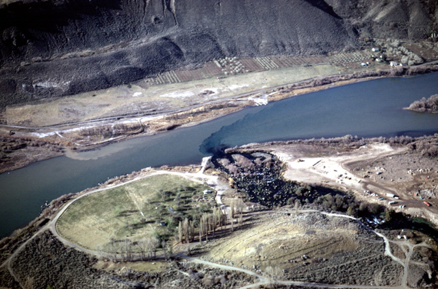
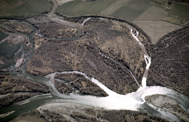
125-18: View south over Snake River at Thousand Springs area fish hatchery 20 miles northwest of Twin Falls, ID. Note effluent from farms and clear spring water. See also photo 125-20. (14Apr66)
6. Craters of the Moon, Yellowstone Park, Jackson Hole, Glaciers of the Wind River Mountains
125-18: View south over Snake River at Thousand Springs area fish hatchery 20 miles northwest of Twin Falls, ID. Note effluent from farms and clear spring water. See also photo 125-20. (14Apr66)
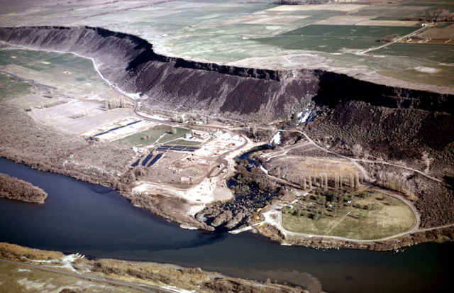
125-20: Snake River and Tertiary lava at Thousand Springs area 20 miles northwest of Twin Falls, ID. View northwest. See also photo 125-18. (14Apr66)
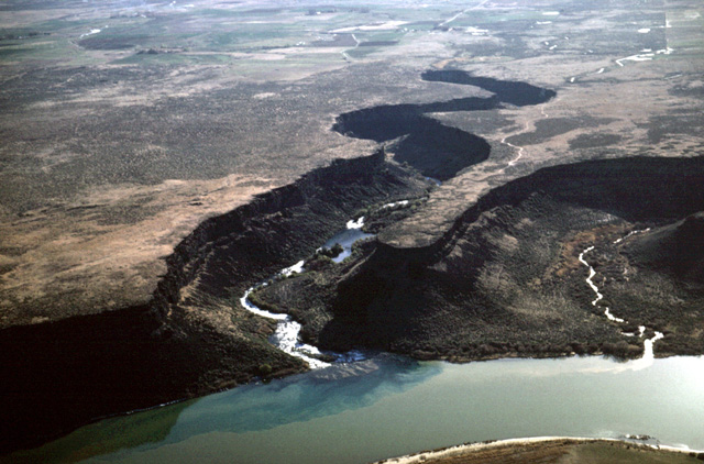
125-21: Snake River tributaries resulting from spring sapping in Tertiary lavas. View to northeast 25 miles northwest of Twin Falls, ID. (14Apr66)
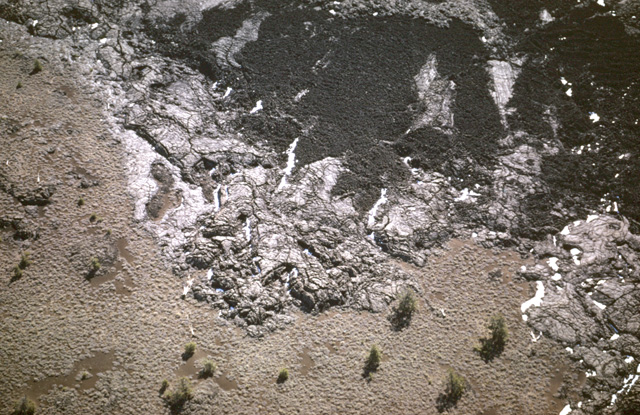
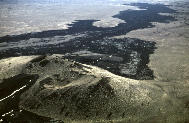
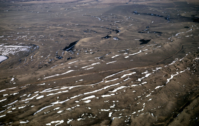
125-26: Quaternary lava surface and collapse features, southwest of Craters of the Moon National Monument, ID. Note areas of wind-blown sand. Clumps of sagebrush provide scale. (14Apr66)
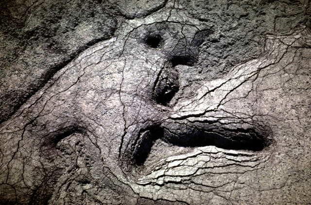
125-29: Fractured and collapsed Quaternary lava southwest of Craters of the Moon National Monument, ID. View to the east; clumps of sagebrush provide scale. (14Apr66)
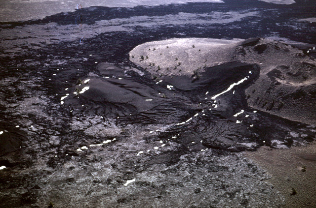
125-36: Edge of recent lava flow at Craters of the Moon National Monument, ID. View to southeast. Note both Aa and Pahoehoe flows. Soil has developed on older lava that supports pine trees and sagebrush. (14Apr66)
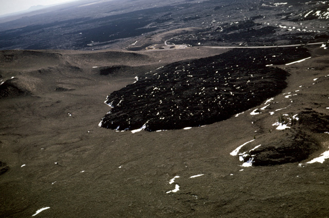
126-04: Recent lava flow at visitor center, Craters of the Moon National Monument, ID. Note soil developed on the older lava. View to the east. Big Southern Butte (7576 ft) on horizon in upper left corner. 14Apr66)
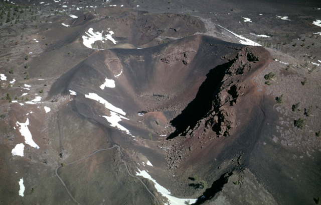
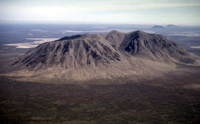
126-12: Three aligned cinder cones at Craters of the Moon National Monument, ID. View to northeast. Pine trees provide scale. (14Apr66)
126-24: Twin cones at Craters of the Moon National Monument, ID. View to east. Pines and sage provide scale. Lava from left crater continues down regional slope to the southeast. Note the linear rifts, the position of which in places are accentuated by snow. See also photo 126-25. (14Apr66)
126-25: Lava from twin cinder cones at Craters of the Moon National Monument, ID. See also photo 126-24. Pine trees provide scale. (14Apr66)
127-06: Big Southern Butte (7576 ft.), 20 miles east of Craters of the Moon National Monument, ID. View to the east. (14Apr66)
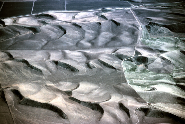
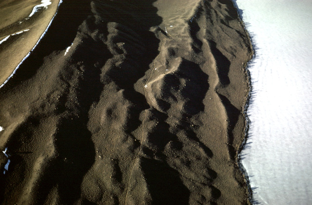
127-13: Stabilized sand dunes along south side of American Falls Reservoir (Snake River), west of Pocatello, ID. (14Apr66) (I visited this site on the ground during June 1966; a wind storm was in progress, and plenty of dust and silt was moving.)
127-17: Braided Snake River upstream from Pocatello, ID. View to the southeast. (14Apr66)
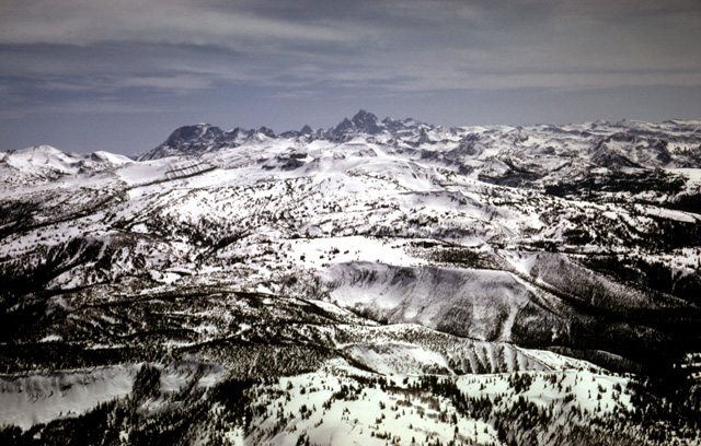
127-21: Teton Mountain Range from the gentle west slope. View looking east from the vicinity of Lamont, ID. (14Apr66)
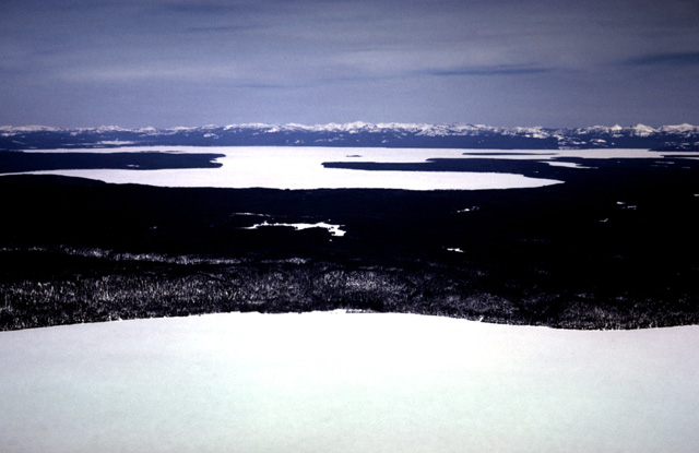
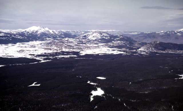
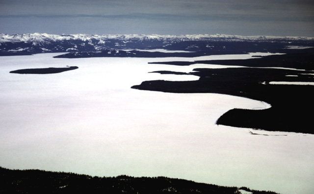
127-22: Yellowstone Plateau, WY. Yellowstone Lake (7733 ft.) in background; Lewis Lake in foreground. Absaroka Mountains at horizon. View to ENE. (14Apr66)
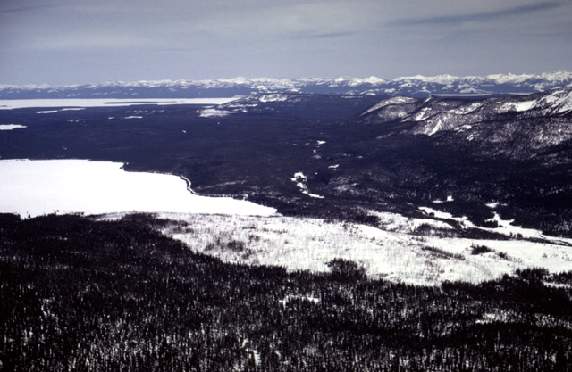
127-23: Yellowstone Plateau, WY. Yellowstone Lake (7733 ft) with West Thumb in middle distance. Shoshone Lake in foreground. Absaroka Mountains at horizon. View to ENE. (14Apr66)
127-24: Old Faithful Geyser Basin in Yellowstone Park, WY. View to northeast. Old Faithful geyser forms the sinter cone at the center of view south of the Firehole River. See also photo 127-25. (14Apr66)
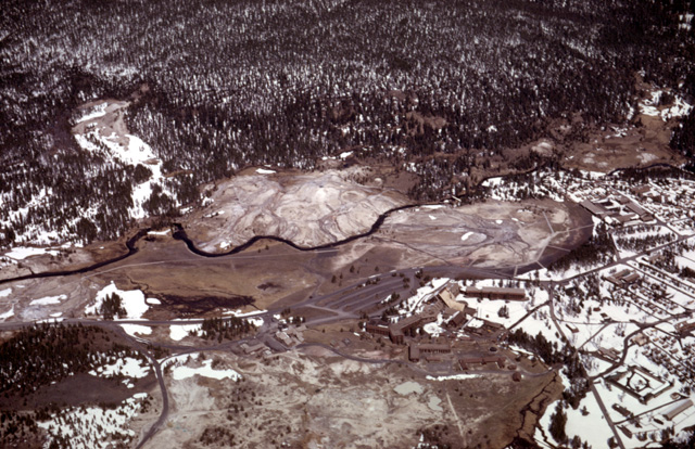
127-25: Old Faithful Geyser Basin in Yellowstone Park, WY. Old Faithful geyser forms the sinter cone at the right, just west of Old Faithful Lodge. Firehole River flows to the left (northwest) through the siliceous sinter of the geyser cones. See also photo 127-24. (14Apr66)
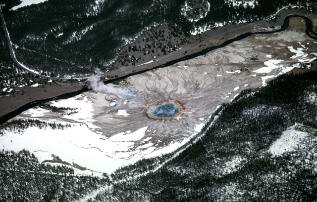
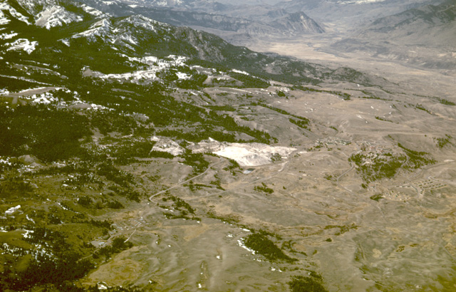
127-29: Midway Geyser Basin with Grand Prismatic Pool, Yellowstone Park, WY. The steam blowing northeastward by the Firehole River is from Excelsior Geyser (last active in 1890) (14Apr66)
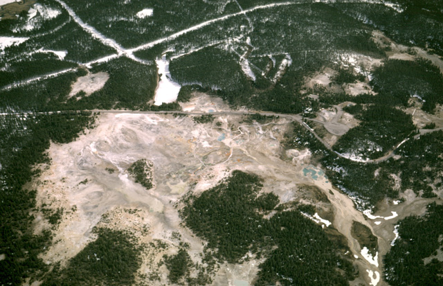
127-30: Norris Geyser Basin, Yellowstone Park, WY. View to east. (14Apr66)
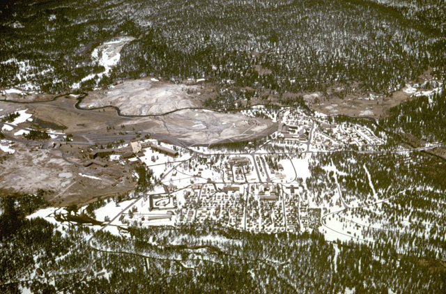
127-31: View north from Norris Geyser Basin toward Mammoth Hot Springs and Electric Peak (10,992 ft., MT), Yellowstone Park, WY. (14Apr66)
127-33: Mammoth Hot Springs' calcareous deposits (center of view) look rather small from the air. Yellowstone Park, WY. View north toward Gardiner, MT along the Yellowstone River in the distance. (14Apr66)
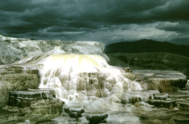
091-20: Mammoth Hot Springs, Yellowstone Park, WY. (Ground) (Jul65)
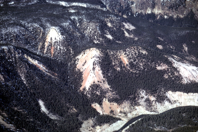
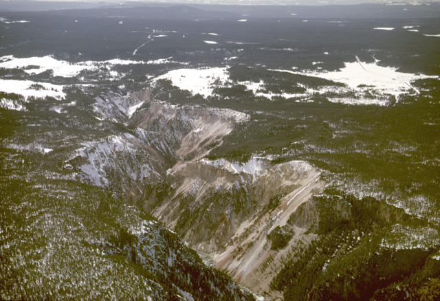
128-05: Grand Canyon of the Yellowstone River, Yellowstone Park, WY. Color comes from altered rhyolite lavas. View to north. (14Apr66)
128-07: Grand Canyon of the Yellowstone River, Yellowstone Park, WY. View to west. Lower Falls are just visible in the distance. (14Apr66)
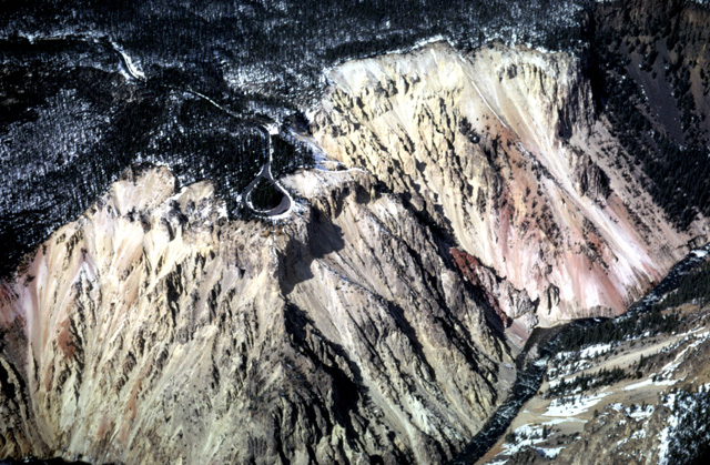
128-09: Inspiration Point, Grand Canyon of the Yellowstone River, Yellowstone Park, WY. View to north about two miles downstream from Lower Falls. (14Apr66)
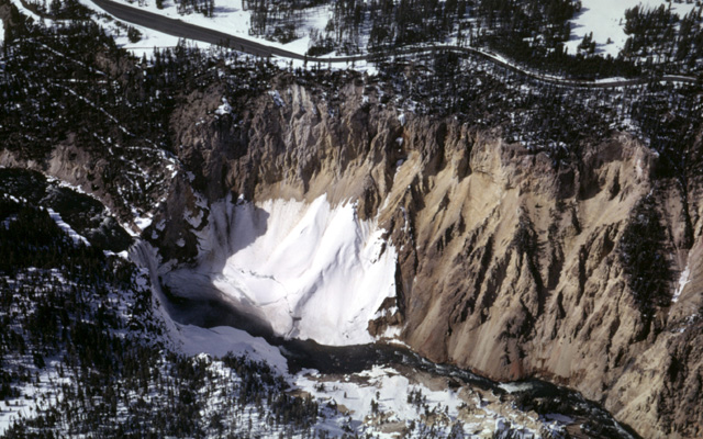
128-11: Lower Falls of the Yellowstone River, Yellowstone Park, WY. The snow lingers in this shaded location. View to northwest. (14Apr66)
128-15: Sulphur Mountain in Hayden Valley, Yellowstone Park, WY. View to the west. (14Apr66)
128-17: Yellowstone Lake (7733 ft), Yellowstone Park, WY. View to southeast; West Thumb is to the right. (14Apr66)
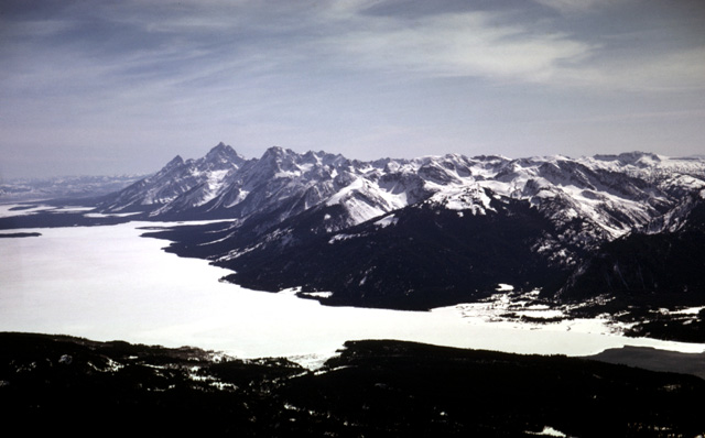
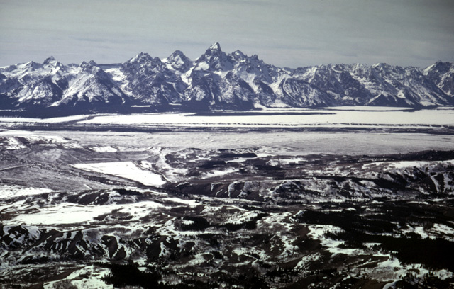
128-20: Teton Range and Jackson Lake, WY from the north. (14Apr66)
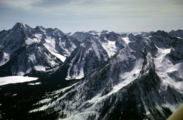
128-23: Glaciated Mountains, Teton Range, WY. (Left to right: Mt. Moran [12,605 ft], Moran Canyon, and Bivouac Peak.) There are several small glaciers (i.e. Triple Glaciers) under the snow high on the north flank of Mt. Moran. (14Apr66)
128-24: Glaciated Mountains, Teton Range, WY. (Left to right: Grand Teton, Mt. St. John, Leigh Lake [under ice] at Leigh Canyon, Mt. Moran and Bivouac Peak) (14Apr66)
128-26: Teton Range, WY. (Left to right: Mt. St. John, Leigh Lake [under ice], Mt. Moran, and Bivouac Peak) (14Apr66)
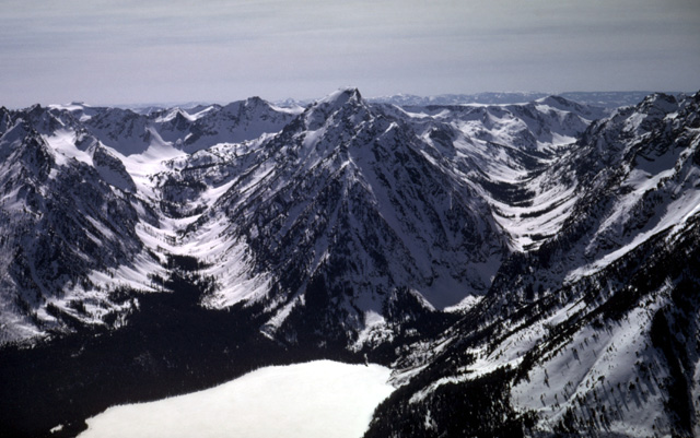
128-31: Teton Range, WY. (Left to right: Mt. St. John, Paintbrush Canyon, Leigh Lake, Leigh Canyon and south side of Mt. Moran.) Note U-shape cross-sections of Paintbrush and Leigh Canyons. (14Apr66)
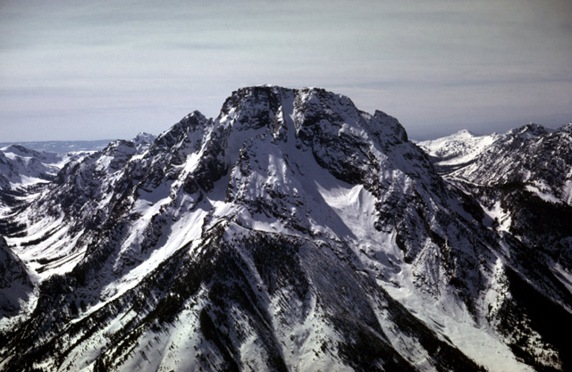
128-32: Mt. Moran (12,605 ft.), Teton Range, WY. (14Apr66)
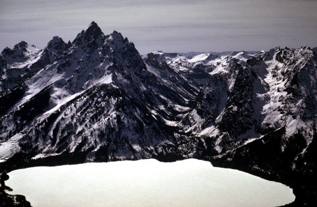
128-33: Jenny Lake along the Teton Range, WY. (Left to right: Grand Teton, U-shaped valley of Cascade Creek, south flank of Mt. St. John). Jenny Lake is within the end moraine (Pinedale) of the glacier that occupied the valley of Cascade Creek. (14Apr66)
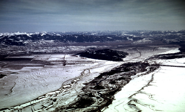
128-34: Jackson Hole, WY. Looking SSE down the Snake River. Note braided pattern and terraces. Blacktail Butte (fault block) is in middle distance. Gros Ventre Range forms background. (14Apr66)
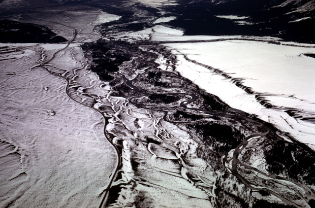
128-35: Braided Snake River with terraces and snow. Jackson Hole, WY. (14Apr66)
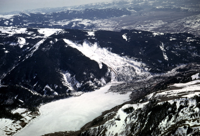
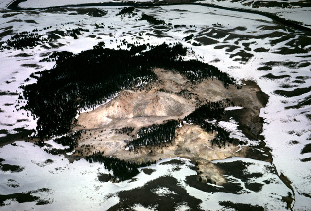
129-02: Snow-covered Gros Ventre Debris Flow scar and ice-covered Lower Slide Lake in the Gros Ventre River. View looking southwest toward Jackson Hole, WY. The Debris flow occurred on June 23, 1925, blocking the valley and creating the Lake. The debris dam gave way on May 18, 1927, releasing the stored discharge, and causing loss of life in Kelly, WY a few miles downstream. (14Apr66)
129-05: Blacktail Butte in Jackson Hole, WY. View to west from Gros Ventre Debris Flow. Kelly, WY is north of the river and highway at the bottom of the view. See photo 129-02. (14Apr66)
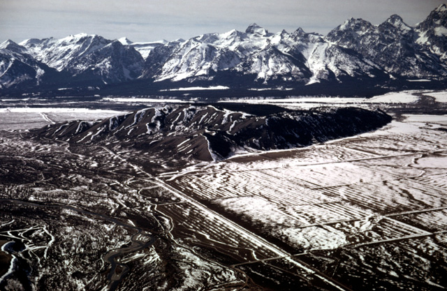
129-03: Jackson Hole, WY and the Teton Range. View to WNW from near the Gros Ventre River. Antelope Flats and Snake River in middle distance. (14Apr66)
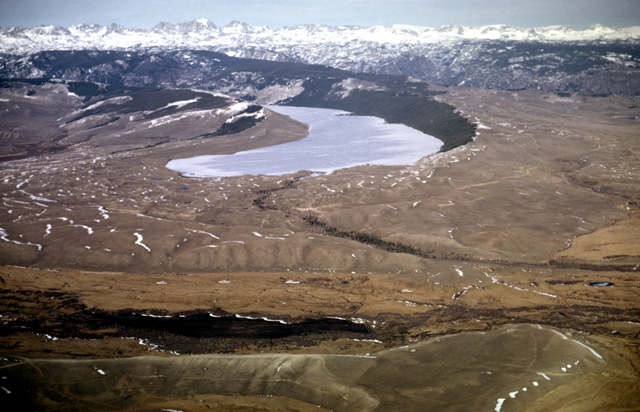
129-10: New Fork Lakes on the southern flank of the Wind River Mtns, 16 miles NNW of Pinedale, WY. View to the northeast. Note lateral, terminal and recessional moraines and outwash channels. See also photo 129-12. (14Apr66)

129-12: New Fork Lakes, 16 miles NNW of Pinedale, WY. View to the left of that in photo 129-10 showing outlying older moraines. (14Apr66)
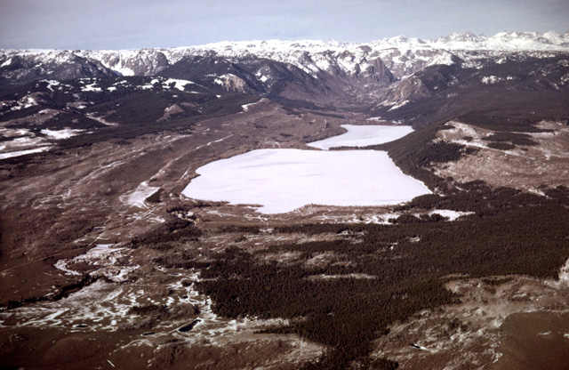
129-14: Willow Lake and moraines on south flank of the Wind River Mtns, 9 miles NNW of Pinedale, WY. View to the northeast. Note one or more recessional moraines and the different morphological ages of the lateral moraines (i.e. pitted or smooth). Outwash channel in foreground. (14Apr66)
129-18: Vertical view down on lateral moraine of Fremont Lake, 6 miles NNE of Pinedale, WY. View to NNE. (14Apr66)
129-20: Interlobate moraine area east of Fremont Lake, 6 miles northeast of Pinedale, WY on south side of Wind River Mountains. View to the southeast. (14Apr66)
Copyright © 2001 Louis J. Maher, Jr.