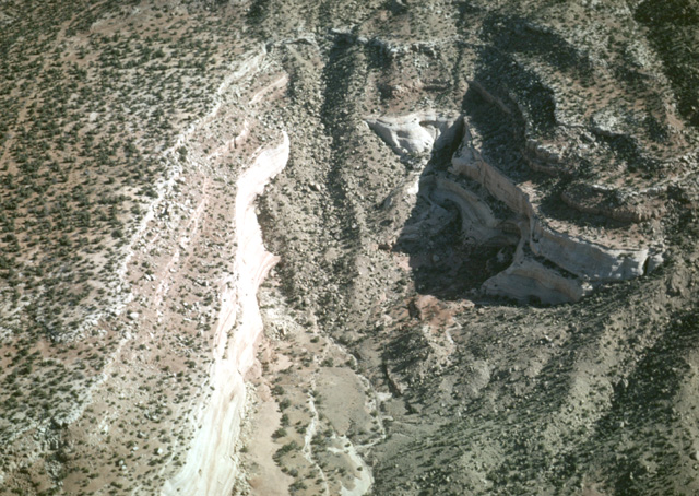
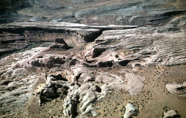
122-14: Looking down on alluvial cone (landslide debris?) in a tributary to East Canyon Wash, south of the La Salle Mountains, UT. View to north; trees (Pine & Juniper) provide scale. (13Apr66)
5. Arches National Park, Salt Lake, Bonneville Beaches
122-14: Looking down on alluvial cone (landslide debris?) in a tributary to East Canyon Wash, south of the La Salle Mountains, UT. View to north; trees (Pine & Juniper) provide scale. (13Apr66)
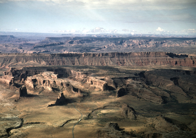
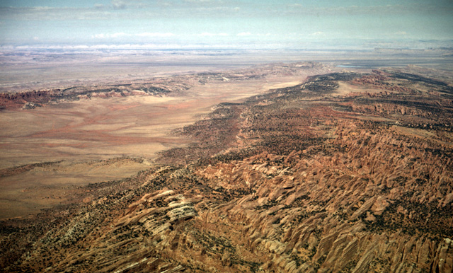
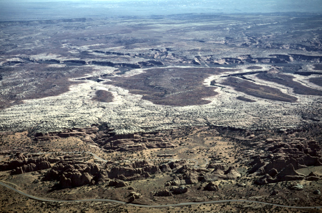
122-15: Canyon Rims Recreational Area in Dry Valley region south of La Salle Junction, UT. View to southwest. (13Apr66)
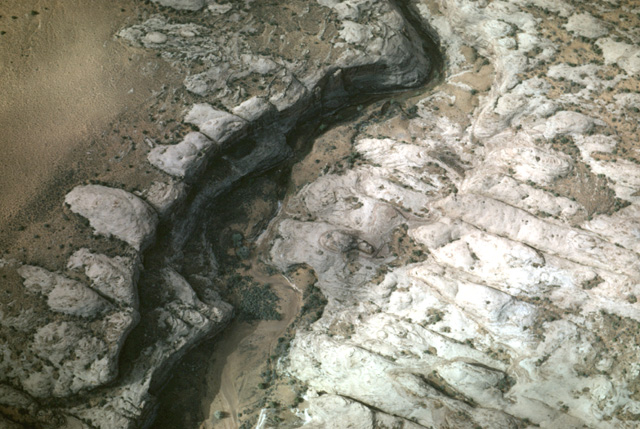
122-19: Stream and joints, Arches National Park near Moab, UT. The plane is low; use clumps of vegetation for scale. (13Apr66)
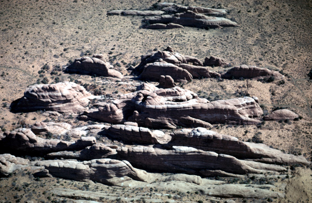
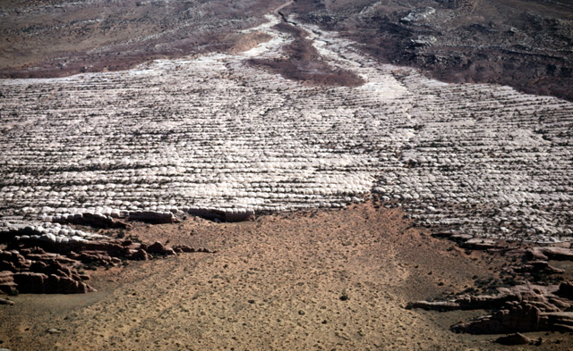
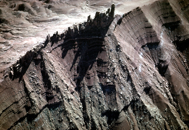
122-20: Isolated "fins" of jointed horizontal sedimentary rock. Slickrock member of the Entrada sandstone (Jurassic), Arches Nation Park, UT. View to northeast. (13Apr66)
122-21: Stream and jointed Jurassic strata in Arches National Park, UT. View to the northeast. The lower red sandstone unit is the Slickrock member of the Entrada ss (Jurassic); it is overlain by the white sandstone of the Entrada's Moab tongue. The overlying nonresistant dark red siltstone belongs to the Tidwell member of the Morrison fm (Jurassic). (13Apr66)
122-22: Landscape Arch at Arches National Park, UT. View is to the northeast. The arch has a span of 291 ft and a height of 118 ft. (13Apr66)
122-24: Joint-produced "fins" in horizontal Jurassic sedimentary rock (Slickrock member of the Entrada ss) at Arches National Park, UT. View to the northeast. The light-colored sandstone of the overlying Entrada's Moab tongue is visible at the top of the photo. 13Apr66)
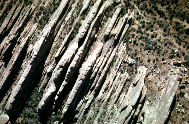
122-25: Looking down on vertical joints at Arches National Park, UT. Gaping joint set is aligned southeast/northwest (south is at upper right corner), parallel with Salt Valley (anticline/graben) located to right of the view. (13Apr66)
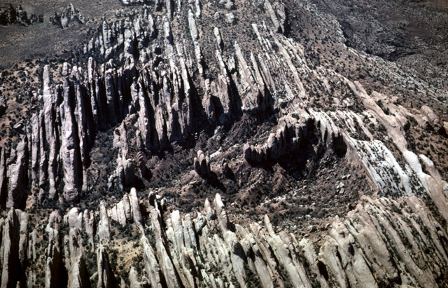
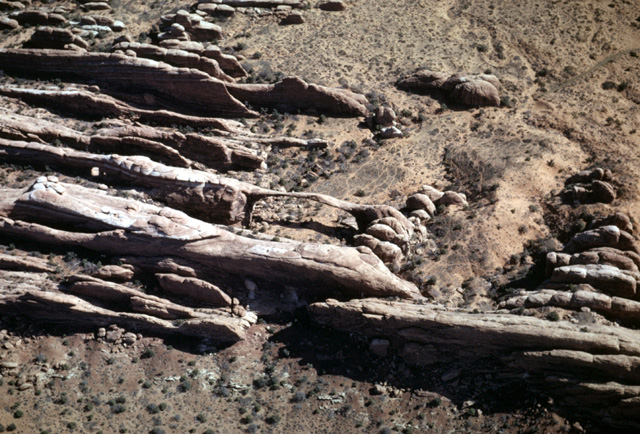
122-26: View of joint caused "fins" at Arches National Park, UT. Red sandstone is the Slickrock member of the Entrada ss (Jurassic) View to the southeast. (13Apr66)
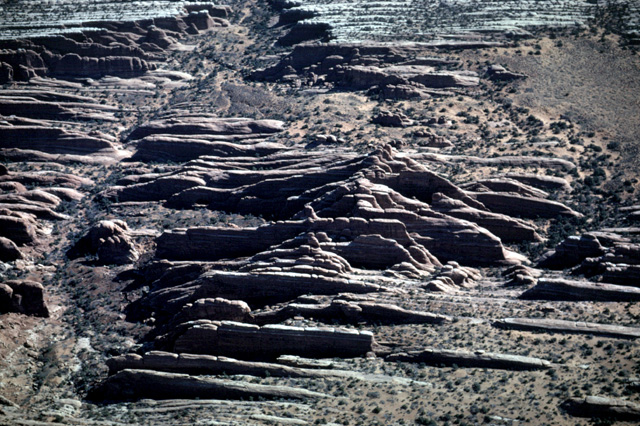
122-27: Strata at Arches National Park, UT. View to southeast. Salt Valley lies to the right. Red sandstone is Slickrock member of the Entrada fm (Jurassic); overlying light-colored bed is the Moab tongue of the Entrada fm; upper red siltstone belongs to the Tidwell member of the Jurassic Morrison fm. (13Apr66)
122-29: Landscape Arch, Arches National Park, UT. View to the west. The arch has a span of 291 ft and a height of 118 ft. (13Apr66)
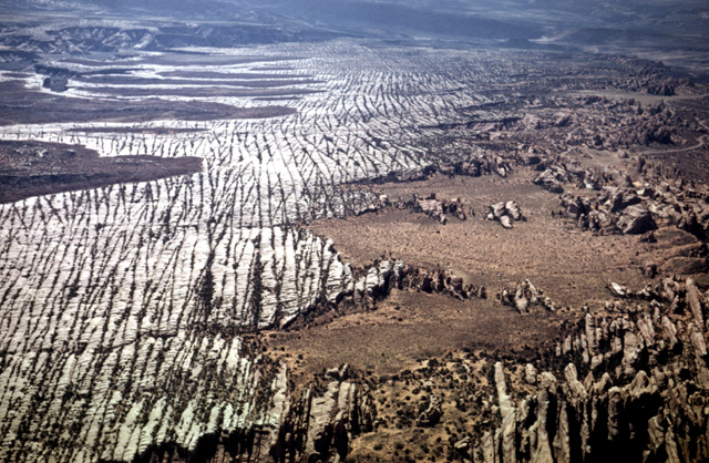
122-30: Salt Creek anticline (graben) at Arches National Park, UT. View to northwest. Solution of evaporites in the underlying Pennsylvanian Paradox fm caused the graben to form. This allowed the northwest/southeast joint set to widen and develop the "fins" so prominently displayed at the right of the photo. Jurassic Entrada fm is in the foreground. (13Apr66)
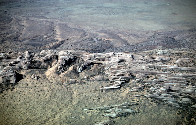
122-33: Erosion characteristics of three sediment layers at Arches National Park, UT. View to northeast. Park road provides scale. Red sandstone is Slickrock member of the Entrada fm (Jurassic); overlying light-colored bed is the Moab tongue of the Entrada fm; upper red shale belongs to the Tidwell member of the Jurassic Morrison fm. (13Apr66)
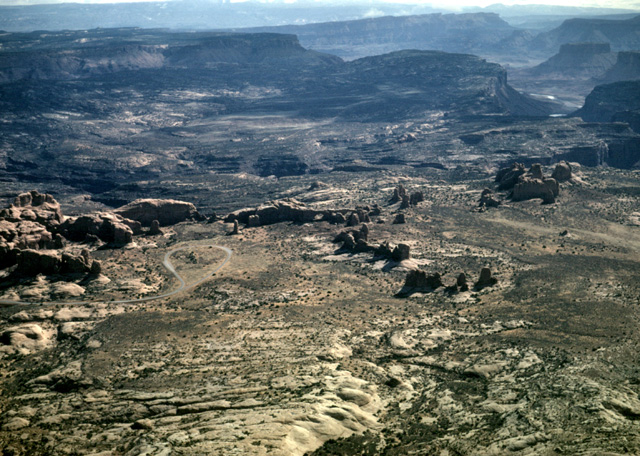
122-35: "The Windows" park loop road and arches at Arches National Park, UT. View to southeast. (13Apr66)
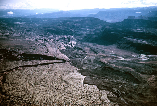
123-02: Cache Valley (graben) at Arches National Park, UT. View to southeast. Jurassic sediments; note that the younger Morrison fm in the graben is at the same level as the older Entrada ss at the left. Solution of evaporites in the underlying Pennsylvanian Paradox fm caused the graben to form(13Apr66)
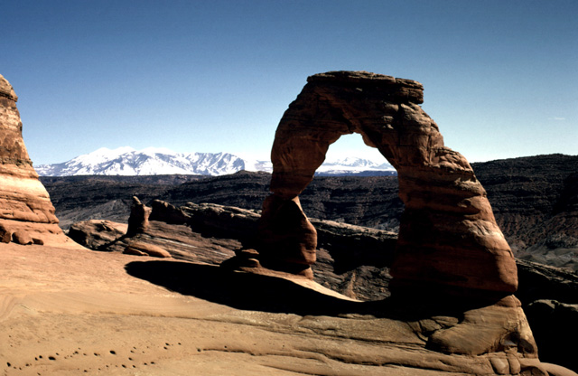
193-26: Ground view of Delicate Arch, Arches National Park, UT. View southeast to the La Sal Mtns. See also photo 123-04. (1Apr70)
123-04: Delicate Arch (center of photo) from air, view to southwest, Arches National Park, UT. See also photo 193-26. (13Apr66)
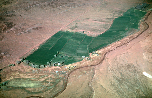
123-13: Irrigated field in a dry land. View to the west. Site on the northwest flank of the La Salle Mountains east of Moab, UT. (13Apr66)
123-14: "Priest & Nuns" (Triassic Wingate fm) - Castle Rock). View to southwest, 10 miles east of Moab, UT. (13Apr66)
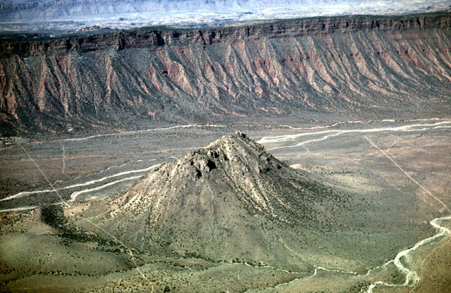
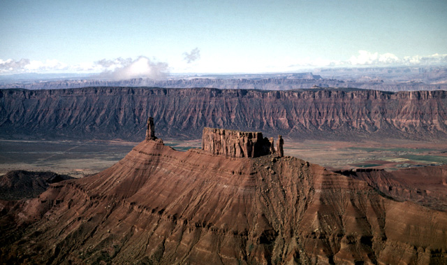
123-15: Round Mountain, an igneous intrusion in Castle Valley. View to northwest, 10 miles east of Moab, UT. (13Apr66)
123-18: A ridge of the Triassic Wingate fm. View to southeast, 10 miles east of Moab, UT. (13Apr66)
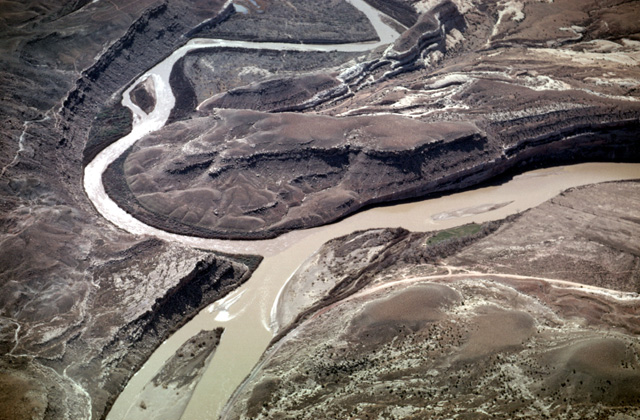
123-22: Confluence of the Colorado and Dolorus Rivers, 20 miles northeast of Moab, UT. View to southeast. (13Apr66)
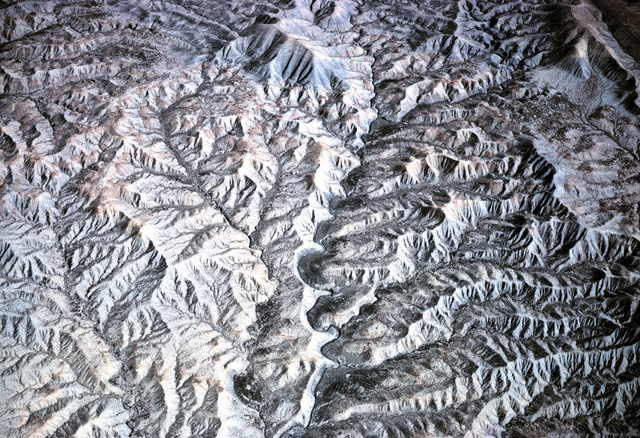
123-24: Dendritic drainage in shale at the foot of the Book Cliffs northwest of Grand Junction, CO. (13Apr66)
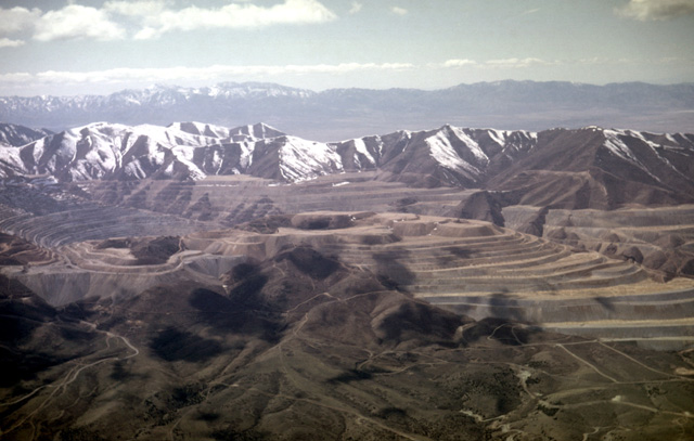
124-11: Distant view of Bingham Copper Mine in Oquirrh Mtns, southwest of Salt Lake City, UT. View to the west. This is a porphyry mass that intrudes Pennsylvanian sediments. (13Apr66)
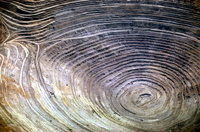
124-14: Bingham Copper Mine in Oquirrh Mtns, southwest of Salt Lake City UT. This porphyry mass intrudes Pennsylvanian sediments; the ore contains about 1 per cent copper. View to the west; note the ore trains that were active when this photo was taken in 1966. (13Apr66)
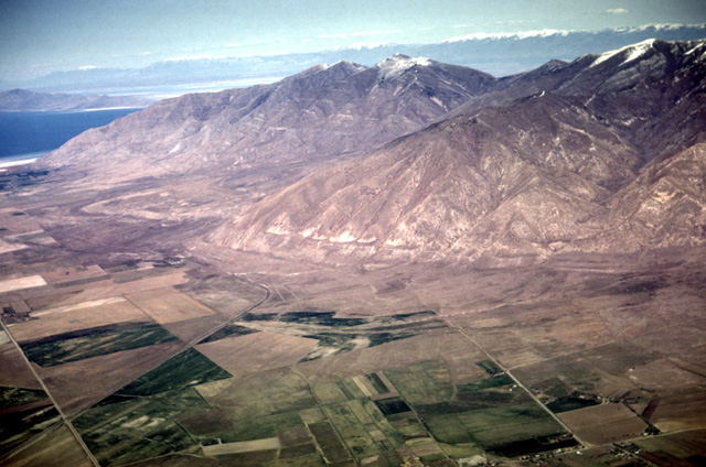
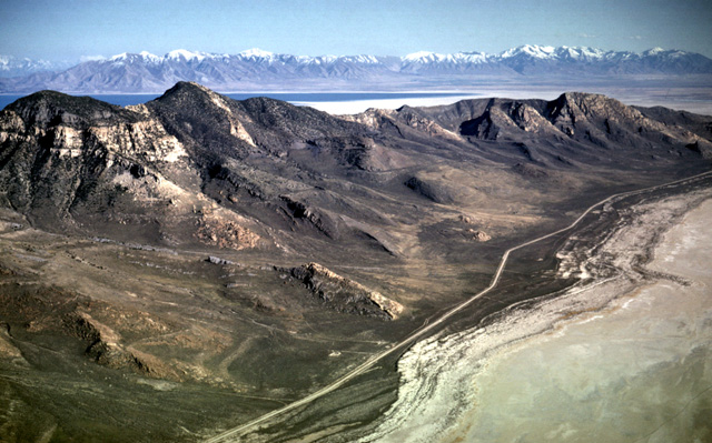
124-18: Lake Bonneville beaches cut on west side of Oquirrh Mtns near Tooele, UT. View to northeast. Also note old strand lines in fields at lower left. Wasatch Mtns are in the distance. (13Apr66)
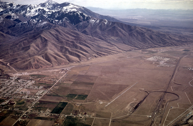
124-22: Lake Bonneville beaches on west side of Oquirrh Mtns near Tooele, UT. View to southeast. The Tooele Airport is the narrow north/south strip in the foreground. (13Apr66)
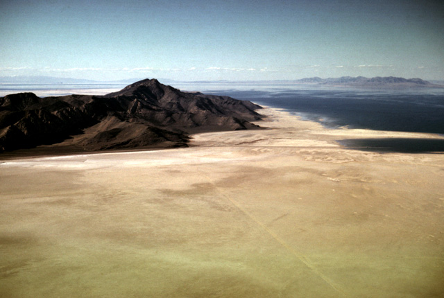
124-27: Distant view of Stansbury Island, surrounded by salt flats on southwest side of Great Salt Lake, UT. View to the north. The Promontory Mtns are visible at the right horizon. (13Apr66)
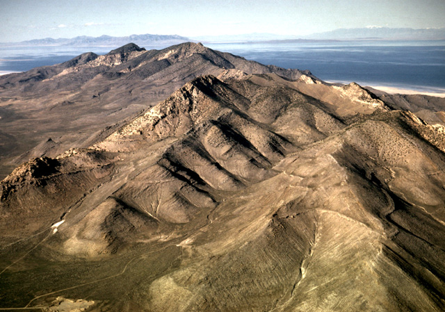
124-29: Stansbury Island on southwest side of Great Salt Lake, UT. View is to the NNE. Stansbury Island is made of dipping Paleozoic sediments. Note the Lake Bonneville beach ridge that contours the ridges and valleys in the foreground. The Promontory Mtns are at the left horizon; the Wasatch Mtns are at the right. (13Apr66)
124-31: Stansbury Island on southwest side of Great Salt Lake, UT. A beach of Lake Bonneville follows a contour on these dipping Paleozoic sediments. View is to the southeast with the Wasatch Mountain Front in background. (13Apr66)
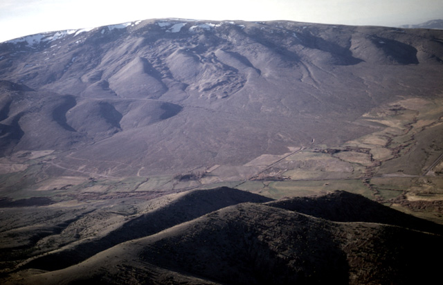
125-11: Alluvial fan on mountain north of Cache Peak, about 20 mi southeast of Burley, ID. View to the west. (Note landslides in higher valleys; is the whole fan the result of weathered mass movements?) (13Apr66)
Copyright © 2001 Louis J. Maher, Jr.