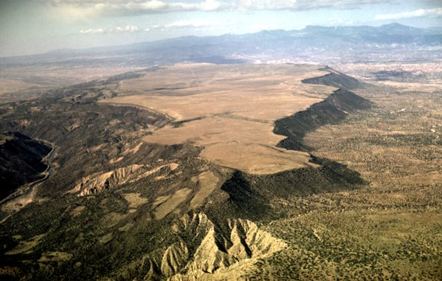
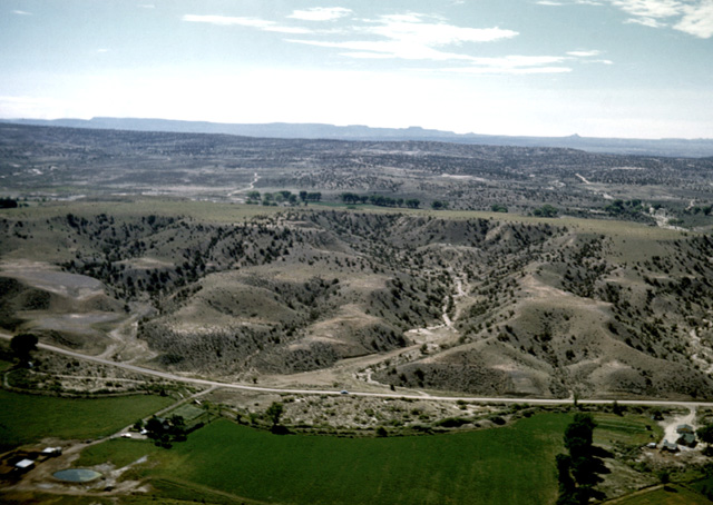
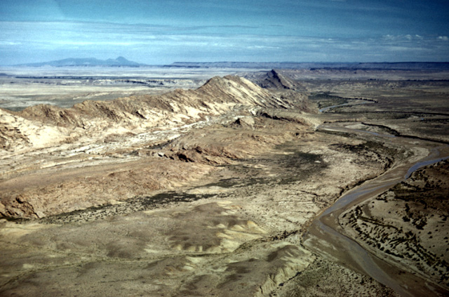
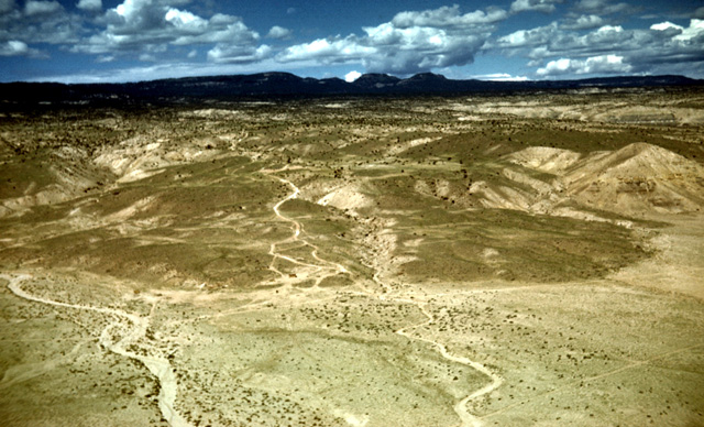
111-32: Lava-capped mesa by Rio Grande southwest of Taos, NM. View to the southwest toward Jemez Mountains in background. Note the difference in slope-wasting between the south-facing and north-facing slopes. (11Apr66)
3. Rio Grande, Jemez Mountains, San Juan Basin, Shiprock
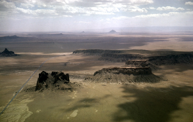
111-32: Lava-capped mesa by Rio Grande southwest of Taos, NM. View to the southwest toward Jemez Mountains in background. Note the difference in slope-wasting between the south-facing and north-facing slopes. (11Apr66)
112-04: Mesa by Rio Grande southwest of Taos, NM. View to northwest. Note the landslide blocks on this mesa flank. See also photo 111-32. (11Apr66)
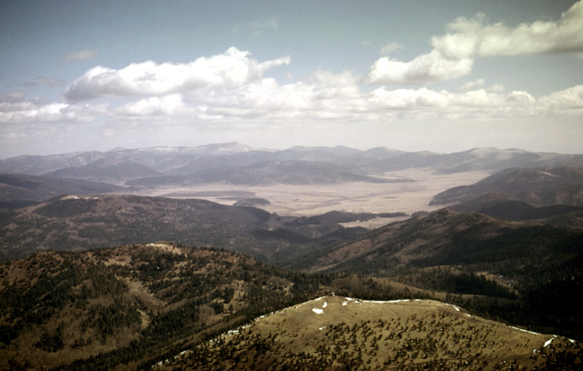
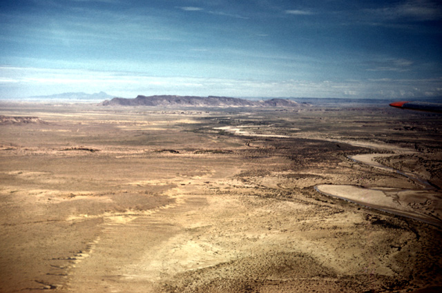
112-20: Valle Grande of the Valles Caldera Preserve, Jemez Mountains, N.M. This is a collapsed crater. View to the NNE. The peak in the foreground with the USFS Lookout is Cerro Pelado (12,120'). Thanks to Richard Krause for providing the text details. (11 Apr 66)
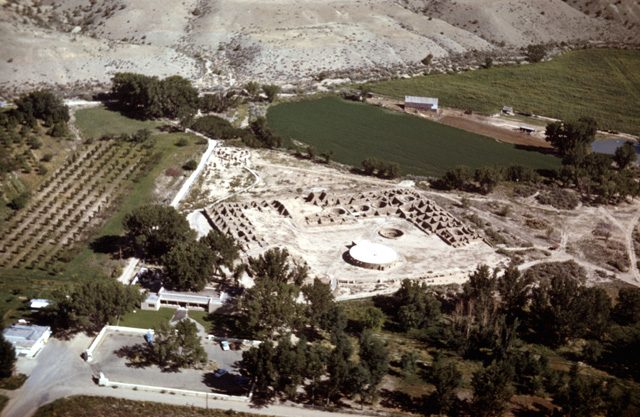
051-24: Aztec, NM; right bank of Animas River valley, ruins of Indian dwellings and kevas at Aztec Ruins National Monument. Note orchards and lush crops made possible by irrigation in a dry land. (23Aug59)
051-25: Partially eroded Quaternary terraces on left bank of the Animas River near Aztec, NM. Note small alluvial fan (with automobile for scale) and irrigated fields. (23Aug59)
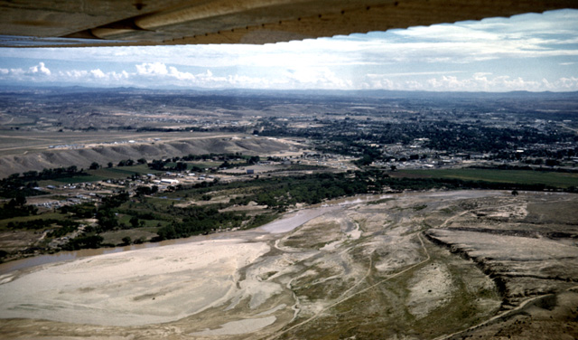
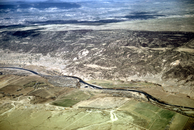
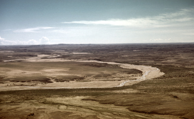
051-28: Braided San Juan River at Farmington, NM. Notice high boulder-armored terrace at left on which airport is located and the lower terraces on both sides of the river. View to northeast looking upstream. (23Aug59)
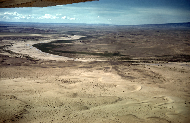
051-29: Junction of La Plata River and San Juan River, just west of Farmington, NM. View to the north. The Farmington airport is on the high terrace at the right margin; the same boulder-armored terrace lies over the Cretaceous sandstone to the left. (23Aug59)
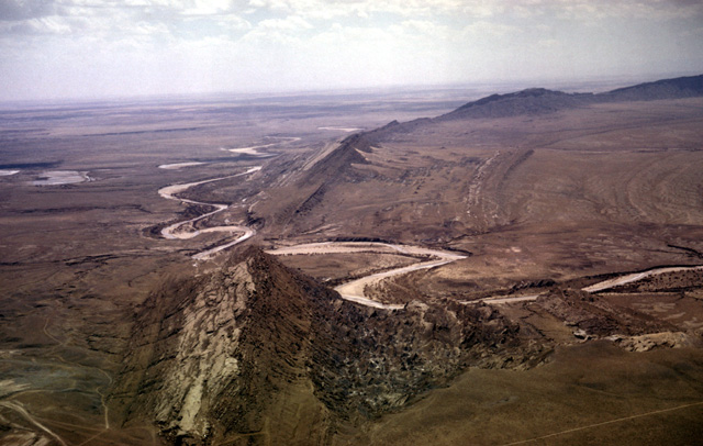
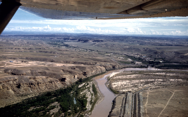
113-12: Chaco River cuts Hogback Mountain (a monocline) 20 miles west of Farmington, NM. View is to the south from over the San Juan River. The Chaco River is superimposed upon this ridge. (11Apr66)
051-33: A view to the north along Hogback Mountain (a monocline) that intersects the San Juan River 18 miles west of Farmington, NM. The Chaco River, at the right, flows northward parallel to the Hogback. The mountain at the left horizon (in Colorado) is the Sleeping Ute. The strata of Mesa Verde lie along the central horizon. (23Aug59)
052-01: Chaco River and distant Hogback, NM; view to north. The river bed may appear to be dry at certain times of year, but shallow holes dug in the sand generally fill with water. Sleeping Ute Mountain and Mesa Verde (CO) lie on the distant horizon. (23Aug59)
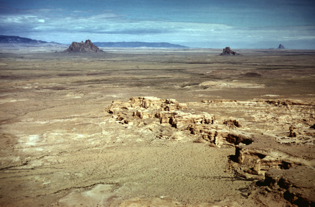
052-04: Eroded rocks in the San Juan Basin, NM. Bennett Peak (6610 ft) and Ford Butte lie in the middle distance; Shiprock (7178 ft) is at the right horizon. The mountains on the center horizon (9412 ft) are the Carizo Mountains (AZ); the range at the left is Beautiful Mountain (8945 ft), an outlier of the Chuska Mountains. (23Aug59)
052-05: Abandoned Navajo fields near Newcomb, NM. View to northwest. The flank of Bennett Peak is at the right. Carizo Mountains and Beautiful Mountain lie on the horizon at the center and left, respectively. (23Aug59)
052-14: Mudflow east of Chuska Mountains, NM. View to west; Washington Pass (volcanic area) lies in background. A series of spectacular landslide blocks occur along the margin of the 9000-ft-high Chuska Mountains, causing the mountain flank to retreat westward. The oldest slump blocks are now far from the mountain margin and highly weathered. This weathered material is subject to flowing when it is wet. (23Aug59)
052-16: Near Great Bend of the Chaco River, 10 miles east of Sheep Springs, NM. Looking SSE. Prevailing winds are from the southwest, and the sandy bed of the river is a good source of sand. Note the dune fields forming downwind from the river at the left of the photo. (23Aug59)
052-18: Barchan dunes east of Chaco River and south of Hunters Wash, 10 miles northeast of Sheep Springs, NM. Looking SSE. (23Aug59)
052-20: Active barchan dunes east of Chaco River and south of Hunters Wash, 15 miles northeast of Sheep Springs, NM. View to SSW. Note parallel north/south traces on the dunes resulting from dust devils. See also photo 052-21. (23Aug59)
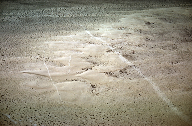
052-21: Dust-devil trails (disturbed desert varnish) on dunes east of Chaco River, 15 miles northeast of Sheep Springs, NM. View to SSW. (23Aug59)
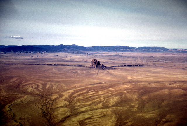
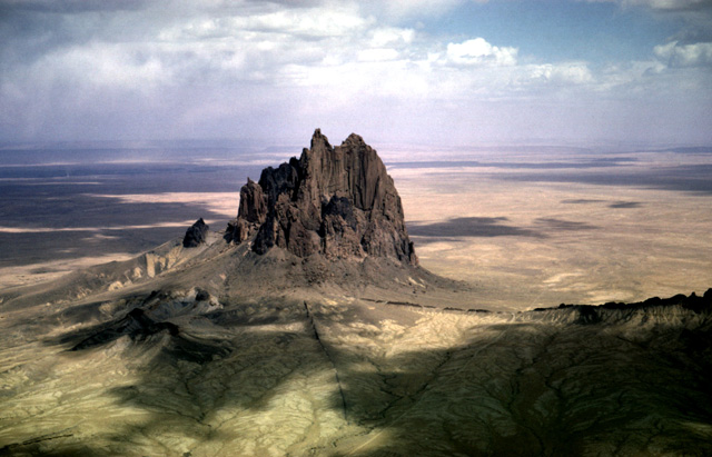
116-11: Shiprock (7178 ft), 12 miles southwest of Shiprock, NM. View toward southwest with Chuska Mountains in background. Beautiful Mountain (8945 ft) is at the left. Tertiary volcanic cones with a petrology similar to Shiprock occur on the flat-topped crest of the Chuska Mountains. The land surface at Shiprock is about 5500 ft, whereas the general elevation of the Chuskas is about 9000 ft; therefore some 3500 feet of erosion has taken place, and Shiprock provides a glimpse of a volcano's plumbing at that depth. (12Apr66)
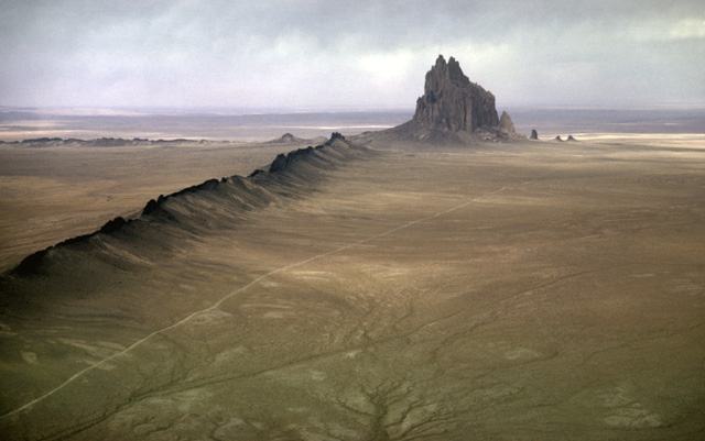
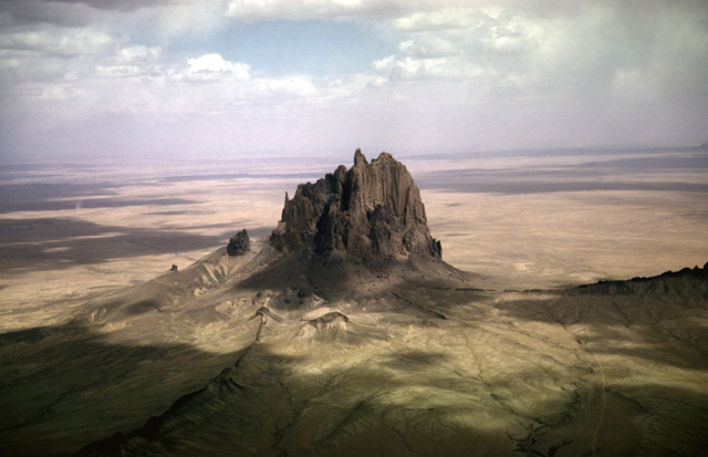
113-19: Shiprock (7178 ft) and southern dike, southwest of Shiprock, NM. View to northwest. Note the several small satellite volcanic necks at the base of Shiprock. (11Apr66)
113-20: Shiprock (7178 ft) from over the southern dike, southwest of Shiprock, NM. View to the NNW. (11Apr66)
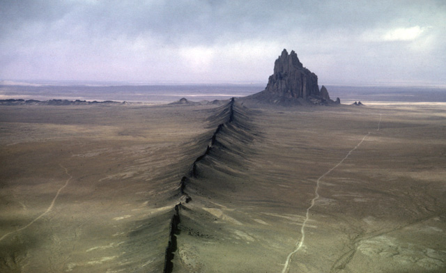
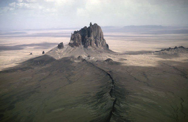
113-25: Shiprock (7178 ft), southwest of Shiprock, NM. View to the ENE. Note the radiating dikes. (11Apr66)
113-26: Shiprock (7178 ft), southwest of Shiprock, NM. View to the east. (11Apr66)
113-27: Shiprock (7178 ft), southwest of Shiprock, NM. View to ESE. The San Juan River and Hogback Mountain are in the background. (11Apr66)
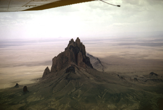
113-31: Shiprock (7178 ft), southwest of Shiprock, NM. View to SSE. Note the small satellite volcanic necks at the lower left. (11Apr66)
114-04: Tertiary volcanic neck and Table Mesa, along Hy 666, 13 miles south of Shiprock, NM. View to the south. Bennett Peak (6610 ft) and Ford Butte are visible in the distance; the Chuska Mountains are at the right horizon. (11Apr66)
Copyright © 2001 Louis J. Maher, Jr.