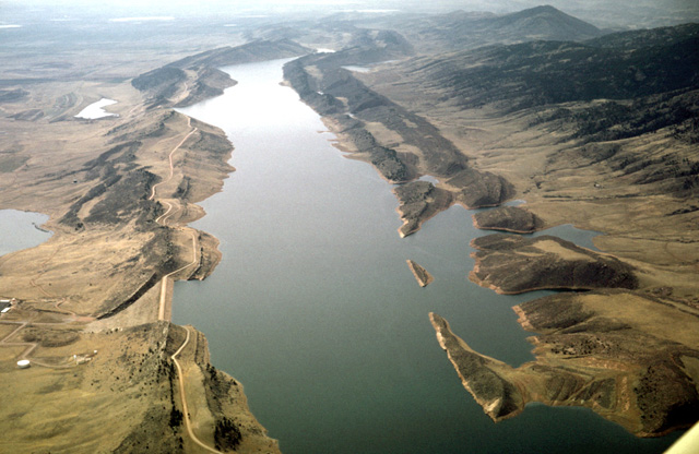
109-27: Horse Tooth Reservoir west of Fort Collins, CO. View to south along strike. (10Apr66)
2. Horse Tooth Reservoir, Spanish Peaks, Great Sand Dunes National Monument
109-27: Horse Tooth Reservoir west of Fort Collins, CO. View to south along strike. (10Apr66)
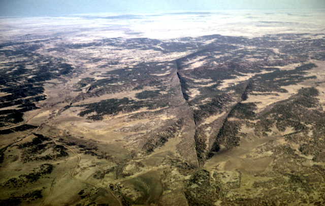
110-30: Intersecting dikes (Tertiary) at Spanish Peaks, Las Animas and Huerfano Counties, CO. View to east. Roads provide scale. (10Apr66)
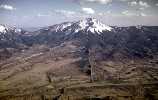
110-32: West Spanish Peak (13,623 ft) and dikes (Tertiary), Las Animas and Huerfano Counties, CO. View to the south. (10Apr66)
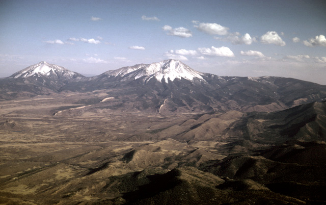
111-02: East Spanish Peak (12,708 ft) and West Spanish Peak (13,623 ft), Huerfano County, CO. View to the southeast from near La Vita Pass. (10Apr66)
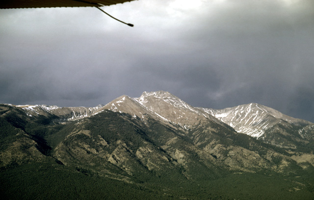
111-07: Blanca Peak (14,363 ft), Sangre de Cristo Mtns, CO. View to the east. (10Apr66)
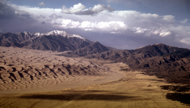
111-11: Great Sand Dunes National Monument, Alamosa and Saguache Counties, CO. High altitude view toward northeast. The sand accumulates in the San Luis Valley on the windward slope of the Sangre de Cristo Range. (10Apr66)
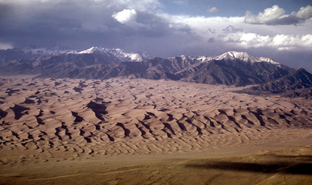
111-12: Great Sand Dunes National Monument, Alamosa and Saguache Counties CO. View to the north. The Sangre de Cristo Range lies in the background. (10Apr66)
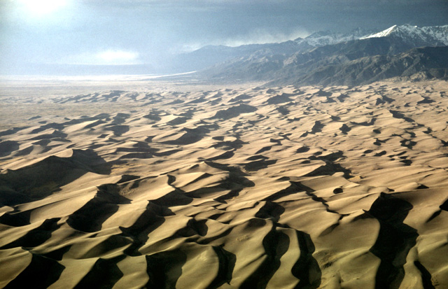
111-14: Great Sand Dunes National Monument, Alamosa and Saguache Counties CO. View to north at lower elevation. (10Apr66)
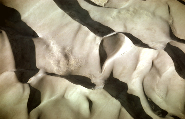
111-20: Looking down on dunes at Great Sand Dunes National Monument, Las Animas and Huerfano Counties, CO. Notice sand blowing over dune crests and the recent mass movements. Top of photo is north. (10Apr66)
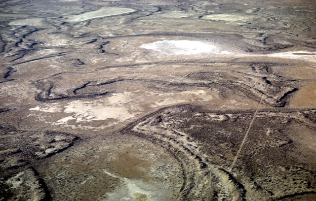
111-25: Dry lake beds in San Luis Valley north of Alamosa CO. View to the north; roads provide scale. Note that in this windy environment the shorelines are stabilized by plant roots. The Great Sand Dunes National Monument lies east of this site. (10Apr66)
Copyright © 2001 Louis J. Maher, Jr.