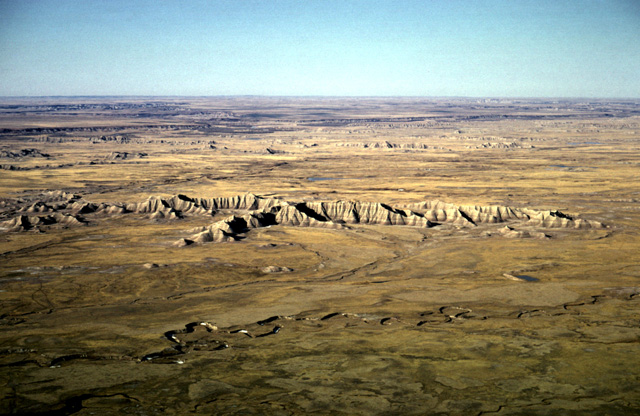
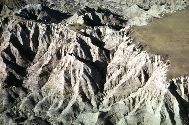
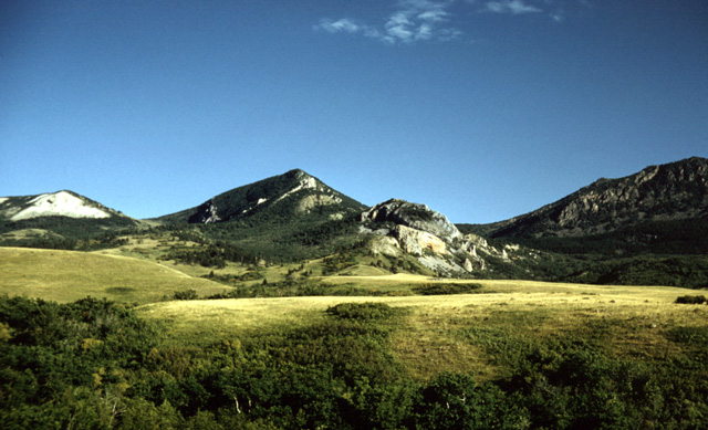
106-03: White River Badlands of SD; view of outliers near Weta, SD. (9Apr66)
1. Badlands, Black Hills, Devils Tower, Eastern Bighorn Mountains
106-03: White River Badlands of SD; view of outliers near Weta, SD. (9Apr66)
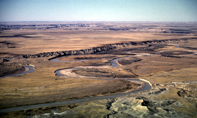
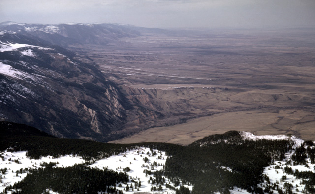
106-07: White River meanders and badlands southwest of Weta, SD. View toward southwest. (9Apr66)
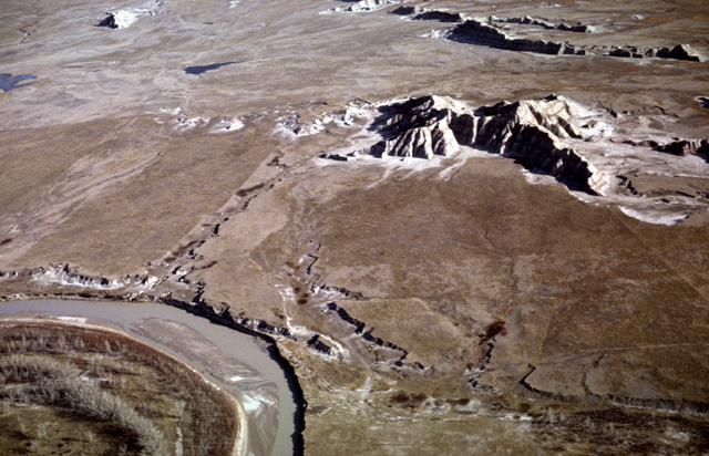
106-10: White River with some badlands outliers southwest of Weta, SD. View toward northeast. (9Apr66)
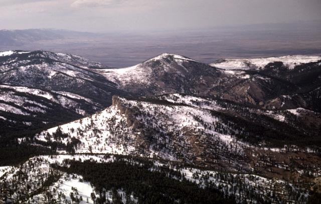
106-18: Grass-topped badlands sediments northwest of Interior, SD. View toward southwest. (9Apr66)
106-19: Eroded badlands with some grass northwest of Interior, SD. View toward southwest. (9Apr66)
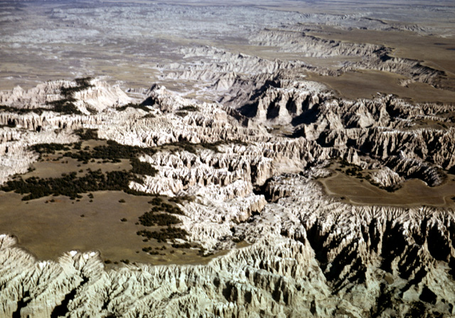
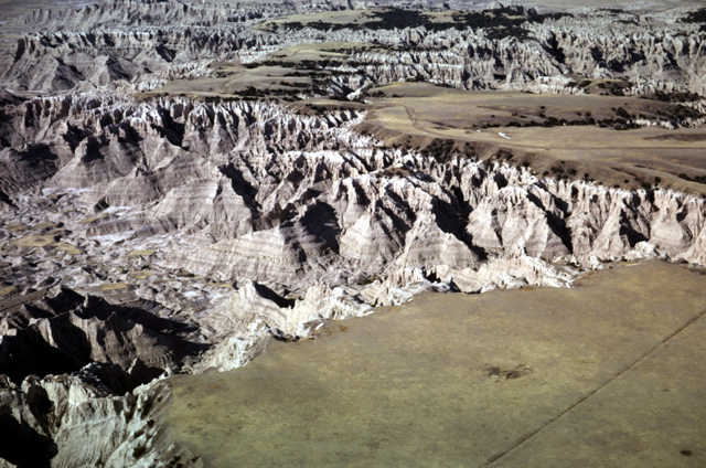
106-28: Grass plateau with surrounding badlands northwest of Interior, SD. View to northeast. (9Apr66)
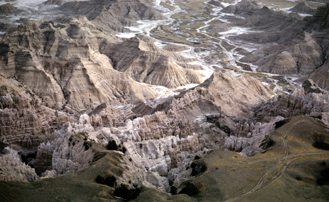
106-30: Badlands erode into grass-covered plateau northwest of Interior, SD. View to east. (9Apr66)
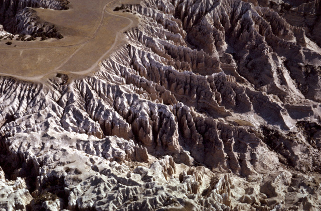
132-32: Badlands in Tertiary sediments of Sheep Mountain Table, south of Scenic, SD. View to the east. Jeep road provides scale. (15Apr66)
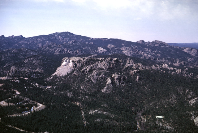
107-10: Mt. Rushmore, Black Hills, SD. View southwest toward Harney Peak (7242 ft). (9Apr66)
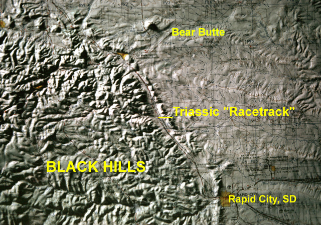
161-16vc: Index map of Black Hills (SD)
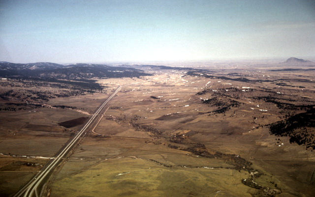
107-19: Black Hills Triassic "racetrack" north of Rapid City, SD. View to NNW parallel to I90. Cretaceous formations form the "Dakota" cuesta at the right. Bear Butte (Tertiary intrusive) in distance at right. (9Apr66)
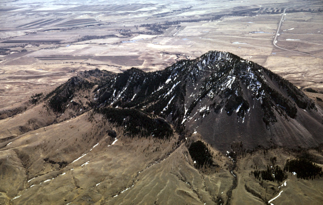
107-24: Bear Butte (4426 ft), a Tertiary intrusive, 7 miles northeast of Sturgis, SD. View to south. (9Apr66)
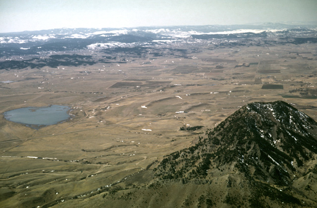
107-26: The Black Hills of South Dakota. View to the southwest. Bear Butte, a Tertiary intrusive, is in the right foreground. Sturgis, SD is behind the Dakota cuesta about 7 miles away. (9Apr66)
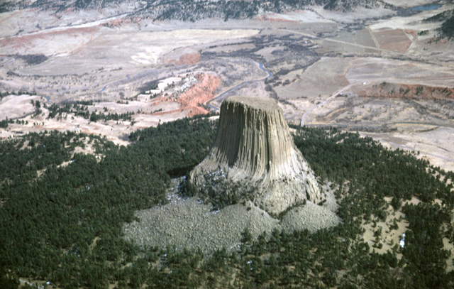
108-13: Devils Tower (5112 ft) at Devils Tower National Monument, WY. Tertiary intrusive; view to east with Belle Fourche River in background. Note columnar joints and the talus derived from them. (9Apr66)
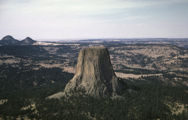
108-17: Devils Tower (5112 ft) at Devils Tower National Monument, WY. Tertiary intrusive; view to northwest; Missouri Buttes at the left background. (9Apr66)
108-14: Missouri Buttes (5372 ft), Tertiary intrusives northwest of Devils Tower, WY. (9Apr66)
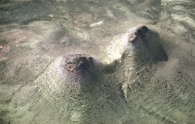
108-30: Twin mounds of Tertiary sediment capped by remnants of resistant clinker-beds (oxidized coal beds). Photo taken between the Power River and Buffalo, WY. (9Apr66)
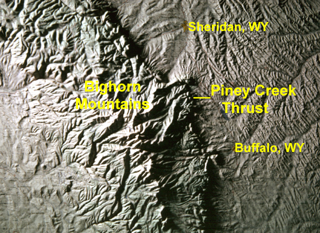
161-20vc: Index map of Bighorn Mountains (WY)
109-05: Canyon of the South Fork of Rock Creek in Mowry Basin along east flank of Bighorn Mountains near Saddlestring, WY. View to southwest. The light-colored flatirons are the Tensleep sandstone (Pennsylvanian-Permian) that dip below the red Chugwater shale (Triassic). Note the pediment remnant at the right. (9Apr66)
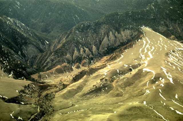
018-25: Mowry Basin and Piney Creek Thrust, Bighorn Mountains, WY. Tensleep ss (Pennsylvanian/Permian) and red Chugwater shale (Triassic) crop out in foreground, beveled by Quaternary pediments. The tree-covered ridge on the horizon is the south margin of the Piney Creek Thrust. The light-colored knob at the horizon is the Bighorn dolomite (Ordovician) and Madison limestone (Mississippian) that have been thrust eastward over younger rocks. The grassy depression to their left is underlain by the Flathead, Gallatin, and Gros Ventre fms of Cambrian age. The grassy ridge on the horizon at the right is composed of the Kingsbury conglomerate, coarse debris of sedimentary rocks eroded from the thrust sheet during Tertiary time and grading eastward into the Wasatch fm. (13Jun56)
109-09: Piney Creek Thrust, Bighorn Mountains WY. View to northwest along strike of eastward-thrust Paleozoic formations. Precambrian crystalline rocks lie at the left. Cambrian sediments crop out in the grassy slopes. The Bighorn dolomite (Ordovician) and Madison limestone (Mississippian) form the ridge in the central part of the photo. Tertiary erosion debris--i.e. Moncrief member of Wasatch fm--is at the right. (9Apr66)
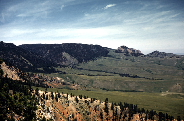
109-12: North edge of the Piney Creek Thrust looking northwest along the front of the Bighorn Mountains, WY. Valley of Little Goose Creek in middle distance. (9Apr66)
020-04: View to the south at the north side of the Piney Thrust sheet, Bighorn Mountains, WY; On the right (west) horizon is the Precambrian crystalline mountain core. The adjacent swale is underlain by Cambrian formations. The ridge at the center is composed of the Ordovician Bighorn dolomite and Mississippian Madison fm. The peak at the left is composed of the Tertiary Moncrief gravels that were eroded from the thrust plate. (22Jul56)
077-15: Wasatch fm (Tertiary) east of the Piney Creek Thrust near Story, WY, Bighorn Mountains; view to west. (Jul63)
Copyright © 2001 Louis J. Maher, Jr.