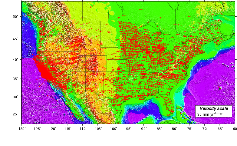
North American GPS velocities relative to fixed mantle
Sources: All maps from the above table are updated daily by C. DeMets of UW-Madison from GPS station velocities determined at the UW Department of Geosciences. Maps are created using Generic Mapping Tools software.
Reference frames: The GPS station motions in the maps above are shown relative to several different frames of reference. Velocities relative to a fixed mantle show a given station's motion over the Earth's mantle. The ITRF2014 geodetic reference frame is used to approximate the "mantle". Station motions relative to the North America plate are determined by subtracting the estimated velocity of the North American plate relative to the fixed mantle from the measured velocity of each GPS station relative to the mantle. These can reveal patterns of movement within a tectonic plate interior such as slow southward movement of stations in Canada and the north-central and northeastern United States in response to ice sheet unloading of these areas at the end of the last ice age (roughly 10,000 years ago).
Wisconsin Department of Transportation & University of Wisconsin-Madison partnership project
Chuck DeMets, Paul Hartzheim, Elliot Smith