Effects of frost wedging, I.
Mountains and mass wasting
I. Physical and chemical weathering: Breaking apart the rocks
II. Mass wasting and gravity: transporting sediments
Until this lecture, we have focused almost exclusively on the processes
that build mountain ranges. It is important to recognize however that
the ranges we see today are not only an outcome of geologic processes that
build topography, but are also a product of eons of weathering and erosion.
In the first part of this lecture, processes by which rocks are physically
and chemically broken down are discussed. The second half of the lecture
concentrates on the mechanisms by which rock debris is transported.
I. Physical and chemical weathering
Weathering is the destructive process by which rocks and minerals are broken down through exposure to atmospheric agents such as air, wind, water, and ice. Weathering processes can be grouped into two broad categories, consisting of
Physical weathering - the fragmentation of a larger rock into smaller pieces by mechanical processes. These processes include
Chemical weathering - breakdown of rock or mineral through reactions between rocks/minerals and atmospheric constituents such as water, oxygen, and carbon dioxide. The most common reactions include
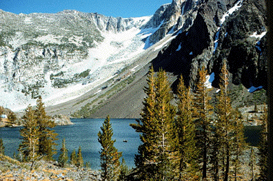
Ice and Physical weathering
The two principal mechanisms by which ice causes rock weathering (and erosion) are via frost wedging and glaciation.
Please study the images shown below to become more familiar with glaciers, glacial features, and the effects of frost wedging.
Effects of frost wedging, I.

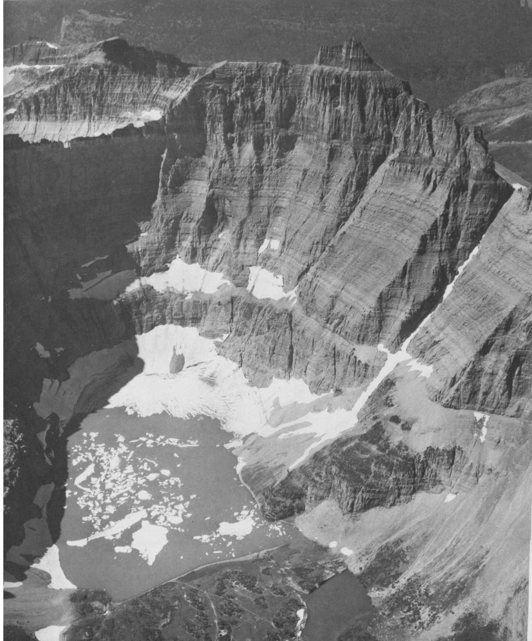
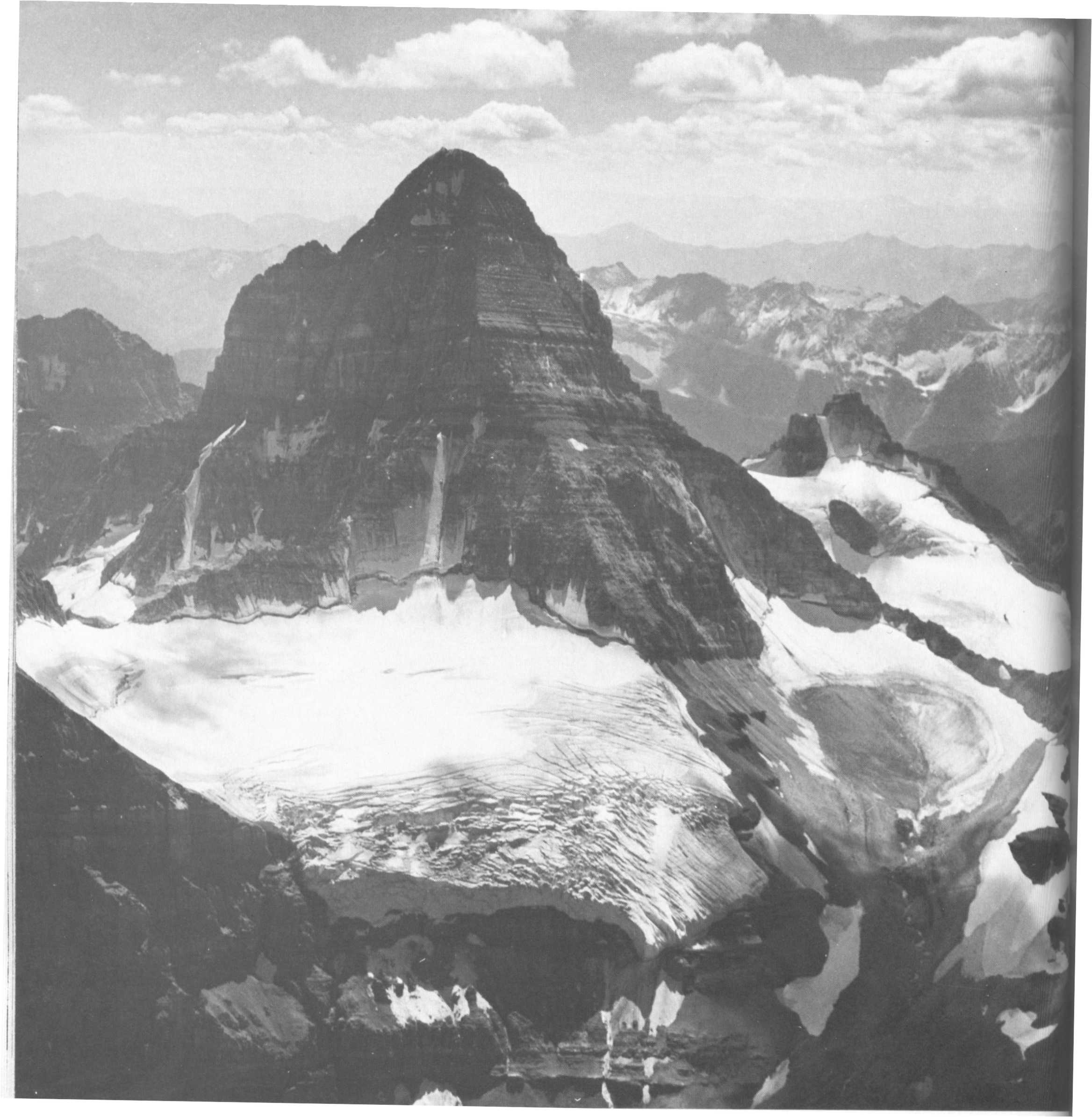
Mount
Assiniboine, Canadian Rockies
Glaciated
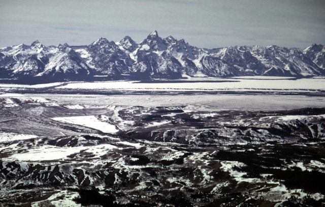
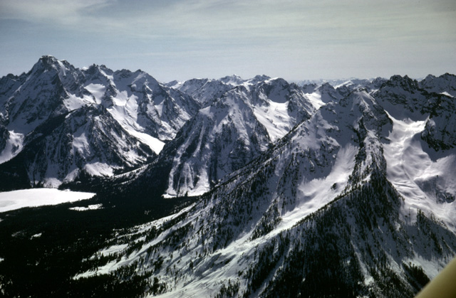
mountain range: View of Grand Tetons from Jackson Hole, Wyoming
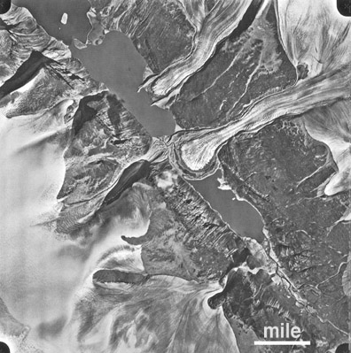
Landsat
photo of glaciers emanating from an ice sheet.
The dark regions in the glacial lobes are parts of the ice that are covered
by rock fragments that have fallen onto or are entrained in the ice.
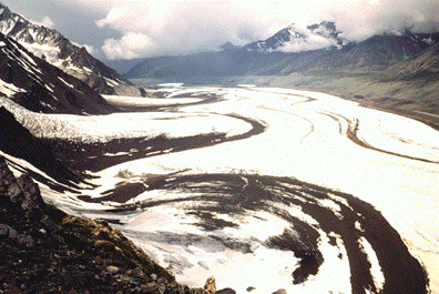
Tributary glaciers streaming into a larger glacier - note the bedrock that
the glaciers "pick up" as they stream by the cliffs.

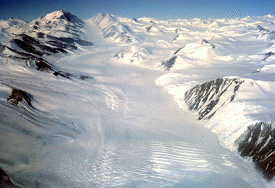
View of a valley glacier streaming by a rock promontory. Note how
the glacier is transporting rock fragments that have fallen onto the glacier
or have been plucked from the cliffs that flank the glacier.
Antarctic glacier filling a valley that it is carving into bedrock.
Mountain glacier in Teton Range, Wyoming
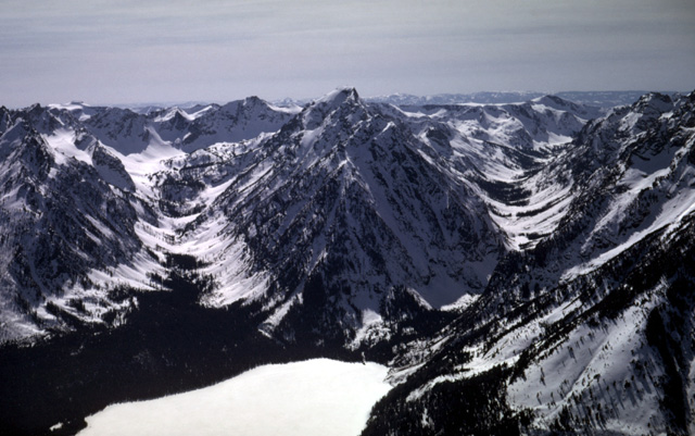
U-shaped, glacier-carved canyons emptying into Leigh Lake, Teton
Range, Wyoming
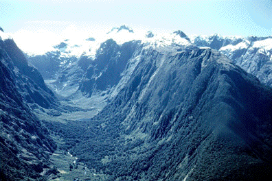
U-shaped valley carved by a glacier that has since melted. The U-shaped valley is a classic indicator that the valley was carved by a glacier.
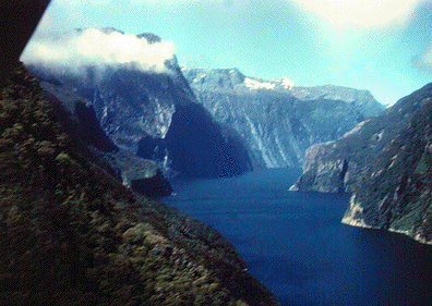
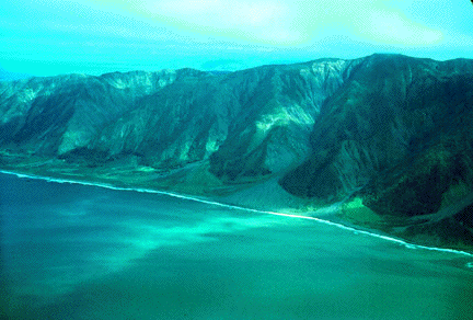
A fjord,
or U-shaped valley once carved by a glacier near sealevel and now filled by
water. Note the extremely steep cliff faces. Compare this to previous and
following figures.
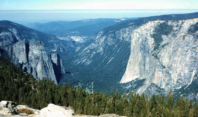
Yosemite
valley.
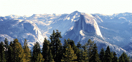
Half-dome
in Yosemite. What process could have carved a vertical face out of bedrock?
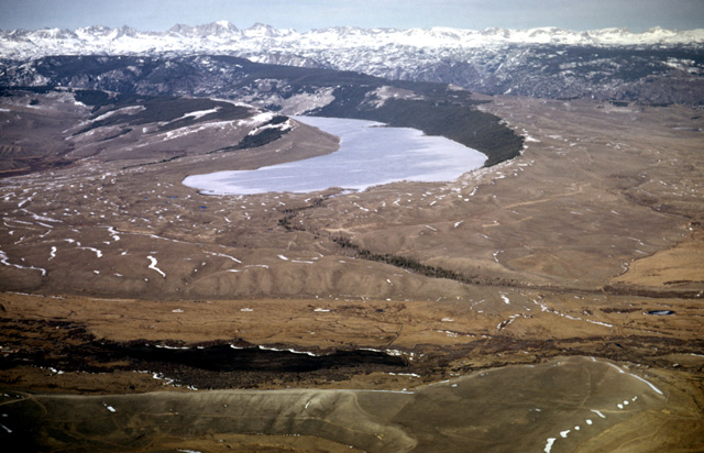
Willow
Lake and glacial moraines on the south flank of the Wind River Mountains,
Wyoming
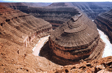
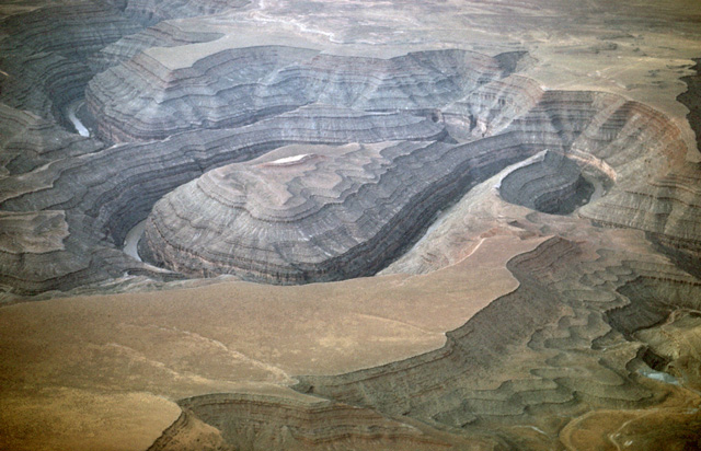
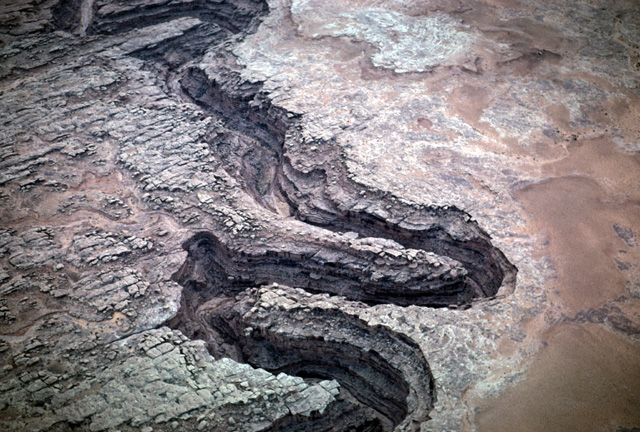
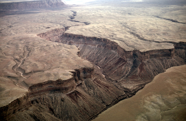
Liquid ice or water is a key erosional mechanism. Although water cannot carve landscapes at the same rate as glaciers, it is nonetheless very effective at abrading rocks and minerals and transporting erosional products over long periods. The Colorado Plateau, which has a multi-million-year-long history of tectonic uplift, offers many superb examples of the ability of rivers to cut downward into the rising landscapes. The erosional topographic features are frequently spectacular. If you're not convinced of this, see the following figures. Some of these come from the "Geology by Light Plane" series by Lou Maher. For more, check out his whole web site!
To save you time, I have thumbnailed all of the photos below. Please click on each image for an enlarged version.
Downcutting of the San Juan River, Utah.
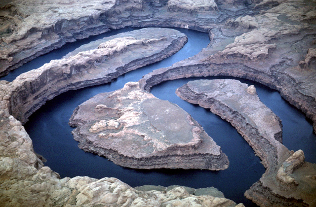
Goosenecks of the San Juan River near Mexican Hat, Utah. Note the nearly flat landscape into which the river has eroded downward.
Canyon cut by a tributary to the San Juan River just upstream from the Colorado River, southern Utah.
San Juan River meandering just upstream from the Colorado River. River valley is now filled by the Powell Reservoir.
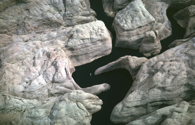
Forbidden Canyon, Utah. The canyon is now flooded by the Powell Reservoir, which backs up behind the Glen Canyon Dam of the Colorado River. For scale, an excursion boat can be found in the river just below the center of the photo.
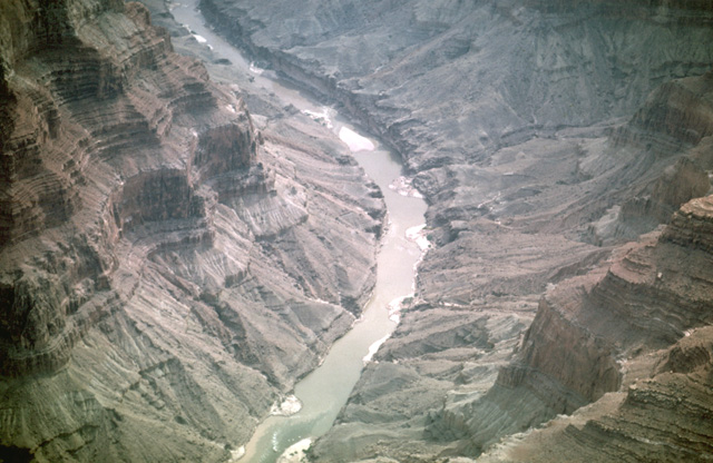
Colorado River in the Grand Canyon, Arizona. Note the small deltas being deposited in the river by each small tributary stream.
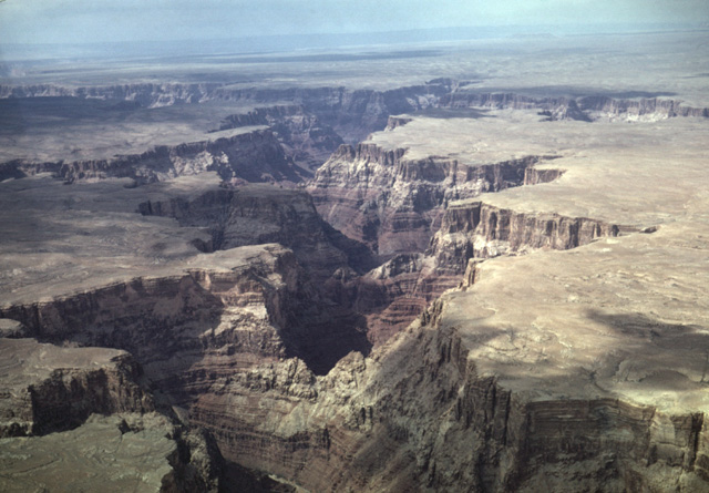
Canyon cut by the Little Colorado River, near Cameron, Arizona
Hanging valleys cut by streams that feed into the Colorado River in Marble Canyon, 20 miles downstream from Page, Arizona. Valleys are termed "hanging" because of the significant drop required to get down to the level of the Colorado River at the end of each canyon.
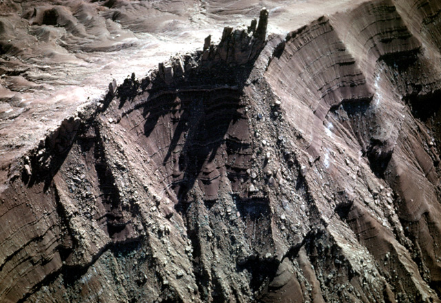
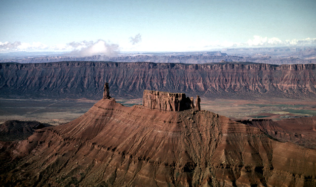
Ridge cut from the Triassic Wingate Formation. Near Moab, Utah
"Priest and Nuns" cut from the Triassic Wingate Formation. Near Moab, Utah
>
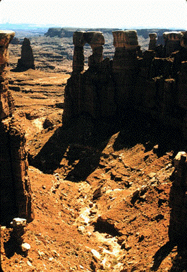
Monument Canyon, Utah
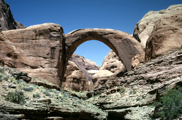
Rainbow Bridge, Utah in Arches National Monument
How does water erode rock? One way it accomplishes this is through dissolution- water dissolves minerals and carries them in suspension. Water also physically transports rock and mineral fragments that range in size from sand grains to boulders.
Streams transport material down slopes in three manners. Ions that are dissolved out of rock or minerals in contact with water become part of a stream's dissolved load - these ions typically will not leave the water column until they precipitate out (note that dissolution is chemical weathering). Fine particles such as clays and other very small rock fragments are carried as part of a stream's suspended load.These particles are too light to settle out of the water unless the water is either still or flows very slowly. Finally, larger rock fragments, ranging in size from sand grains to large boulders, constitute a stream's bed load.These particles roll, slide, or bounce along the stream bottom and thus physically abrade the stream bed.
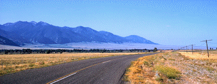
The ability of a stream to carry material is proportional to the velocity of the water squared. In alpine regions, where topographic gradients are steep and water thus flows quickly, water is capable of transporting rocks as large as boulders downhill. As soon as a stream slows down (which happens when it flows off from a steep slope onto a plain or valley floor), it can no longer carry much of its bed load. Rock fragments drop out of the water and are thus deposited at the base of a steep slope. Alluvial fans are a depositional feature that forms when a stream flows out of a steep and narrow canyon onto a valley floor and drops its bed load. Images of alluvial fans are shown above.
The role of wind in eroding mountain ranges is less than that of water and ice. Wind can carry sand grains that abrade and thus erode rock that is exposed at the surface. The figure below is an excellent example of the ability of wind to carry and deposit sediment.
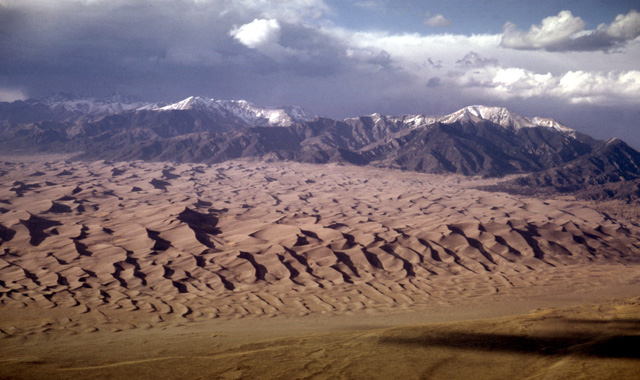
Great Sand Dunes National Monument, Colorado. Sand accumulates in the San Luis Valley on the windward side of the Sangre de Cristo Mountains, which lie in the background.
II. Mass wasting and gravity
Mass wasting, the downhill movement of soil and rock under the influence of gravity, encompasses a variety of physical processes by which mountain ranges are eroded. These processes include
There are other categories of mass wasting processes such as slumps, rock flows, rockfalls, block glides (etc...) that can be grouped together or separately with creep, slides, and debris flows depending on which characteristics that share in common. All of these processes share one thing in common, namely, that they are caused by the incessant downward pull of gravity , which moves loose slope material downwards.
Gravity-driven mass wasting processes are a subset of larger set of processes that transport weathered and unweathered earth materials. These processes are classified as erosional processes, which include all processes that remove and transport weathered or unweathered soil and rocks. Erosional processes include
Mass-wasting processes
Mass-wasting processes such as creep, landslides,
and debris flows are distinguished from each other in part by whether they
occur rapidly or slowly. Landslides are capable of transporting massive amounts
of rock and soil downslope for miles in very short periods (e.g. minutes).
Creep can also transport much material, but at rates of only millimeters per
year. Both are important erosional processes. Rapid mass wasting events
such as massive landslides or debris flows are typically triggered by
events that destabilize material that resides on steep slopes. Such events
include earthquakes, volcanic eruptions, rain or melting snow, and poorly
planned landscape alterations by humans (e.g. road cuts or developments that
require the removal of material at the bases of slopes).
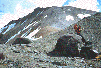
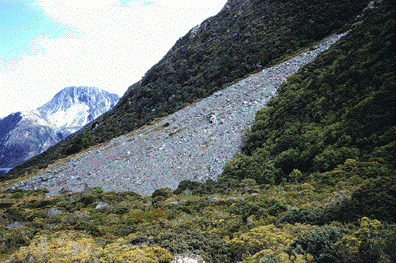
The figure below shows the landscape at roughly
12,000 feet in the Sierra Nevada mountains of eastern California. Notice how
the peaks are covered with loose rock. These loose angular rock fragments
that accumulate at the base of a slope are referred to as talus or scree. Talus is notoriously unstable
to climb down or up, but can be lots of fun if it consists mostly of small
rock fragments. Talus is however brutal on hiker's boots!
The following figures show typical talus:
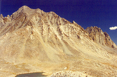
Talus, Eastern side of Sierra Nevada Mountains, CA
Talus, Yosemite National Park, CA
Once rock debris is transported out of a mountain range,
it may build up in thick piles in the adjacent basins. Viewed from space,
the mountain range below looks as if it is drowning in its own erosional debris.
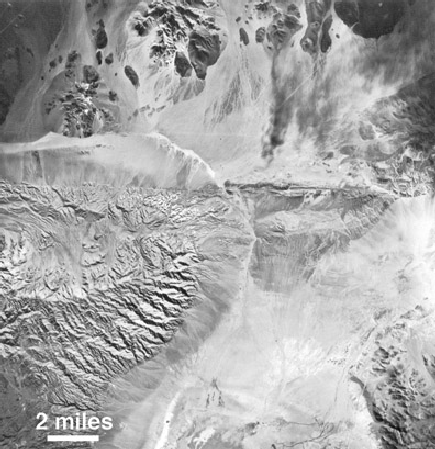
Landsat satellite photo of desert ranges.
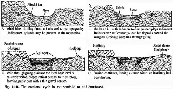
The image on the left nicely illustrates some important features of mountain ranges. First, let's review some terminology. Notice how the dissected topography of the mountain range in the central left part of the image gives way to a smooth skirt of rock debris that rings the mountain range. This skirt of erosional debris is known as a bajada (pronounced "bahada"). A bajada is a series of individual alluvial fans that have merged together to form a nearly continuous skirt of rock debris that has been transported to the base of the range by flowing water and possibly landslides. An alluvial fan is a fan-shaped deposit of rock debris (ranging in size from clay particles to large boulders) that forms as the mouth of a canyon. Alluvial fans have much in common with river deltas, except that river deltas are water-transported sediments that are deposited beneath water.
Several
images of alluvial fans are shown below. The bajada has a much gentler
slope than the mountain canyons from which the alluvial fans emanate.
At the top of the satellite image, you can see some isolated darkly-colored
peaks that appear to stick through the rock debris that dominates the landscape.
These isolated peaks, awash in their own erosional debris, are called inselbergs.
One final feature worth mentioning is a playa, which is a desert basin with no
outlet to the sea. Water flowing from mountains around a playa will accumulate
and slowly evaporate, leaving behind salts that were dissolved in the water.
An example of a playa in the desert east of Los Angeles is shown below.
Playa is also the Spanish word for "beach". But don't get
confused and head for a "playa" in the desert, thinking that you're going
to find a nice body of water and beach. Desert playas are frequently
some of the hottest and least hospitable environments on earth!
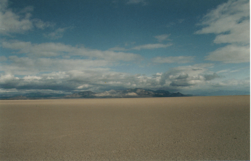
Playa in the Black Rock desert, Nevada
Photo by Gene
Ichinose
Assorted photos of alluvial fans
Alluvial fans, New Zealand
Shallow-sloping alluvial fans
Boulder fan
Just
in case you are still a little unsure about what features are displayed in
the figures above, I have included the diagram below as a guide to where you
can find the assorted features that are defined.