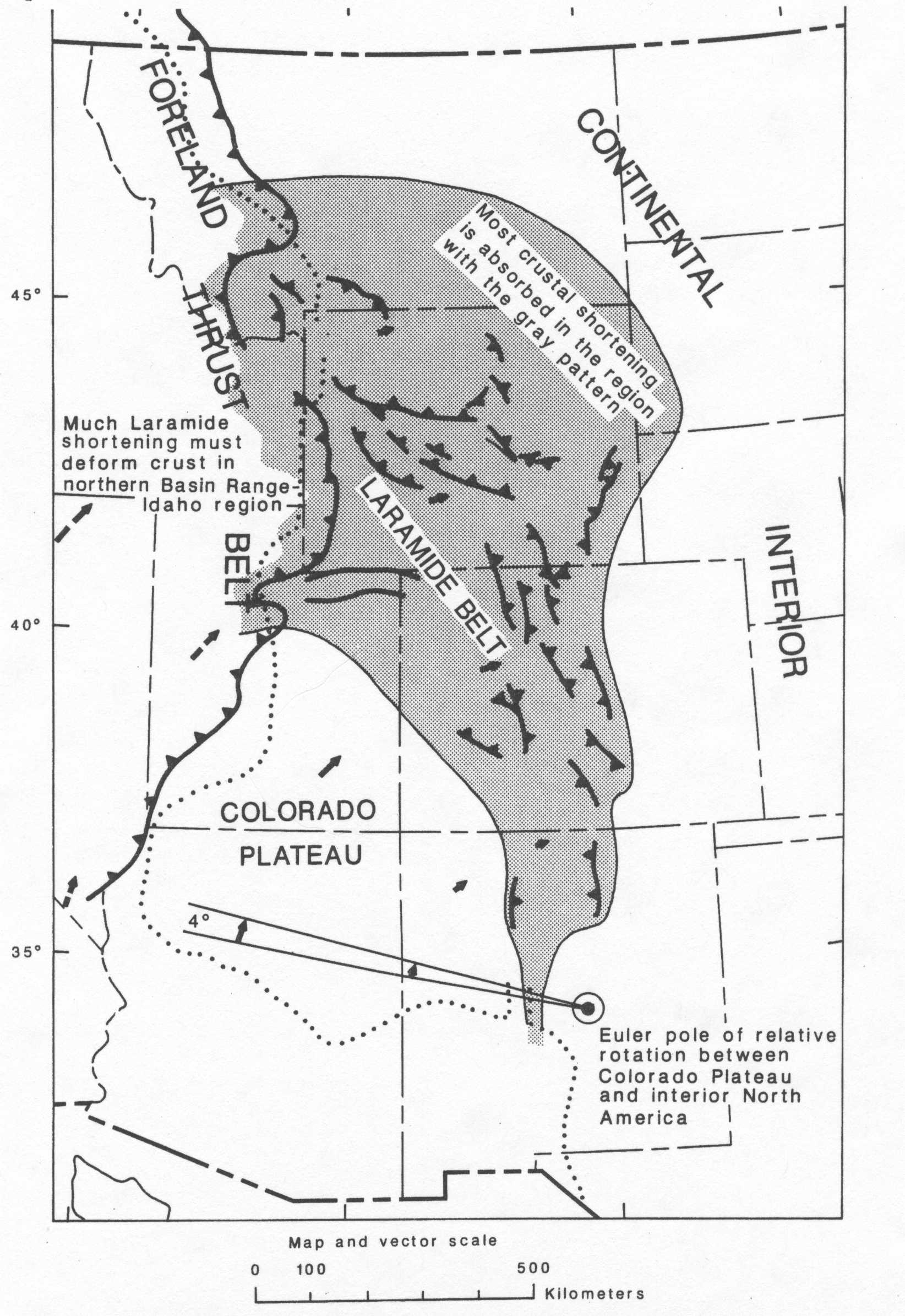
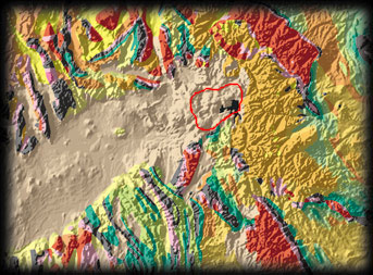
The Laramide
orogeny refers to a phase of mountain building that affected
parts of Montana, Wyoming, Colorado, and lesser areas of nearby states (see
the shaded area in the figure below). The Laramide orogeny occurred
from approximately 70 million years ago to 40 million years ago during a period
when the Farallon oceanic plate was subducting rapidly beneath the western
coast of the U.S. The most unusual aspect of the Laramide orogeny is
the fact that the mountain ranges created during this period were so far inland
from the subduction zone, much farther than is usually the case for mountains
built inland from subduction zones. Although the reason for this is still
debated, independent evidence for dramatic shifts in the location of volcanic
activity during the Laramide age (see the previous lecture) suggests that
the Farallon plate was subducting at an extremely shallow angle beneath the
western U.S. from 70-40 Ma. This postulated flat subduction may have
caused stresses at the base of the continental crust that were large enough
to build mountains far inland from the trench.
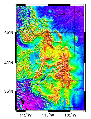
Click
here for map that shows names of major mountain ranges in the maps
above.
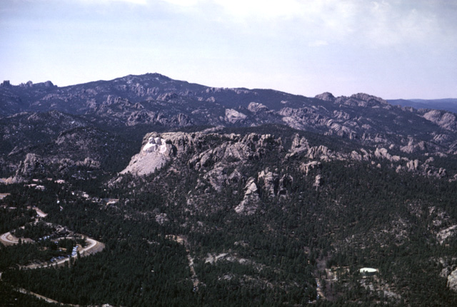
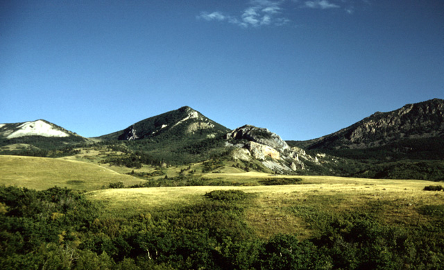
The easternmost Laramide uplift is the Black Hills of western
South Dakota. Immediately west of the Black Hills, the arc-shaped,
isolated Big Horn Mountains are found in north-central Wyoming. The Powder
River basin, which is located between the Black Hills and Big Horns, also
formed during the Laramide orogeny. It contains up to 18,000 feet of
clastic sedimentary rocks (sandstones, shales, limestones), some related to
the great interior seaway that covered much of the central U.S. 75 million
years ago (see previous lecture), and some from sediments shed off from the
adjacent Big Horn Mountains. The Powder River basin contains enormous
oil, natural gas, and coal deposits - by some estimates, this basin contains
25% of all of the coal-bed natural gas in the United States.
The Beartooth Highway (US 212), which extends 65 miles from
Red Lodge to Cooke City, Montana, deserves special mention since it is considered
by many people to be the most scenic drive of any road in the lower 48 states.
Climbing to altitudes of nearly 11,000 feet, the highway goes through
some of the most beautiful alpine mountainous terrain in the country. If
you are driving to Yellowstone, strongly consider taking this little-used
route to the park. Just make sure to leave enough time since it can
take a few hours to drive the 65 miles and longer in the likely event that
you stop to hike or snap photos. The Beartooth and Absaroka mountains
are some of the most primitive and wildly beautiful mountains in the country.
There are more than 20 peaks that extend above 12,000 feet and the
high terrain is beautifully glaciated. The Absaroka-Beartooth Wilderness
is a 900,000-acre roadless area protected in its wild state. It guards
the northeastern entrance to the adjacent Yellowstone National Park. If
you are adventurous, this is a great place to hike!
The Bob - the Bob Marshall Wilderness of northwestern Montana is considered by many to be the crown jewel of America's wilderness system (excluding Alaska, which is in a category by itself). At more than 1,500,000 acres, the Bob extends more than 40 miles from east-to-west and 100 miles from north-to-south without any roads. It includes three adjacent wilderness areas and spans a wide topographic range, from valley bottoms to 9000-foot-high peaks. As the best preserved mountain/valley ecosystem in the lower 48 states, the wilderness is reserved for hikers and horse packers, with many interior park areas requiring days to reach on foot.
The wilderness was established in recognition of
Bob Marshall, a legendary hiker and U.S. Forest Service researcher who
died in 1939 at the age of only 39. Despite frequent poor health, Mr.
Marshall frequently hiked 30-40 miles per day in mountainous areas and
once climbed 14 Adirondack peaks within a single 19-hour period.
Native Americans who accompanied him were reportedly
unable to keep up. An avid outdoor enthusiast and founder of the Wilderness
Society, Mr. Marshall explored many of the wildest areas of the United States
and Alaska. He advocated protecting wild areas long before wildland preservation
was an important national issue.
The Chinese Wall. Photo Courtesy of the Bob Marshall Wilderness
Ranch (www.wildernessranch.org)
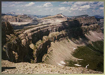
Much of the mountain-building in the Bob occurred during the Laramide orogeny, when rocks west of the park were thrust tens of miles eastward along the Lewis Overthrust to form mountain ranges now within the park boundaries. A 20-mile-long, 1000-foot-high vertical cliff called the Chinese Wall marks where the Lewis Overthrust reaches the surface in the park and is one of the most popular hiking destinations for its spectacular view points.
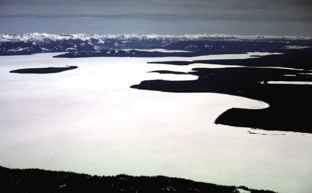
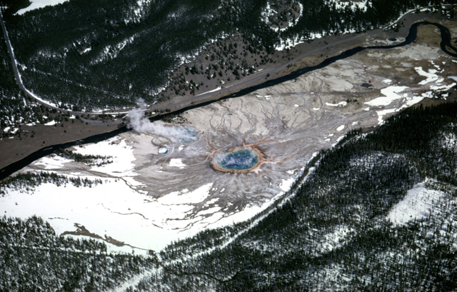
The image links are meant to sample additional images of Laramide features.
Please examine each of them and read the accompanying text.
(all photos and most text below are from the "Geology by Lightplane" aerial photo Web site of Professor Lou Maher.)
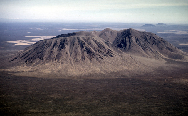
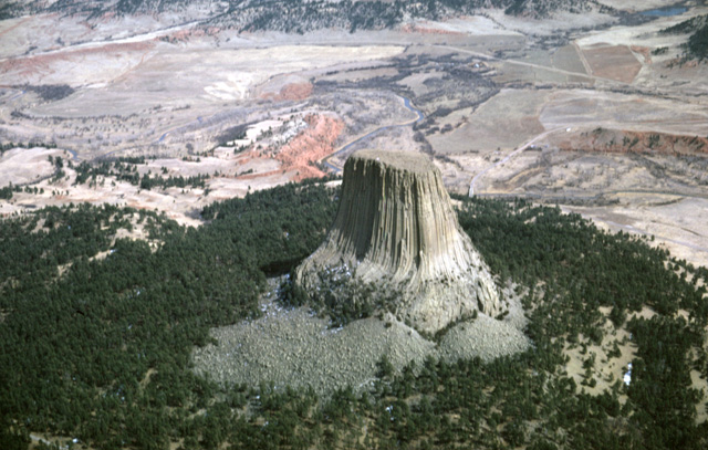
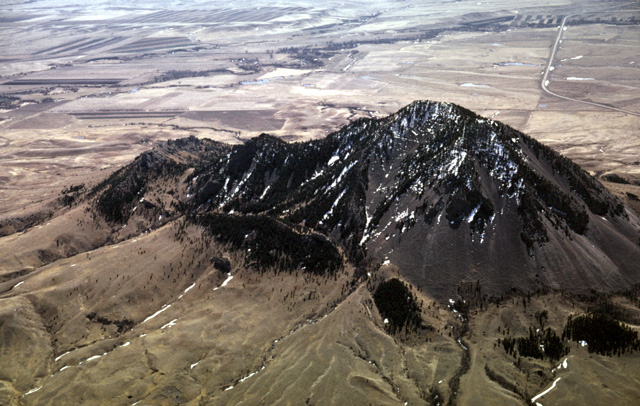
#1 - Devil's Tower, Wyoming - a Laramide-era intrusive volcanic feature
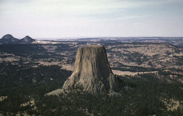
#2 - Devil's Tower with Missouri Buttes, more Laramide-era volcanics, in left background
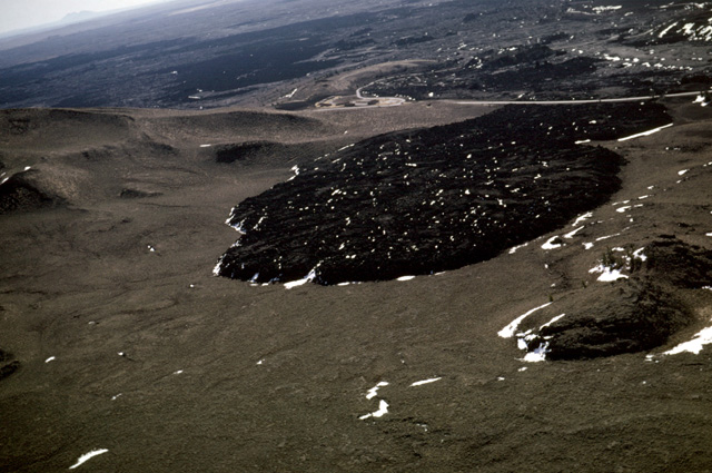
Laramide-period volcanic features, South Dakota
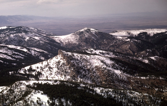
#1 - Big Horn Mountains, WY- Piney Creek Thrust. View to northwest along strike of eastward-thrust Paleozoic formations. Precambrian crystalline rocks lie at the left. Cambrian sediments crop out in the grassy slopes. The Bighorn dolomite (Ordovician) and Madison limestone (Mississippian) form the ridge in the central part of the photo. Tertiary erosion debris--i.e. Moncrief member of Wasatch fm--is at the right. (9Apr66)
#2 - Big Horn Mountains, WY View to the south at the north side of the Piney Thrust sheet, Bighorn Mountains, WY; On the right (west) horizon is the Precambrian crystalline mountain core. The adjacent swale is underlain by Cambrian formations. The ridge at the center is composed of the Ordovician Bighorn dolomite and Mississippian Madison fm. The peak at the left is composed of the Tertiary Moncrief gravels that were eroded from the thrust plate. (22Jul56)
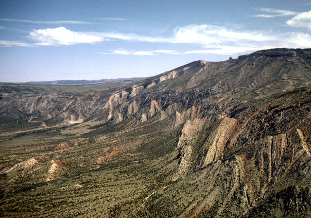
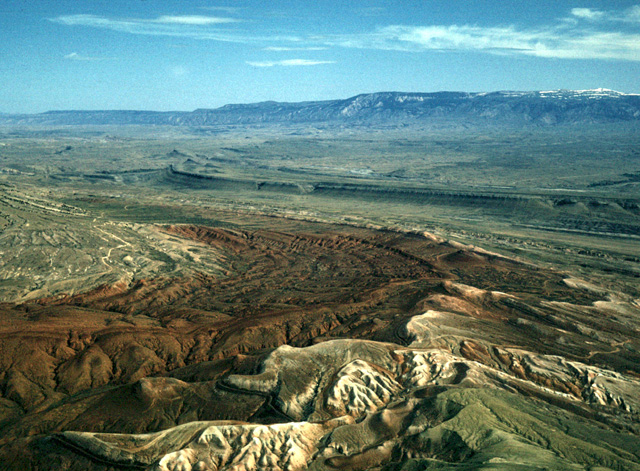
#3 - Big Horn Mtns, WY. Western edge where the mountains drop into the Big Horn Basin. See how the layers of sedimentary rocks are draped over and eroded away from the steep slopes along the edge of mountain range. This indicates that the range was uplifted after the sediments were deposited.
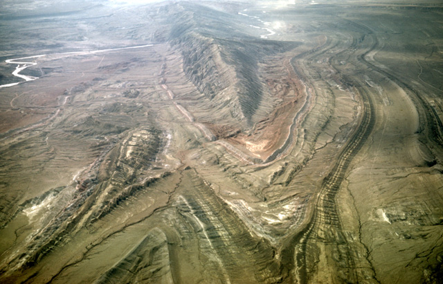
Big Horn Basin - Sheep Mountain anticline between Greybull and Lovell, WY. View to southeast. Anticline plunges to northwest. At left is northwest-plunging syncline. Note that Bighorn River has been superimposed across this structure. See Lovell-Greybull Area, Big Horn Co., WY, Department of Agriculture, Commodity Stabilization Service, 1961: Air photo BBN-3BB-66. (15Apr66 )The region between Lovell and Greybull, Wyoming, is in the Bighorn Basin, a structural basin formed during the Laramide Orogeny of the early Tertiary. The Bighorn and Pryor Mountains make up the eastern and northern margins, the Owl Creek Mountains establish the southern margin, and the Absaroka Range and the Yellowstone Plateau form the western limit of the basin. The Bighorn Basin, like the other intermountain basins of Wyoming and Colorado, was filled with the debris eroded from the surrounding uplifts even as folding continued. During the later part of the Tertiary the rivers were able to remove much of the basin fill, exposing the older bedrock. The modern topographic basin is situated in the rain shadow downwind of the Yellowstone Plateau, and few trees grow unless they can find water along the Bighorn River and its tributaries. The rocks are very well-exposed, and make a good area for air photo interpretation. They range from Mississippian to Cretaceous in age. Quaternary alluvium occurs along the major valleys.
Sheep Mountain - View to southwest. Bighorn River superimposed across the fold. The river valley that cuts through the anticline implies that the river predated this feature and eroded down through the feature as it was slowly uplifted. See Lovell-Greybull Area, Big Horn Co., WY, Department of Agriculture, Commodity Stabilization Service, 1961: Air photo BBN-3BB-110. (15Apr66)
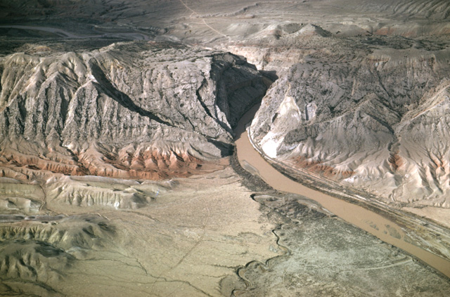
Sheep Mountain - Red Chugwater fm (Triassic) and white Gypsum Spring fm (Jurassic) at south end of Sheep Mountain, Bighorn Basin, WY. View to northeast. Bighorn Mountains in background
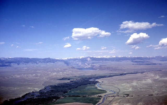
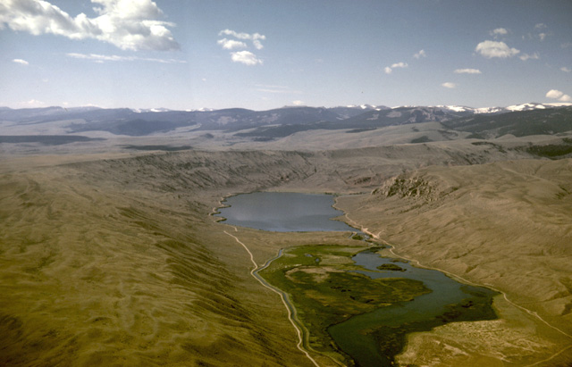
#1 - Wind River Mountains, WY. View to west looking upstream over the Wind River to the Wind River Mountains. The deep notch on the mountain flank is the valley of Bull Lake. (21Jul65). What formed the deep valley emanating from the lake in the direct center of the photo?
#2 - Wind River Mountains, WY. Dinwoody lakes
