The Basin-and-Range Province
In this lecture, I outline the history of the Basin-and-Range region of Nevada, Utah, and eastern California. In class, I will also discuss the San Andreas Fault and how it influences the landscape of western California.
I. Geographic limits and present activity
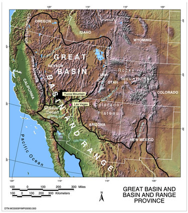
As you can see from the map above and Figure 2 below, the Basin-and-Range province extends hundreds of miles from east to west between central Utah and eastern California and nearly one thousand miles from north to south between southern Idaho/Oregon and central Mexico. It is the most geographically extensive, "young" geologic region in North America and is easily defined in map view by the numerous mountain ranges and basins, each one of which is bordered by normal faults along which the mountains were uplifted and the basins subsided.
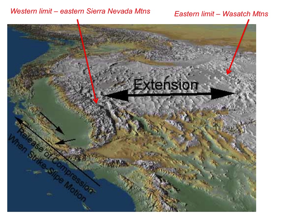
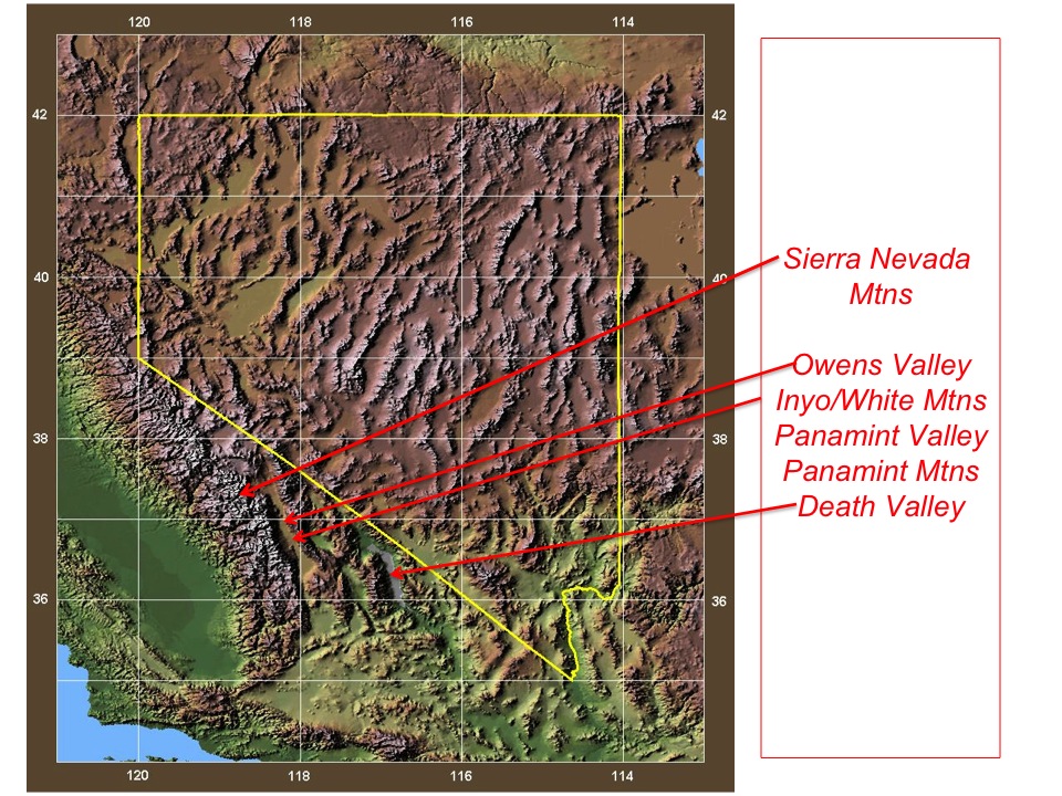
As Figure 2 shows, the eastern and western edges of the central Basin-and-Range are defined
respectively by the Wasatch Fault along the western edge of the Wasatch Mountains of central Utah
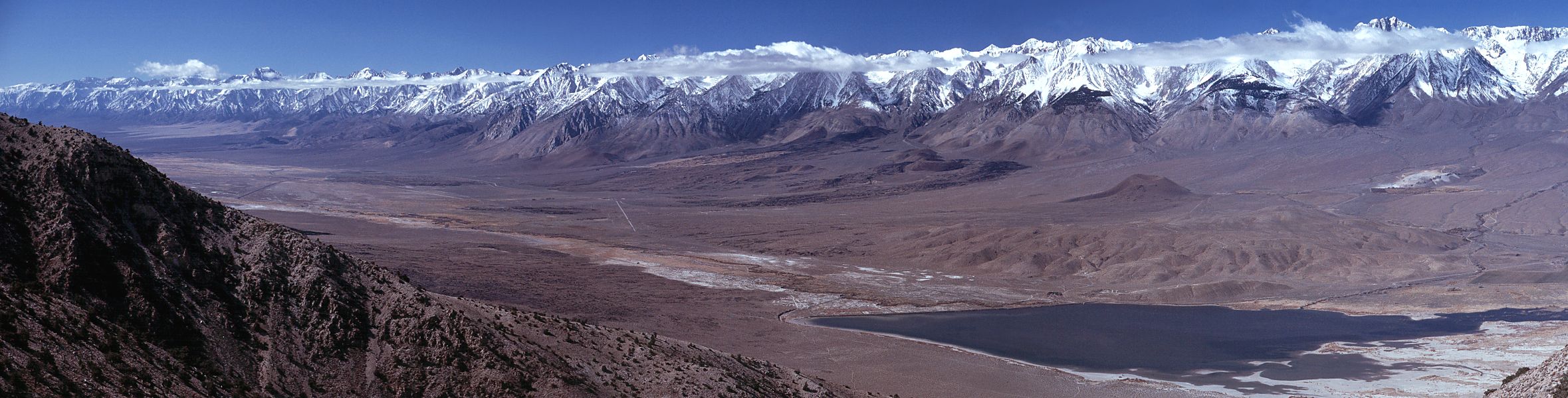
and the Sierra Nevada range-front fault of eastern California. Both fault zones are still active,
meaning that occasional large earthquakes occur on both fault zones in response to the active (though slow)
east-to-west stretching that occurs between the Wasatch and Sierra Nevada mountain ranges.
More information and graphics for both fault zones will be given later in this lecture.
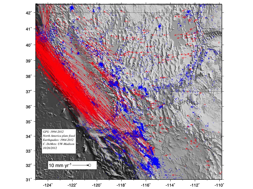
Figure 3 shows present-day activity in the Basin-and-Range region as indicated by very precise Global Positioning System measurements at hundreds of stations in the region and earthquakes (blue circles). The red arrows show the directions and rates of the GPS site movements with respect to a stationary North America plate. At the right-hand edge of the image, in eastern Utah and northwestern Arizona, the arrows that show the GPS site movements are very short (and thus hard to see) because the sites are located EAST of the Wasatch Fault and are therefore on stable areas of the North America plate. Those sites therefore do not move since the North America plate is fixed in this diagram.
Beginning in central Utah at locations immediately west of the Wasatch Fault (can you find the Wasatch Fault on this map?), the GPS sites are moving 1-2 millimeters per year nearly straight to the west. These site motions show that the surface west of the Wasatch fault is pulling away from the surface east of the fault. The measurements show that stretching (extension) occurs across the fault. In fact, the Wasatch Fault is a normal fault, as might be expected given that normal faults tend to form in areas where tectonic forces are extending the crust.
Figure 3 also clearly shows that as one travels westward from the Wasatch Mountains, neither the
rate nor direction of the GPS sites changes very much until roughly central Nevada, where the
GPS site directions begin to rotate more toward the northwest and the site rates increase modestly.
The GPS site rates and directions continue to both increase and rotate clockwise as one travels
to western Nevada and eastern California until site rates reach roughly 10 millimeters per year
at the eastern edge of the Sierra Nevada Mountain Range. The cumulative stretching across the central
Basin and Range is thus just under one-half inch per year. At that rate, one mile of stretching
requires roughly 160,000 years of sustained stretching. In fact, geologists estimate that
extension has doubled the original width of the central Basin-and-Range, which implies
that the distance between its eastern and western edges has increased by more than 100 miles
since 17 million years ago, when faults in the Nevada/Utah region first became active.
II. Origin of the basins and ranges.
Geologic studies of the normal faults that border the numerous mountain ranges in Nevada, western Utah, and eastern California clearly indicate that the faults were born about 17 million years ago, almost surely as a response to a change in the geologic forces that prevailed in this region before and after 17 Myr. Before 17 Myr ago, a series of small oceanic plates were subducting along the entire west coast of North America. These plates most likely exerted an eastward "push" on the continent, which kept the interior of the North America plate in a state of compression (which as you should recall is generally associated with thrust faulting).
At roughly 17 Myr ago, subduction of these small oceanic plates ceased along the coast of most of California. Instead, the Pacific plate came into direct contact with the edge of the North America plate for the first time. As you know from previous lectures, the Pacific plate slides to the northwest along its border with North America (the San Andreas fault). As it slides slowly northwestward, it imposes a much different force on the interior of the North America plate than did the eastward-subducting oceanic plates before 17 Myr, namely, the Pacific plate moves slowly away from interior areas of North America and thus imposes a small extensional force on the plate interior. The change in the type of plate motion along the west coast of California at 17 Myr thus altered the forces acting on the interior from compressional to extensional.
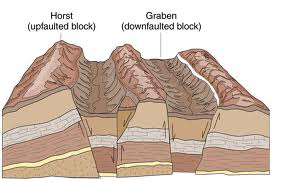
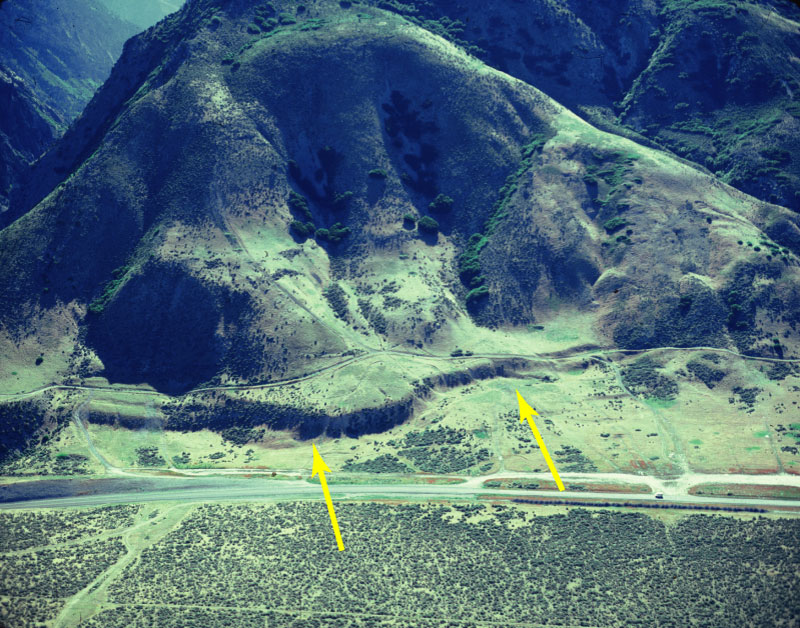
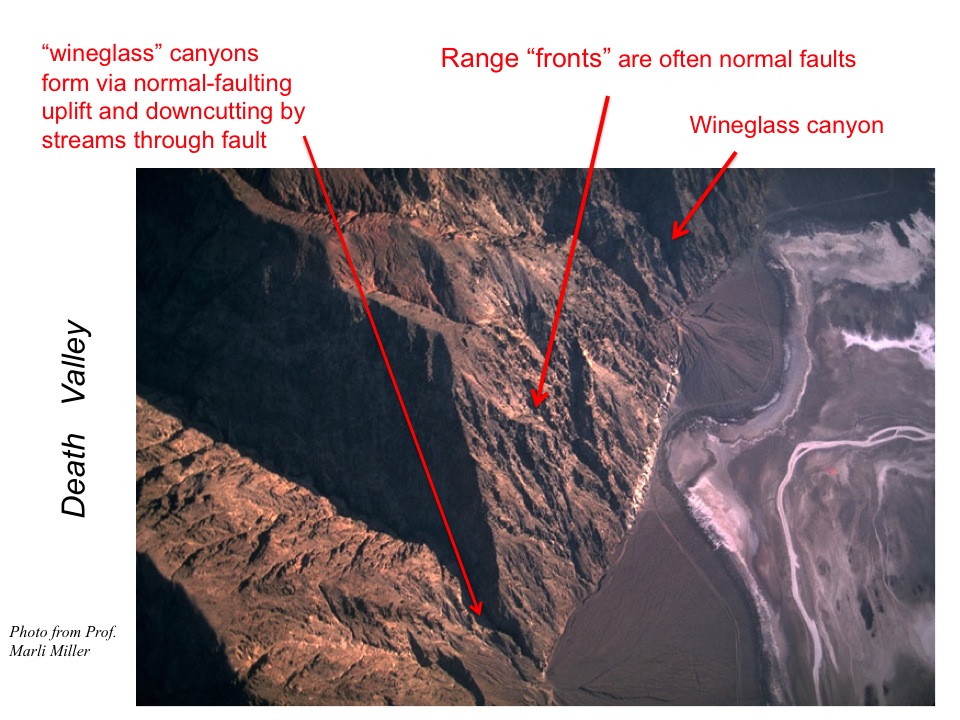
The Basin-and-Range Province formed in response. Referring to Figures 4 and 5 below, east-to-west extension
across the central Basin-and-Range caused a series of normal faults to form in order to accommodate
the east-to-west stretching of the crust. The series of alternating ranges and basins are sometimes
referred to as "horst and graben", which are German terms for an uplifted block (horst) and a
downthrown block (graben).
The central Basin and Range province is "young" in the sense that it is still an actively evolving part of the western landscape (if you doubt this, see Figure 3). In contrast, the Laramide ranges of Montana and Wyoming have been tectonically inactive for 30 million years or longer, as have the Colorado Rockies.
III. Wasatch and Sierra Nevada range-front faults
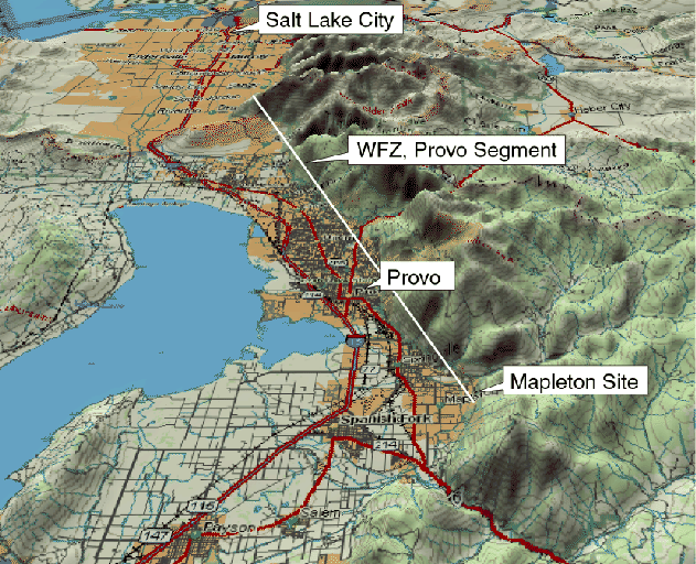
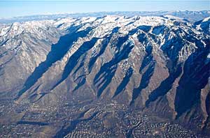
The Wasatch Fault consists of ten roughly 25-mile-long faults that collectively define a 240-mile-long fault zone at the western edge of the Wasatch Mountains of central Utah. Due to its location near the urbanized areas of Salt Lake City and Provo, as well as the heavily developed Salt Lake basin west of the Wasatch Mountains, the Wasatch Fault poses a significant earthquake hazard. Figures 6 through 8, which show different segments of the Wasatch Fault, identify the fault location and clearly show the proximity of the fault to major urban areas in Utah, including Salt Lake City and Provo.
IV. Other interesting features
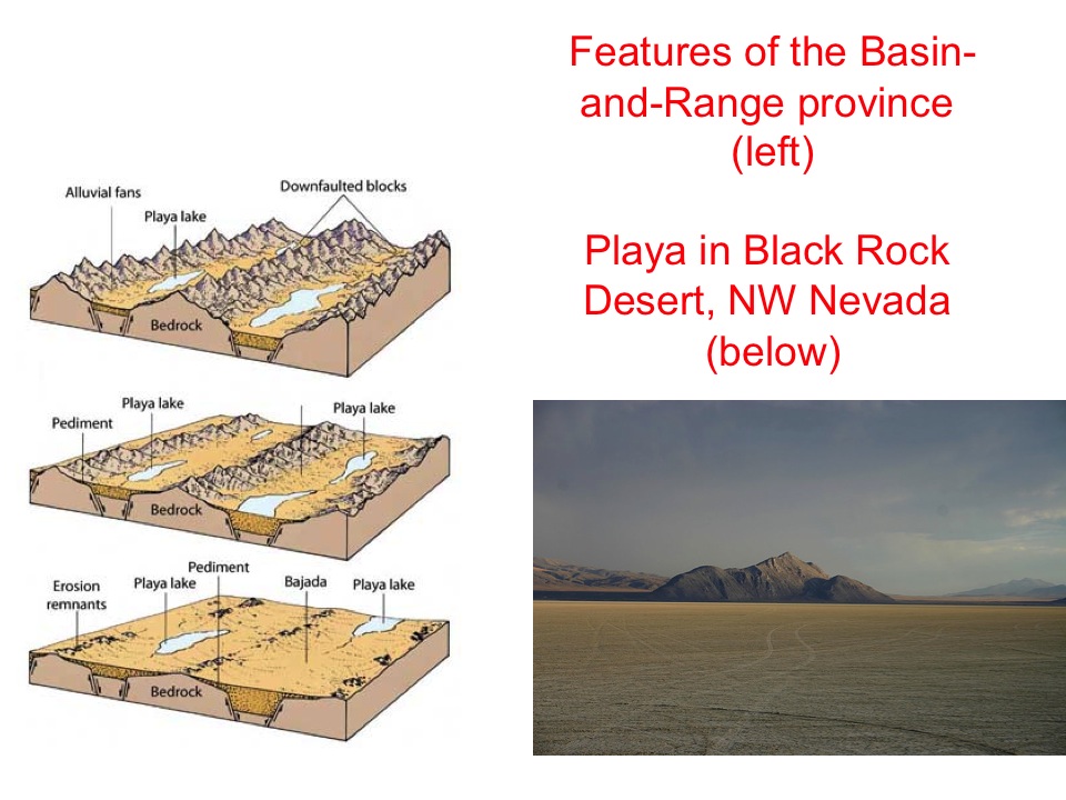
One could write volumes about the interesting features in the Great Basin (i.e. the
central Basin-and-Range province). Although our class focuses on processes that build mountains,
a common landscape that one encounters in the Great Basin is the desert playa, which is an
inland basin without any outlet to the ocean or sea. Figure 13 depicts a playa in the famous Black
Rock Desert of northwestern Nevada.
Water that runs into the playa during storms or from snow melting at high elevations collects
in the basin and evaporates in place since the water cannot escape the basin. Various elements
that are dissolved in the water gradually precipitate as the water evaporates, leaving behind
a variety of salts that often color the playa white. Salt-encrusted playas can be blinding
(and hot) during the desert day and are good places to avoid unless you have plenty of water
and sunscreen!
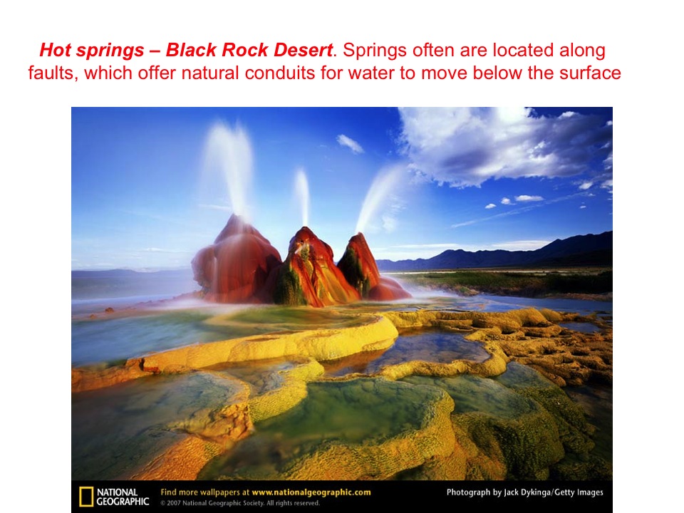
To conclude the Basin-and-Range section of this lecture, I leave you with a gorgeous National
Geographic image of isolated hot springs in the Black Rock Desert. Perhaps this will convince
you to pause in a future drive across the seemingly endless desert landscapes of Nevada and
Utah and seek some of the amazing features that are hiding away from the road.