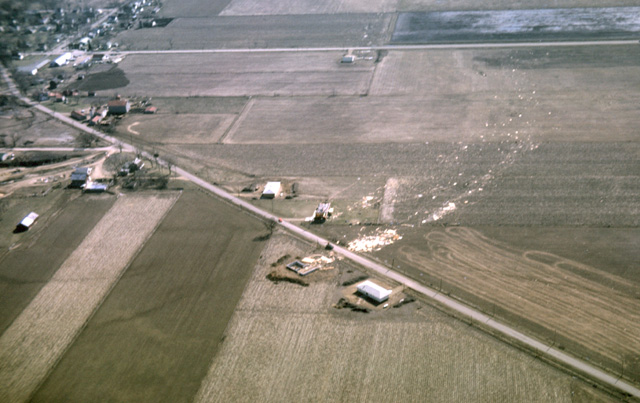
085-01: Tornado damage that occurred 11 Apr 65 near Evansville, WI. Note selectivity of damage. (13Apr65)
13. Floods and Tornados in Wisconsin
085-01: Tornado damage that occurred 11 Apr 65 near Evansville, WI. Note selectivity of damage. (13Apr65)
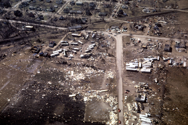
085-06: Tornado damage that occurred 11 Apr 65 to trailer park at Monroe, WI (13Apr65)
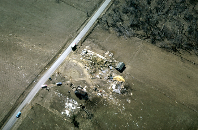
085-10: Tornado damage that occurred 11 Apr 65 to a farm and wood lot near Monroe WI (13Apr65)
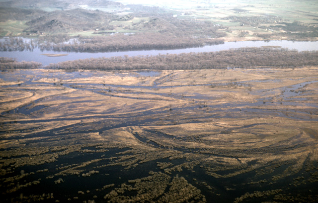
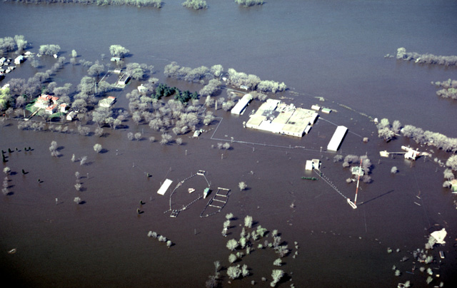
085-25: Lower Wisconsin River in flood near Muscoda, WI (27Apr65)
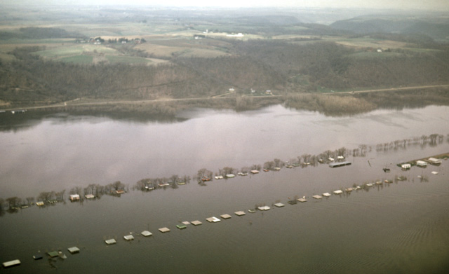
085-35: Mississippi River flood. Partially submerged houses north of Guttenburg, IA. View to west. (27Apr65)
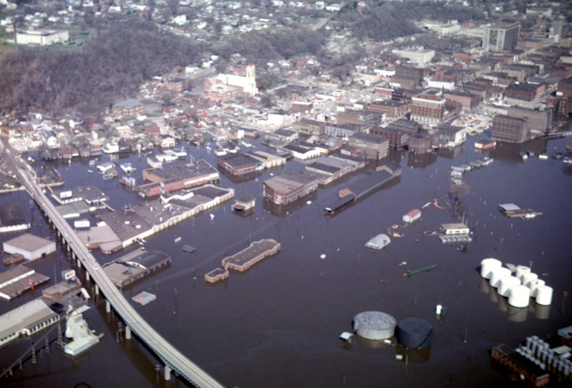
085-37: Mississippi River flood at Dubuque, IA (27Apr65)
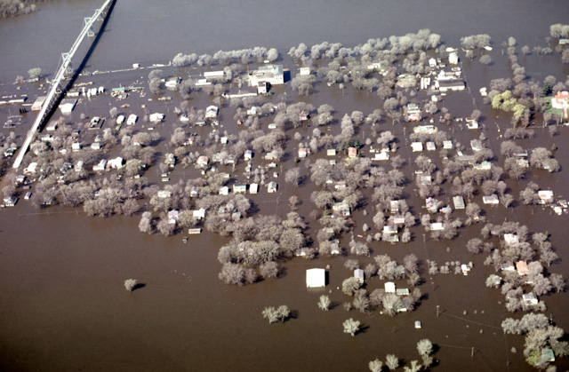
188-11: 1969 Mississippi River flood at Prairie du Chien, WI. View to the west. High bridge carries Hy 18 to Iowa. See also photo 188-13 for area immediately north. (23Apr69)
188-13: 1969 Mississippi River flood at Prairie du Chien, WI. Note Villa Louis, the red-roofed mansion, high and dry on its own mound at the left. Villa Louis was built by the family of Hercules Dousman, a wealthy fur trapper who came to town in 1826. He apparently picked his mound wisely. The estate is now maintained by the Historical Society of Wisconsin. See also photo 188-11, immediately to the south. (23Apr69)
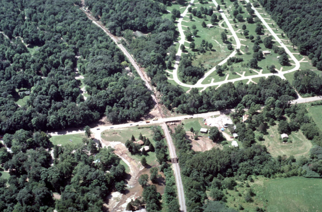
407-16: Devils Lake, WI. During the evening of 17-18 July 1993, eight inches of rain was recorded within a 3-hr period in the Baraboo Hills; it is reported that a station with an electronic rain gauge accumulated 13 inches of rain in one hour. The resulting runoff caused Devils Lake to overflow and wash out the railroad and the Park's north exit road. The view is toward the south; the discharge came from the upper left flowing north along the railroad. (19Jul93)
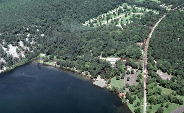
407-23: Devils Lake, WI. During the evening of 17-18 July 1993, eight inches of rain was recorded within a 3-hr period in the Baraboo Hills; it is reported that a station with an electronic rain gauge accumulated 13 inches of rain in one hour. The resulting runoff caused Devils Lake to overflow and wash out the railroad and the Park's north exit road. The view is toward the NNW. The lake overflowed by the partially submerged pavilion and then northward along the railroad line. (19Jul93)
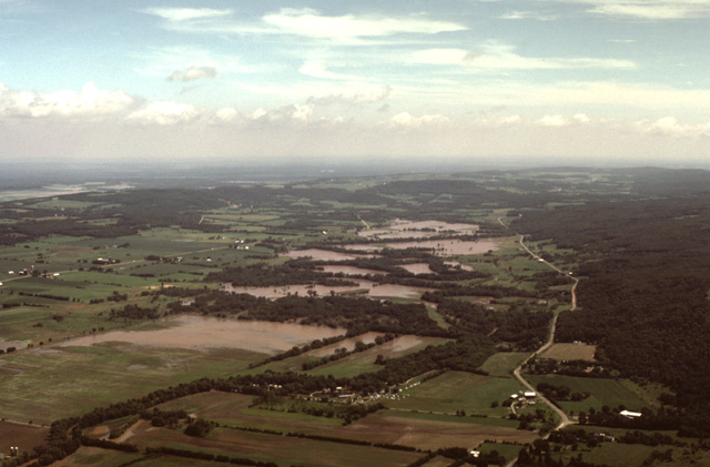
407-22: Baraboo River in flood after eight inches of rain was recorded within a 3-hr period in the Baraboo Hills. The view is to the northeast toward the Lower Narrows from a position just south of Baraboo, WI. See also photos 407-16 and 407-23 (19Jul93)
440-12: High water along the Baraboo River just before it enters the Upper Narrows (Ableman Gorge) north of Rock Springs, WI. View toward the southwest. Road is WI Hy 136. (6Jun00)
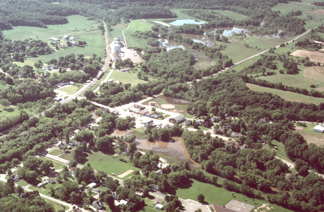
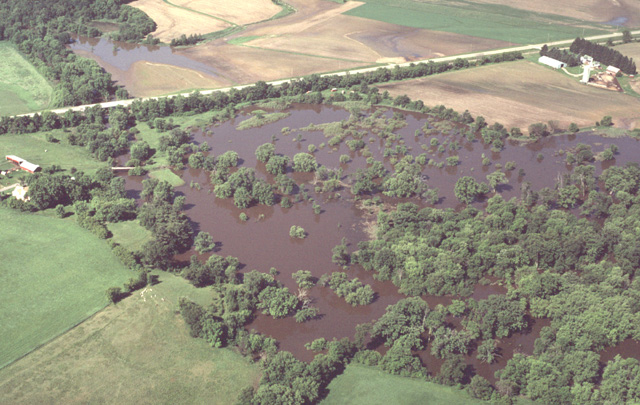
440-14: Baraboo River flood at Rock Springs, WI. View to the southeast. In the foreground Narrows Creek is backed up at its junction with the Baraboo River. In the distance the flood water can be seen endangering the commuity's sewage treatment plant. (6Jun00)
Copyright © 2001 Louis J. Maher, Jr.