4. San Juan Mountains, Craters, Sink holes, Colorado and San Juan Rivers
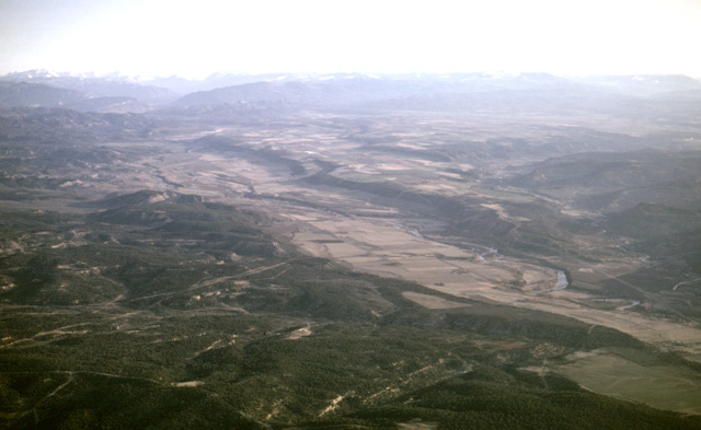
114-11: Animas River Valley and Florida Mesa, 20 miles south of Durango, CO. View to NNE. The Florida River joins the San Juan just off the photo at the right. Note the terraces (edges in shadow) on the edge of the Mesa; these can be traced to glacial moraines in Durango. See also photo 114-15. (12Apr66)
114-15: Animas River terraces south of Durango, CO. View to the east. In the foreground the San Juan River flows to the right; the Florida River (east of the Mesa) joins the San Juan several miles downstream. Terrace levels represent aggregating streams during glacial periods; they can be traced to moraines in Durango. (12Apr66)
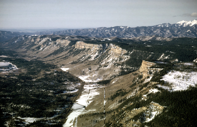
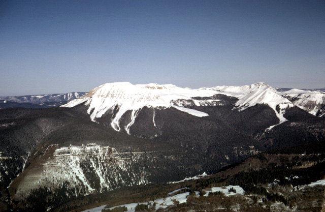
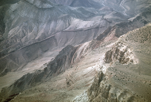
114-34: Hermosa Cliffs (Hermosa fm, Pennsylvanian) in San Juan Mtns, 20 miles north of Durango, CO. View to south, Hy 550 and Durango narrow gauge RR in view. Note beveled spurs; this valley contained about 2000 feet of glacial ice that nearly reached the top of the cliffs several times during the Pleistocene. (12Apr66)
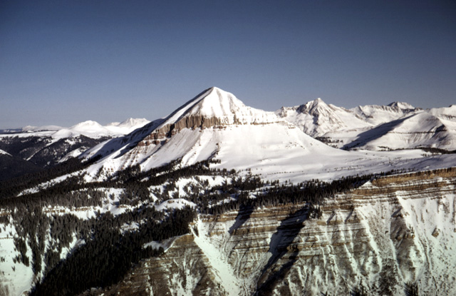
115-08: Engineer Mtn (12,968 ft) and Coalbank Hill, San Juan Mtns, CO. Coalbank Hill in foreground is Hermosa fm (Pennsylvanian); Engineer Mtn (a sill) is quartz trachyte. View to the northwest. (12Apr66)
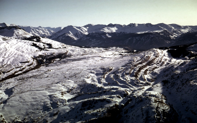
115-10: Avalanche trails on the south side of Graysill Mtn, San Juan Mtns, CO. View to north. Site near San Juan/La Plata County line. (12Apr66)
115-13: Molas Pass area in snow, San Juan Mts, CO. Layers under snow are sedimentary rock of Carboniferous age. Although the land surface lies below timberline, most of the forest was destroyed during the "Lime Creek Burn" of 1879. (12Apr66)
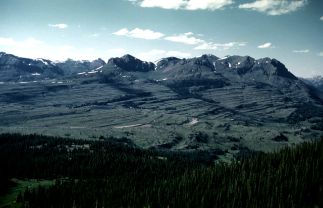
058-18: Molas Pass area, San Juan Mtns, CO. Treeless area below peaks was caused by the Lime Creek Burn of 1879. Layered sedimentary rocks produce the tabular structure. (29Jun60)
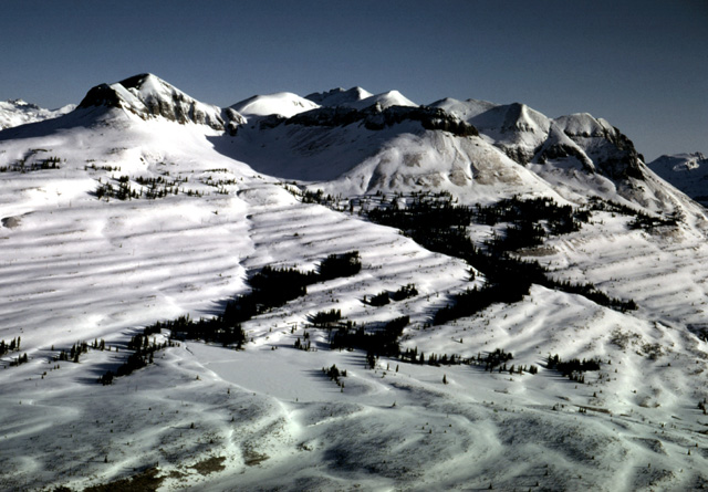
115-25: Molas Pass area, San Juan Mts, CO. Layers under snow are Carboniferous sediments. The overlying rocks at the mountain crests are crystalline rocks of Tertiary age. View to the north. Area burned over by Lime Creek Burn in 1879. The fire moved from southwest to northeast, leaving unburned forest remnants on the down-wind sides of firebreaks like that of Little Molas Lake which lies under the snow in the foreground. (12Apr66)
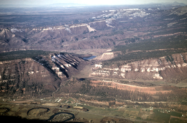
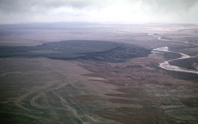
115-29: Looking WSW at the north side of Animas City Mtn, just north of Durango, CO. Mesozoic rocks are exposed in the canyon wall. Part of the meander belt of the Animas River is in the foreground. During the Pleistocene, this valley was filled with glacial ice. When the glacier reached this locality, Animas City Mtn deflected some of the flow to the west. Notice the basin of Chapman Lake that is formed by the small terminal moraine at its west side. Sleeping Ute Mtn is on the horizon at the right; the Carizo Mtns are at the left. (12Apr66)
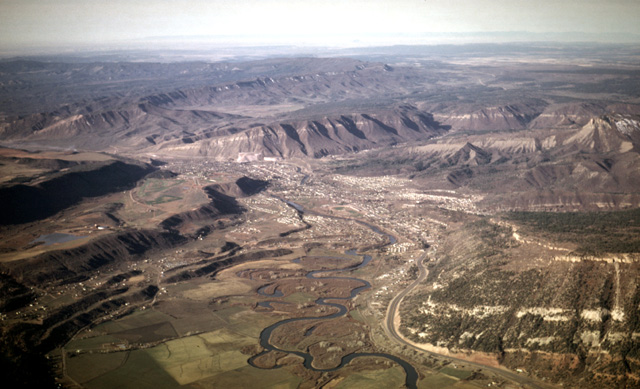
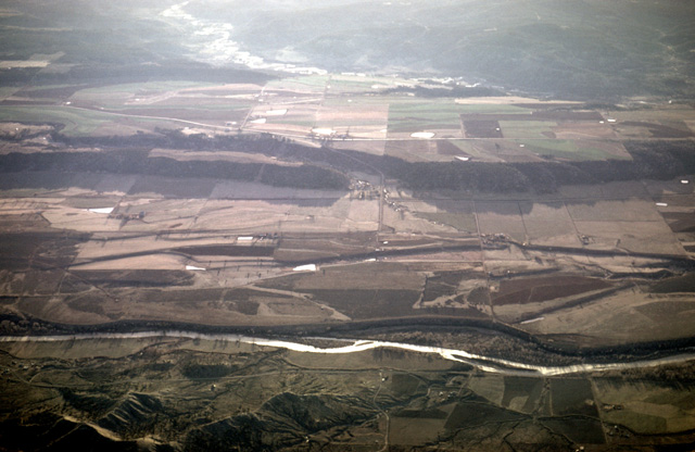
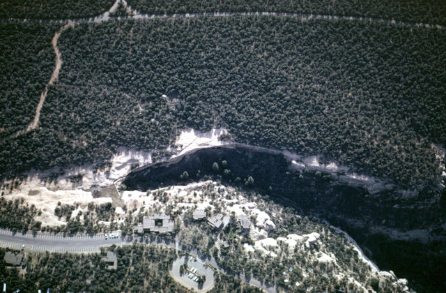
115-31: Twin-ridged Pinedale glacial moraines at Durango, CO. View to southwest. The Pinedale ice over-deepened the valley of the Animas River. This depression was filled with sediment, and the Animas River today meanders actively across the flat. Beyond the twin-ridged moraines, the Animas flows again in a bedrock channel. At the left, a higher flat level dates from an older (Bull Lake?) glaciation; the valley has cut down since that time. A small airport was once located on the high terrace; today it is occupied by Fort Lewis College. River terraces continue far down the river from these moraines. The rocks are generally Mesozoic in age. Durango's famous "moving mountain," a landslide with spontaneously-combusting coal seams, appears as a light-colored scar on the right bank of river at the central left edge of the view. See also photo 115-35 (12Apr66)
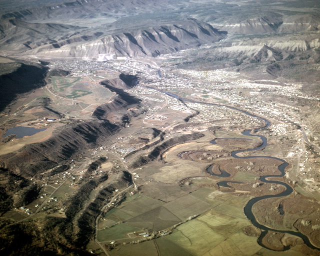
115-35: Glacial moraines at Durango, CO. View toward southwest. The Pinedale ice over-deepened the valley of the Animas River. This depression was filled with sediment, and the Animas River today meanders actively across the flat. Beyond the twin-ridged moraines, the Animas flows again in a bedrock channel. At the left, a higher flat level dates from an older (Bull Lake?) glaciation; the valley has cut down since that time. A small airport was once located on the high level; today it is occupied by Fort Lewis College. River terraces continue far down the river from these moraines. The rocks are generally Mesozoic in age. See photo 115-31. (12Apr66)
116-04: Mesa Verde National Park, CO. Near vertical view of cliff dwellings. (12Apr66)
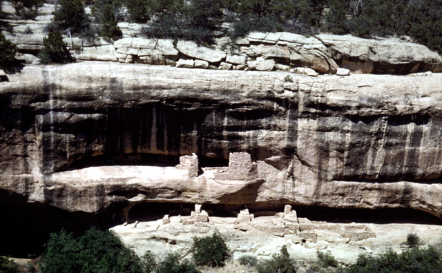
059-06: Cliff House, Mesa Verde National Park, CO. Taken from the ground. (2Jul60)
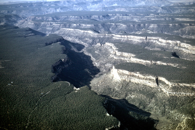
116-05: Canyons and mesas at Mesa Verde National Park, CO. View to southwest. Note road loop overlooking Navajo Canyon. (12Apr66)
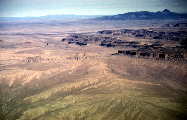
116-09: Outlying mesas south of Mesa Verde, CO. View to northwest. Sleeping Ute Mtn at right middle distance; Abajo Mtns (UT) in background. (12Apr66)
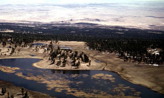
117-01: Whiskey Lake, Chuska Mtns, NM. View to the ENE. The Chuska sandstone (Tertiary) represents a dune field that once occupied a valley. A siliceous cement has made the Chuska sandstone more resistant than its surroundings, and a reversal of topography has taken place. A series of partially-connected lake basins occur on the broad crest of the Chuskas. Their origin is not certain; it is thought that selective removal of cement by groundwater action may have caused localized subsidence. In the photo a series of NW/SE-aligned fresh landslide blocks can be seen east of the Chuska escarpment. These appear to occur at places where the sandstone is underlain by clay of Mesozoic age. Very highly weathered ancient landslide debris extends 10 miles to the east into the San Juan basin. (12Apr66)
117-23: Lava-capped mesa over red Triassic shale of the Painted Desert near Dilkon, AZ. (12Apr66)
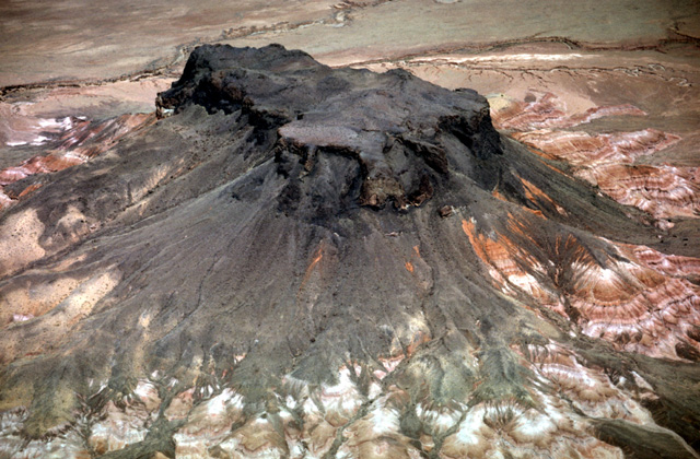
117-26: Hopi Buttes, near Dilkon, AZ. These are Tertiary intrusives and lavas. View toward the west. Pines and Junipers provide scale. (12Apr66)
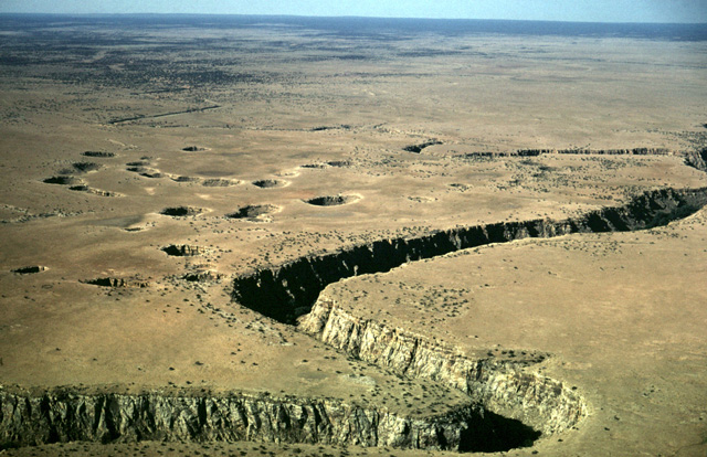
146-30: Sinkholes in Permian Kaibab ls along right bank of Chevelon Fork (of the Little Colorado River), 18 miles southeast of Winslow, AZ. View to the southwest. (13Jun66)
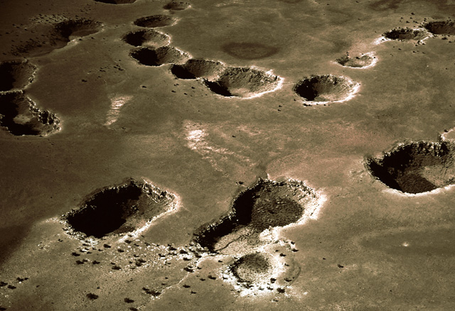
147-11: Sinkholes in Permian Kaibab ls along right bank of Chevelon Fork (of the Little Colorado River), 18 miles southeast of Winslow, AZ. View to the south. Note aligned sinks and one that is just starting its collapse. Small Juniper trees provide scale. (13Jun66)
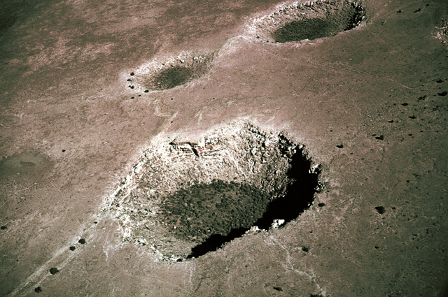
147-22: Three sinkholes aligned along a fracture. Sinkholes in Permian Kaibab ls along right bank of Chevelon Fork (of the Little Colorado River), 18 miles southeast of Winslow, AZ. View to the north. Small juniper trees provide scale. (13Jun66)
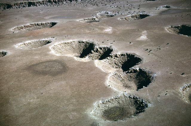
147-23: Aligned sinkholes in Permian Kaibab ls along right bank of Chevelon Fork (of the Little Colorado River), 18 miles southeast of Winslow, AZ. View to the northwest. For scale, there is a white-faced cow at about the "eight o'clock" position to the left of a small tree at the edge of the second sink from the lower border of the photo. (13Jun66)
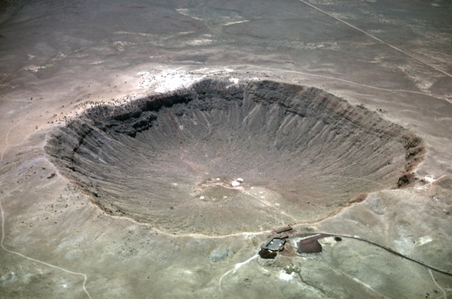
118-02: Meteor Crater, 20 miles west of Winslow, AZ. View to the south. (12Apr66)
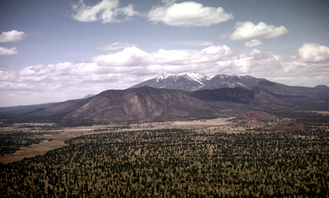
118-07: San Francisco Mountains, north of Flagstaff, AZ. Humphreys Peak (12,635 ft) is covered with snow. View to the northwest. (12Apr66)
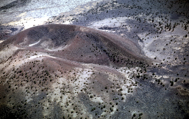
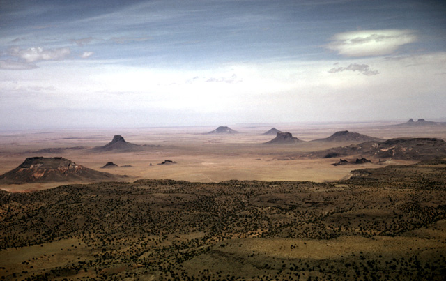
118-19: Cinder cones on north flank of San Francisco Mountains, north of Flagstaff, AZ. View to the northeast. Pine trees provide scale. (12Apr66)
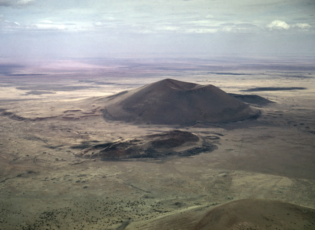
118-20: Cinder cones north of San Francisco Mountains, north of Flagstaff, AZ. View to the east. (12Apr66)
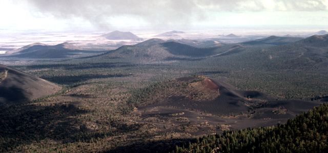
334-16: Volcanic cones northeast of the San Francisco Mountains north of Flagstaff, AZ. View to the east. (25Oct87)
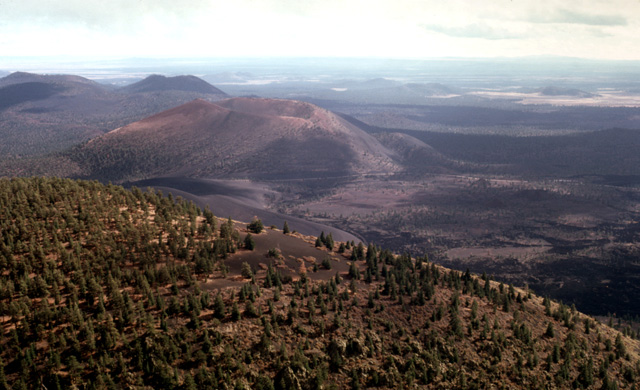
334-18: Sunset Crater (erupted in 1190 A.D.) northeast of the San Francisco Mountains north of Flagstaff, AZ. View to the southeast. Note remnants of volcanic ash among the trees in foreground. (25Oct87)
118-26: Eroded lava flow and Little Colorado River about 15 miles south of Cameron, AZ. View to north. See also photo 118-30. (12Apr66)
118-30: View down on eroded lava flow along Little Colorado River, about 15 miles south of Cameron, AZ. View to the south. Jeep road provides scale. See also photo 118-26. (12Apr66)
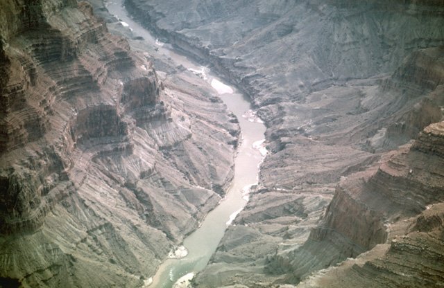
119-07: Jointing along Little Colorado River, northwest of Cameron, AZ. Note the river at upper left that is 2000 feet below the rim. (12Apr66)
119-16: Canyon of Little Colorado River, northwest of Cameron, AZ. View to north about 10 miles upstream from the Colorado River. (12Apr66)
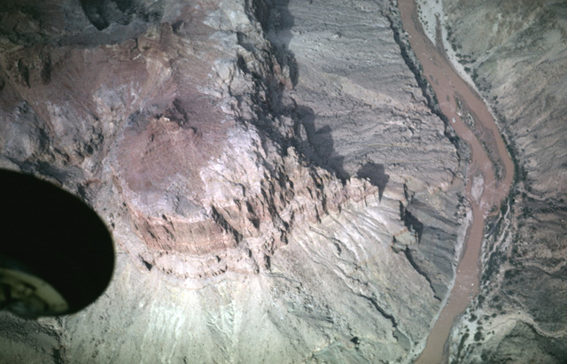
119-23: Looking down 4000 ft at Little Colorado River near its junction with the Colorado River in AZ. Plane wheel at lower left. (12Apr66)
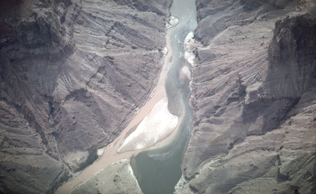
119-25: Confluence of Colorado River and Little Colorado River in the Grand Canyon, AZ. View downstream to the southwest. Note the red color of the Little Colorado River; the Colorado has left its red mud behind the Glen Canyon Dam 60 miles upstream. (12Apr66)
119-26: Colorado River in Grand Canyon, AZ. View downstream just below confluence with Little Colorado River; see its red color near the left bank. Note temporary deltas being deposited at just about each tributary. (12Apr66)
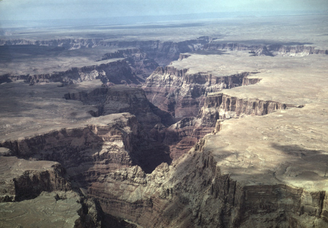
119-28: Grand Canyon, AZ. View northwest. Kwagunt Butte in foreground is capped by Permian Kaibab fm; lower butte to the right is Malgosa Crest, which is capped by a remnant of Permian Coconino ss. Nankoweap Mesa is in the middle distance at the right margin. Note the vertical beds to its left; these are drag folds along a faulted part of the East Kaibab Monocline. See also photo 119-34. (12Apr66)
119-34: Drag fold along Grand Canyon, AZ. The drag has occurred along a faulted part of the East Kaibab Monocline. A portion of Nankoweap Mesa is at the right. See also photo 119-28. (12Apr66)
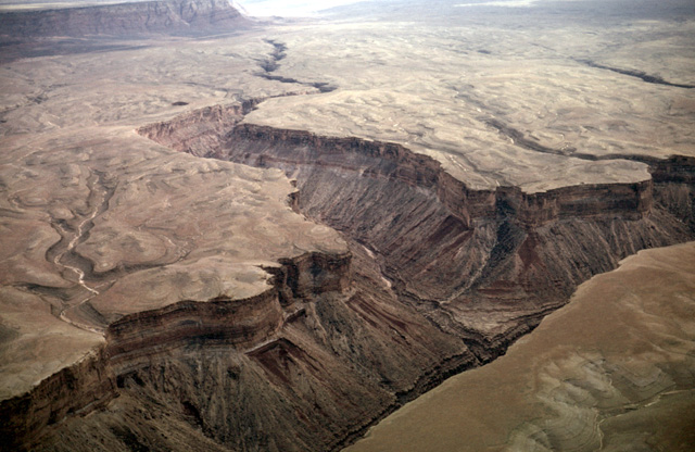
120-12: Hanging valleys along Colorado River in Marble Canyon, about 20 miles downstream from Page, AZ. View to southeast. Echo Cliffs are in the background. (12Apr66)
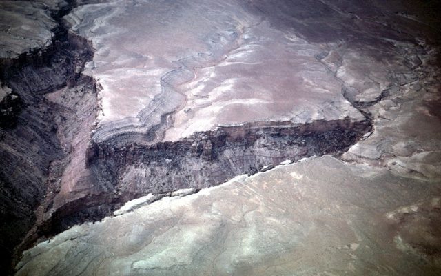
120-14: Hanging valleys along Colorado River in Marble Canyon, about 18 miles downstream from Page, AZ. View to west. (12Apr66)
120-16: Tributaries and hanging valleys, sand bars and erosion along Colorado River in Marble Canyon, downstream from Page, AZ. View to southeast. (12Apr66)
120-17: Colorado River in Marble Canyon, about 15 miles downstream from Page, AZ. View to NNE. (12Apr66)
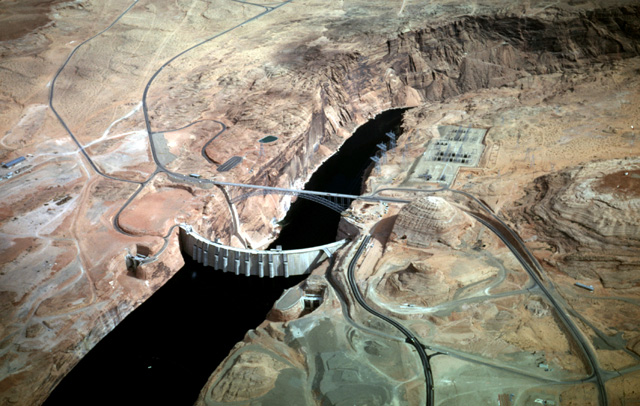
120-18: Colorado River and Glen Canyon Dam at Page, AZ. View downstream. Rocks are part of the Glen Canyon group of Triassic and Jurassic age. (12Apr66)
120-26: Horizontal strata (Mesozoic) and a narrow divide between buttes near Page, AZ (12Apr66)
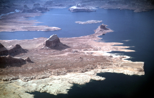
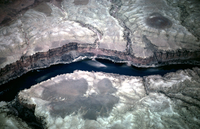
120-27: Powell Reservoir and buttes of Glen Canyon group (Triassic-Jurassic) at AZ/UT state line. View westward. (12Apr66)
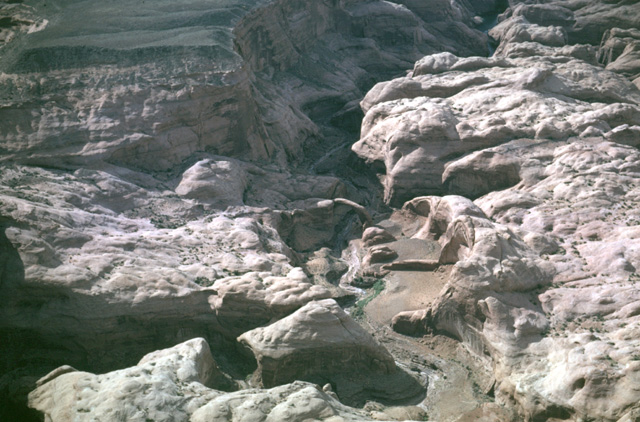
120-32: Forbidden Canyon (with excursion boat) north of Rainbow Bridge, UT. Rock is Navajo ss of Jurassic age. Canyon flooded by Powell Reservoir. (12Apr66)
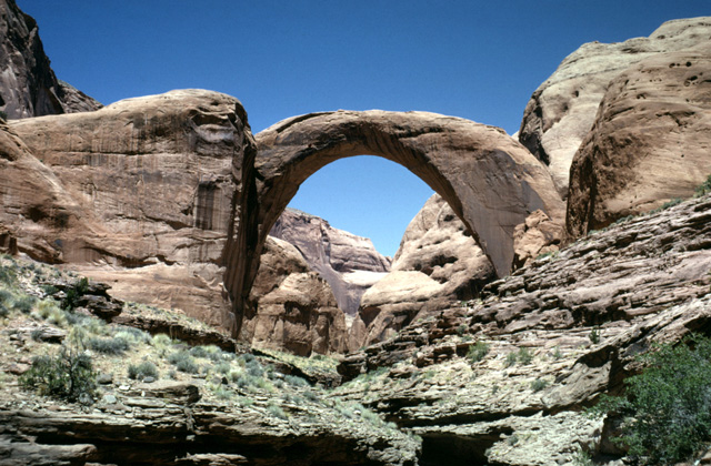
149-14: Rainbow Bridge, UT. View looking north from the ground. (14Jun66)
120-35: Rainbow Bridge in Forbidden Canyon, UT. Rock is Navajo ss (Triassic-Jurassic). View to north. (12Apr66)
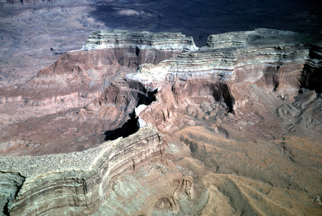
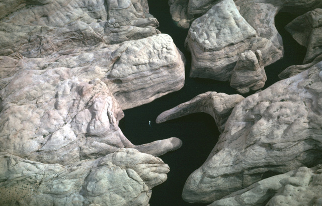
120-36: Potential new "Rainbow Bridges" in Forbidden Canyon to north of Rainbow bridge, UT. Rock is Navajo ss (Triassic-Jurassic). (12Apr66)
121-03: San Juan River meanders just upstream from the Colorado River, UT. Valley flooded by Powell Reservoir. (12Apr66)
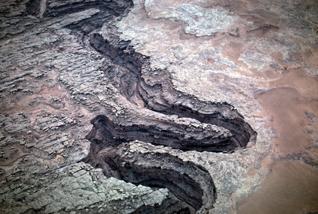
121-12: Incised and joint-controlled San Juan River tributary, upstream from confluence with Colorado River, southern UT. (12Apr66)
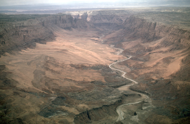
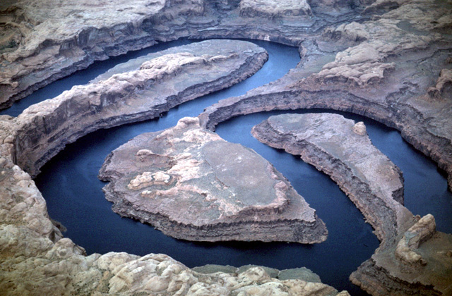
121-32: Goosenecks of San Juan River, 9 miles northwest of Mexican Hat, UT. Very top layers are Rico fm (Pennsylvanian-Permian); main walls are Hermosa fm (Pennsylvanian). (12Apr66)
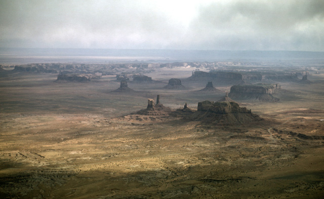
121-35: Monument Valley, UT and AZ. View south from San Juan River near Mexican Hat, UT. (12Apr66)
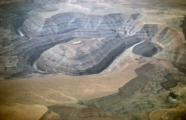
122-02: Goosenecks of San Juan River, 5 miles northwest of Mexican Hat, UT. Very top layers are Rico fm (Pennsylvanian-Permian); main walls are Hermosa fm (Pennsylvanian). (12Apr66)
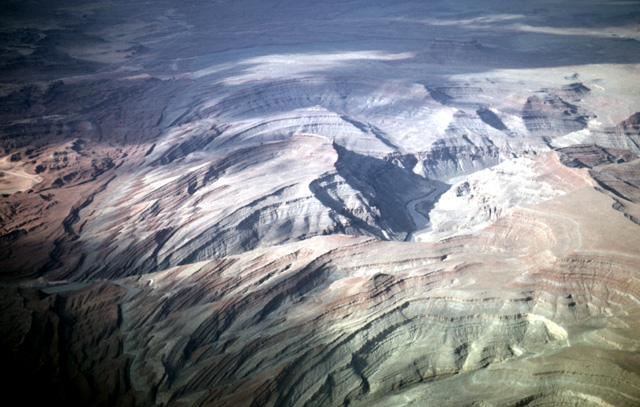
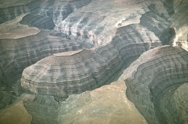
122-06: West limb of anticline along San Juan River just east of Mexican Hat, UT. The flat rocks at left belong to the Halgaito fm, a member of the Cutler fm (Permian). The steeply-dipping beds at center belong to the Rico fm (Pennsylvanian-Permian), and the underlying beds at the right belong to the Hermosa fm (Pennsylvanian). (12Apr66)
122-09: East limb of anticline along San Juan River east of Mexican Hat, UT. View southeast. Rock ages range from Pennsylvanian to Jurassic. (12Apr66)
Click here to return
Copyright © 2001 Louis J. Maher, Jr.